Grostenquin geodata
Grostenquin (Grand Est) is a populated place; located in France in Europe/Paris (GMT+2) time zone. With population of 591 people, there are 13465 cities with bigger population in this country. Compared to other cities in France, 79.2% of cities are located further ↓South; 93.3% of cities are located further ←West and 77.4% of cities have lower elevation than Grostenquin. Note1
Administrative division(s):
- Level 1: Grand Est
- Level 2: Moselle
- Level 3: Arrondissement de Forbach-Boulay-Moselle
- Level 4: Grostenquin


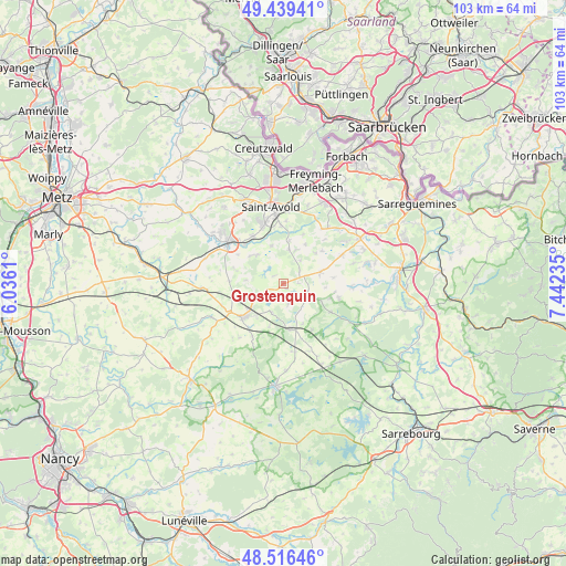
Grostenquin GPS coordinates[2]
48° 58' 48.252" North, 6° 44' 21.228" East
| Map corner | latitude | longitude |
|---|---|---|
| Upper-left | 49.43941°, | 6.0361° |
| Center: | 48.98007°, | 6.73923° |
| Lower-right: | 48.51646°, | 7.44235° |
| Map W x H: | 102.6×102.6 km | = 63.8×63.8mi |
| max Lat: | 51.07786° ⇑20.8% North |
| Grostenquin: | 48.98007° |
| min Lat: | ⇓79.2% South 41.3874° |
| min Long | Grostenquin | max Long |
| -5.08615° | 6.73923° | 9.52242° |
| W 93.3%⇐ | ⇒6.7% E |
Elevation
Elevation of Grostenquin is 267 m = 876 ft, and this is 73.3 m = 240 ft above average elevation for this country.
| Max E: |
2333 m = 7654 ft | 22.6% |
| Grostenquin | 267 m 876 ft | |
| Avg. | 193.7 m = 635 ft | |
Min E: |
-1 m = -3 ft | 77.4% |
See also: France elevation on elevation.city.
Geographical zone
Grostenquin is located in North temperate zone (between Tropic of Cancer and the Arctic Circle). Distance of this North polar circle is 1955.1 km =1214.8 mi to North.| Distance of | km | miles | from Grostenquin |
|---|---|---|---|
| North Pole | 4561 | 2834.1 | to North |
| Arctic Circle | 1955.1 | 1214.8 | to North |
| Tropic Cancer | 2840.2 | 1764.8 | to South |
| Equator | 5446.1 | 3384 | to South |


Nearby cities:
15 places around Grostenquin: (largest is in red/bold)
• Albestroff
10 km =6.2 mi,  121°
121°
• Altviller
10.4 km =6.5 mi,  357°
357°
• Bénestroff
8.5 km =5.3 mi,  170°
170°
• Francaltroff
4.7 km =2.9 mi,  114°
114°
• Guessling-Hémering
7.7 km =4.8 mi,  310°
310°
• Hellimer
6.8 km =4.2 mi,  74°
74°
• Insming
10.3 km =6.4 mi, 105°
• Lachambre
11.3 km =7 mi,  2°
2°
• Laning
6.6 km =4.1 mi,  22°
22°
• Lixing-lès-Saint-Avold
6.3 km =3.9 mi,  8°
8°
• Morhange
9.5 km =5.9 mi,  228°
228°
• Pontpierre
10.1 km =6.3 mi, 314°
• Racrange
7.9 km =4.9 mi,  219°
219°
• Teting-sur-Nied
10.2 km =6.3 mi,  326°
326°
• Vahl-Ebersing
7.8 km =4.8 mi, 7°
Sources, notices
• [Note1] Compared only with cities in France existing in our database
• [Src1] Map data: © OpenStreetMap contributors (CC-BY-SA)
• [Src2] Other city data from geonames.org with taken over terms of usage.
• [Src3] Geographical zone / Annual Mean Temperature by Robert A. Rohde @ Wikipedia
