La Ferté-Loupière geodata
La Ferté-Loupière (Bourgogne-Franche-Comté) is a populated place; located in France in Europe/Paris (GMT+2) time zone. With population of 582 people, there are 13612 cities with bigger population in this country. Compared to other cities in France, 57.5% of cities are located further ↓South; 61.1% of cities are located further ←West and 53.6% of cities have lower elevation than La Ferté-Loupière. Note1
Administrative division(s):
- Level 1: Bourgogne-Franche-Comté
- Level 2: Département de l'Yonne
- Level 3: Auxerre
- Level 4: La Ferté-Loupière


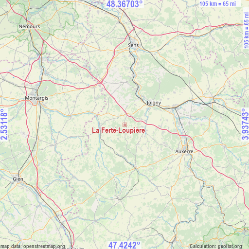
La Ferté-Loupière GPS coordinates[2]
47° 53' 51.936" North, 3° 14' 3.516" East
| Map corner | latitude | longitude |
|---|---|---|
| Upper-left | 48.36703°, | 2.53118° |
| Center: | 47.89776°, | 3.23431° |
| Lower-right: | 47.4242°, | 3.93743° |
| Map W x H: | 104.8×104.8 km | = 65.1×65.1mi |
| max Lat: | 51.07786° ⇑42.5% North |
| La Ferté-Loupière: | 47.89776° |
| min Lat: | ⇓57.5% South 41.3874° |
| min Long | La Ferté-Loupi | max Long |
| -5.08615° | 3.23431° | 9.52242° |
| W 61.1%⇐ | ⇒38.9% E |
Elevation
Elevation of La Ferté-Loupière is 145 m = 476 ft, and this is 48.7 m = 160 ft below average elevation for this country.
| Max E: |
2333 m = 7654 ft | 46.4% |
| Avg. | 193.7 m = 635 ft | |
| La Ferté-Loupière | 145 m = 476 ft | |
Min E: |
-1 m = -3 ft | 53.6% |
See also: France elevation on elevation.city.
Geographical zone
La Ferté-Loupière is located in North temperate zone (between Tropic of Cancer and the Arctic Circle). Distance of this North polar circle is 2075.4 km =1289.6 mi to North.| Distance of | km | miles | from La Ferté-Loupière |
|---|---|---|---|
| North Pole | 4681.3 | 2908.8 | to North |
| Arctic Circle | 2075.4 | 1289.6 | to North |
| Tropic Cancer | 2719.8 | 1690 | to South |
| Equator | 5325.7 | 3309.2 | to South |


Nearby cities:
15 places around La Ferté-Loupière: (largest is in red/bold)
• Aillant-sur-Tholon
9 km =5.6 mi,  106°
106°
• Champlay
16.3 km =10.1 mi,  68°
68°
• Champvallon
9.2 km =5.7 mi,  62°
62°
• Chamvres
11.6 km =7.2 mi, 55°
• Charny
10.4 km =6.5 mi,  263°
263°
• Cézy
13.2 km =8.2 mi,  36°
36°
• Douchy
14.3 km =8.9 mi,  290°
290°
• Fleury-la-Vallée
16.4 km =10.2 mi,  102°
102°
• Guerchy
15.3 km =9.5 mi,  92°
92°
• Joigny
15.6 km =9.7 mi,  52°
52°
• La Celle-Saint-Cyr
9.4 km =5.8 mi,  25°
25°
• Poilly-sur-Tholon
12.5 km =7.8 mi, 106°
• Saint-Julien-du-Sault
15.6 km =9.7 mi,  17°
17°
• Senan
9.4 km =5.8 mi,  80°
80°
• Villefranche
8.5 km =5.3 mi,  297°
297°
Sources, notices
• [Note1] Compared only with cities in France existing in our database
• [Src1] Map data: © OpenStreetMap contributors (CC-BY-SA)
• [Src2] Other city data from geonames.org with taken over terms of usage.
• [Src3] Geographical zone / Annual Mean Temperature by Robert A. Rohde @ Wikipedia
