Champvallon geodata
Champvallon (Bourgogne-Franche-Comté) is a populated place; located in France in Europe/Paris (GMT+2) time zone. With population of 504 people, there are 15167 cities with bigger population in this country. Compared to other cities in France, 58.2% of cities are located further ↓South; 62.6% of cities are located further ←West and 52.3% of cities have higher elevation than Champvallon. Note1
Administrative division(s):
- Level 1: Bourgogne-Franche-Comté
- Level 2: Département de l'Yonne
- Level 3: Auxerre
- Level 4: Montholon


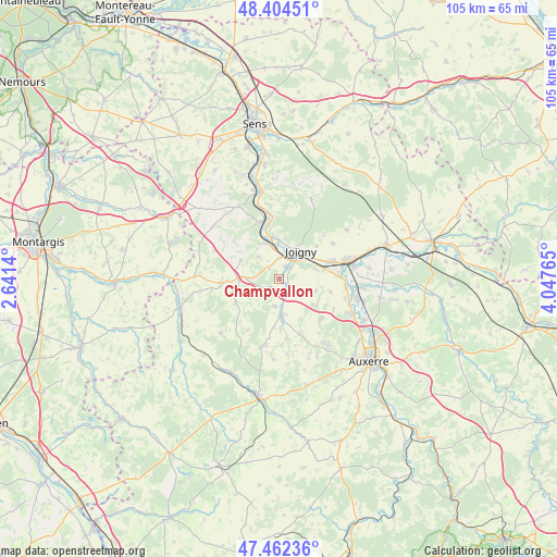
Champvallon GPS coordinates[2]
47° 56' 8.088" North, 3° 20' 40.308" East
| Map corner | latitude | longitude |
|---|---|---|
| Upper-left | 48.40451°, | 2.6414° |
| Center: | 47.93558°, | 3.34453° |
| Lower-right: | 47.46236°, | 4.04765° |
| Map W x H: | 104.8×104.8 km | = 65.1×65.1mi |
| max Lat: | 51.07786° ⇑41.8% North |
| Champvallon: | 47.93558° |
| min Lat: | ⇓58.2% South 41.3874° |
| min Long | Champvallon | max Long |
| -5.08615° | 3.34453° | 9.52242° |
| W 62.6%⇐ | ⇒37.4% E |
Elevation
Elevation of Champvallon is 124 m = 407 ft, and this is 69.7 m = 229 ft below average elevation for this country.
| Max E: |
2333 m = 7654 ft | 52.3% |
| Avg. | 193.7 m = 635 ft | |
| Champvallon | 124 m = 407 ft | |
Min E: |
-1 m = -3 ft | 47.7% |
See also: France elevation on elevation.city.
Geographical zone
Champvallon is located in North temperate zone (between Tropic of Cancer and the Arctic Circle). Distance of this North polar circle is 2071.2 km =1287 mi to North.| Distance of | km | miles | from Champvallon |
|---|---|---|---|
| North Pole | 4677.1 | 2906.2 | to North |
| Arctic Circle | 2071.2 | 1287 | to North |
| Tropic Cancer | 2724 | 1692.6 | to South |
| Equator | 5329.9 | 3311.8 | to South |


Nearby cities:
15 places around Champvallon: (largest is in red/bold)
• Aillant-sur-Tholon
6.8 km =4.2 mi,  176°
176°
• Brion
12.1 km =7.5 mi,  56°
56°
• Champlay
7.2 km =4.5 mi,  75°
75°
• Chamvres
2.7 km =1.7 mi,  29°
29°
• Cézy
6.4 km =4 mi,  357°
357°
• Fleury-la-Vallée
10.9 km =6.8 mi,  134°
134°
• Guerchy
8.6 km =5.3 mi, 125°
• Joigny
6.7 km =4.2 mi,  38°
38°
• La Celle-Saint-Cyr
5.9 km =3.7 mi,  315°
315°
• La Ferté-Loupière
9.2 km =5.7 mi,  242°
242°
• Laroche-Saint-Cydroine
11 km =6.8 mi,  70°
70°
• Poilly-sur-Tholon
8.6 km =5.3 mi,  154°
154°
• Saint-Julien-du-Sault
11.3 km =7 mi,  341°
341°
• Senan
2.8 km =1.7 mi,  157°
157°
• Épineau-les-Voves
10.3 km =6.4 mi, 80°
Sources, notices
• [Note1] Compared only with cities in France existing in our database
• [Src1] Map data: © OpenStreetMap contributors (CC-BY-SA)
• [Src2] Other city data from geonames.org with taken over terms of usage.
• [Src3] Geographical zone / Annual Mean Temperature by Robert A. Rohde @ Wikipedia
