Chamvres geodata
Chamvres (Bourgogne-Franche-Comté) is a populated place; located in France in Europe/Paris (GMT+2) time zone. With population of 666 people, there are 12279 cities with bigger population in this country. Compared to other cities in France, 58.5% of cities are located further ↓South; 62.8% of cities are located further ←West and 65.6% of cities have higher elevation than Chamvres. Note1
Administrative division(s):
- Level 1: Bourgogne-Franche-Comté
- Level 2: Département de l'Yonne
- Level 3: Arrondissement de Sens
- Level 4: Chamvres


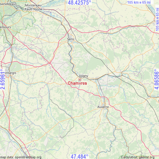
Chamvres GPS coordinates[2]
47° 57' 25.272" North, 3° 21' 45.828" East
| Map corner | latitude | longitude |
|---|---|---|
| Upper-left | 48.42575°, | 2.65961° |
| Center: | 47.95702°, | 3.36273° |
| Lower-right: | 47.484°, | 4.06586° |
| Map W x H: | 104.7×104.7 km | = 65.1×65.1mi |
| max Lat: | 51.07786° ⇑41.5% North |
| Chamvres: | 47.95702° |
| min Lat: | ⇓58.5% South 41.3874° |
| min Long | Chamvres | max Long |
| -5.08615° | 3.36273° | 9.52242° |
| W 62.8%⇐ | ⇒37.2% E |
Elevation
Elevation of Chamvres is 88 m = 289 ft, and this is 105.7 m = 347 ft below average elevation for this country.
| Max E: |
2333 m = 7654 ft | 65.6% |
| Avg. | 193.7 m = 635 ft | |
| Chamvres | 88 m = 289 ft | |
Min E: |
-1 m = -3 ft | 34.4% |
See also: France elevation on elevation.city.
Geographical zone
Chamvres is located in North temperate zone (between Tropic of Cancer and the Arctic Circle). Distance of this North polar circle is 2068.9 km =1285.6 mi to North.| Distance of | km | miles | from Chamvres |
|---|---|---|---|
| North Pole | 4674.7 | 2904.7 | to North |
| Arctic Circle | 2068.9 | 1285.6 | to North |
| Tropic Cancer | 2726.4 | 1694.1 | to South |
| Equator | 5332.3 | 3313.3 | to South |


Nearby cities:
15 places around Chamvres: (largest is in red/bold)
• Aillant-sur-Tholon
9.2 km =5.7 mi,  185°
185°
• Armeau
10.4 km =6.5 mi,  342°
342°
• Brion
9.8 km =6.1 mi,  63°
63°
• Champlay
5.7 km =3.5 mi,  96°
96°
• Champvallon
2.7 km =1.7 mi,  209°
209°
• Cézy
4.3 km =2.7 mi, 337°
• Guerchy
9.3 km =5.8 mi,  142°
142°
• Joigny
4 km =2.5 mi,  44°
44°
• La Celle-Saint-Cyr
5.8 km =3.6 mi,  288°
288°
• Laroche-Saint-Cydroine
9.2 km =5.7 mi,  82°
82°
• Migennes
11.6 km =7.2 mi,  85°
85°
• Poilly-sur-Tholon
10.5 km =6.5 mi,  167°
167°
• Saint-Julien-du-Sault
9.7 km =6 mi,  329°
329°
• Senan
5 km =3.1 mi,  183°
183°
• Épineau-les-Voves
8.9 km =5.5 mi, 94°
Sources, notices
• [Note1] Compared only with cities in France existing in our database
• [Src1] Map data: © OpenStreetMap contributors (CC-BY-SA)
• [Src2] Other city data from geonames.org with taken over terms of usage.
• [Src3] Geographical zone / Annual Mean Temperature by Robert A. Rohde @ Wikipedia
