La Celle-Saint-Cyr geodata
La Celle-Saint-Cyr (Bourgogne-Franche-Comté) is a populated place; located in France in Europe/Paris (GMT+2) time zone. With population of 829 people, there are 10301 cities with bigger population in this country. Compared to other cities in France, 58.8% of cities are located further ↓South; 61.8% of cities are located further ←West and 56.9% of cities have higher elevation than La Celle-Saint-Cyr. Note1
Administrative division(s):
- Level 1: Bourgogne-Franche-Comté
- Level 2: Département de l'Yonne
- Level 3: Arrondissement de Sens
- Level 4: La Celle-Saint-Cyr


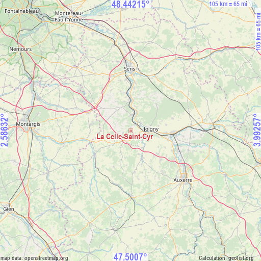
La Celle-Saint-Cyr GPS coordinates[2]
47° 58' 24.852" North, 3° 17' 22.02" East
| Map corner | latitude | longitude |
|---|---|---|
| Upper-left | 48.44215°, | 2.58632° |
| Center: | 47.97357°, | 3.28945° |
| Lower-right: | 47.5007°, | 3.99257° |
| Map W x H: | 104.7×104.7 km | = 65.1×65.1mi |
| max Lat: | 51.07786° ⇑41.2% North |
| La Celle-Saint-Cyr: | 47.97357° |
| min Lat: | ⇓58.8% South 41.3874° |
| min Long | La Celle-Saint- | max Long |
| -5.08615° | 3.28945° | 9.52242° |
| W 61.8%⇐ | ⇒38.2% E |
Elevation
Elevation of La Celle-Saint-Cyr is 111 m = 364 ft, and this is 82.7 m = 271 ft below average elevation for this country.
| Max E: |
2333 m = 7654 ft | 56.9% |
| Avg. | 193.7 m = 635 ft | |
| La Celle-Saint-Cyr | 111 m = 364 ft | |
Min E: |
-1 m = -3 ft | 43.1% |
See also: France elevation on elevation.city.
Geographical zone
La Celle-Saint-Cyr is located in North temperate zone (between Tropic of Cancer and the Arctic Circle). Distance of this North polar circle is 2067 km =1284.4 mi to North.| Distance of | km | miles | from La Celle-Saint-Cyr |
|---|---|---|---|
| North Pole | 4672.9 | 2903.6 | to North |
| Arctic Circle | 2067 | 1284.4 | to North |
| Tropic Cancer | 2728.2 | 1695.2 | to South |
| Equator | 5334.2 | 3314.5 | to South |


Nearby cities:
15 places around La Celle-Saint-Cyr: (largest is in red/bold)
• Aillant-sur-Tholon
11.9 km =7.4 mi,  157°
157°
• Armeau
8.4 km =5.2 mi,  16°
16°
• Champlay
11.4 km =7.1 mi,  102°
102°
• Champvallon
5.9 km =3.7 mi,  135°
135°
• Chamvres
5.8 km =3.6 mi,  108°
108°
• Chaumot
13 km =8.1 mi,  335°
335°
• Cézy
4.4 km =2.7 mi,  60°
60°
• Joigny
8.4 km =5.2 mi,  82°
82°
• La Ferté-Loupière
9.4 km =5.8 mi,  205°
205°
• Piffonds
13.8 km =8.6 mi,  310°
310°
• Poilly-sur-Tholon
14.3 km =8.9 mi,  147°
147°
• Saint-Julien-du-Sault
6.5 km =4 mi,  4°
4°
• Senan
8.6 km =5.3 mi, 142°
• Villefranche
12.5 km =7.8 mi,  248°
248°
• Villeneuve-sur-Yonne
12.1 km =7.5 mi, 2°
Sources, notices
• [Note1] Compared only with cities in France existing in our database
• [Src1] Map data: © OpenStreetMap contributors (CC-BY-SA)
• [Src2] Other city data from geonames.org with taken over terms of usage.
• [Src3] Geographical zone / Annual Mean Temperature by Robert A. Rohde @ Wikipedia
