La Chapelle-Rousselin geodata
La Chapelle-Rousselin (Pays de la Loire) is a populated place; located in France in Europe/Paris (GMT+2) time zone. With population of 629 people, there are 12831 cities with bigger population in this country. Compared to other cities in France, 52.8% of cities are located further ↑North; 86.4% of cities are located further →East and 58.7% of cities have higher elevation than La Chapelle-Rousselin. Note1
Administrative division(s):
- Level 1: Pays de la Loire
- Level 2: Département de Maine-et-Loire
- Level 3: Arrondissement de Cholet
- Level 4: Chemillé-en-Anjou
Current local time in La Chapelle-Rousselin:
08:37 AM, SaturdayDifference from your time zone: hours


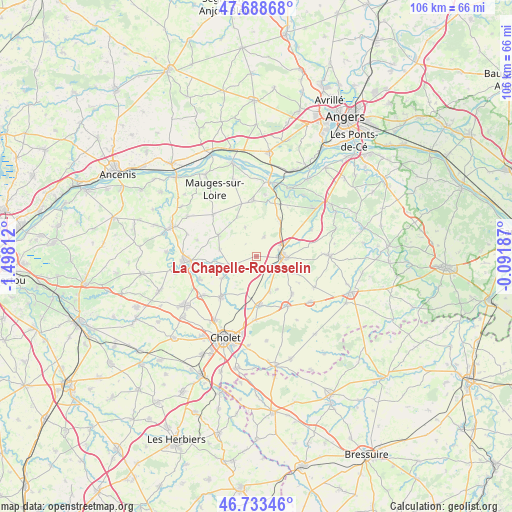
La Chapelle-Rousselin GPS coordinates[2]
47° 12' 47.592" North, 0° 47' 41.964" West
| Map corner | latitude | longitude |
|---|---|---|
| Upper-left | 47.68868°, | -1.49812° |
| Center: | 47.21322°, | -0.79499° |
| Lower-right: | 46.73346°, | -0.09187° |
| Map W x H: | 106.2×106.2 km | = 66×66mi |
| max Lat: | 51.07786° ⇑52.8% North |
| La Chapelle-Rousselin: | 47.21322° |
| min Lat: | ⇓47.2% South 41.3874° |
| min Long | La Chapelle-Rou | max Long |
| -5.08615° | -0.79499° | 9.52242° |
| W 13.6%⇐ | ⇒86.4% E |
Elevation
Elevation of La Chapelle-Rousselin is 106 m = 348 ft, and this is 87.7 m = 288 ft below average elevation for this country.
| Max E: |
2333 m = 7654 ft | 58.7% |
| Avg. | 193.7 m = 635 ft | |
| La Chapelle-Rousselin | 106 m = 348 ft | |
Min E: |
-1 m = -3 ft | 41.3% |
See also: France elevation on elevation.city.
Geographical zone
La Chapelle-Rousselin is located in North temperate zone (between Tropic of Cancer and the Arctic Circle). Distance of this North polar circle is 2151.6 km =1336.9 mi to North.| Distance of | km | miles | from La Chapelle-Rousselin |
|---|---|---|---|
| North Pole | 4757.4 | 2956.1 | to North |
| Arctic Circle | 2151.6 | 1336.9 | to North |
| Tropic Cancer | 2643.7 | 1642.7 | to South |
| Equator | 5249.6 | 3261.9 | to South |


Nearby cities:
15 places around La Chapelle-Rousselin: (largest is in red/bold)
• Bourgneuf-en-Mauges
11.4 km =7.1 mi,  344°
344°
• Chemillé-Melay
5.3 km =3.3 mi,  88°
88°
• Jallais
5.8 km =3.6 mi,  251°
251°
• La Jubaudière
8.7 km =5.4 mi,  238°
238°
• La Jumellière
8.9 km =5.5 mi,  33°
33°
• La Tourlandry
10.7 km =6.6 mi,  136°
136°
• Le May-sur-Èvre
11.2 km =7 mi,  220°
220°
• Le Pin-en-Mauges
9.1 km =5.7 mi,  299°
299°
• Melay
8.3 km =5.2 mi,  113°
113°
• Neuvy-en-Mauges
6.4 km =4 mi, 339°
• Saint-Laurent-de-la-Plaine
11.6 km =7.2 mi,  356°
356°
• Saint-Lézin
4.4 km =2.7 mi,  21°
21°
• Sainte-Christine
9.1 km =5.7 mi,  333°
333°
• Trémentines
10 km =6.2 mi,  175°
175°
• Vezins
12.2 km =7.6 mi,  148°
148°
Sources, notices
• [Note1] Compared only with cities in France existing in our database
• [Src1] Map data: © OpenStreetMap contributors (CC-BY-SA)
• [Src2] Other city data from geonames.org with taken over terms of usage.
• [Src3] Geographical zone / Annual Mean Temperature by Robert A. Rohde @ Wikipedia
