Saint-Lézin geodata
Saint-Lézin (Pays de la Loire) is a populated place; located in France in Europe/Paris (GMT+2) time zone. With population of 691 people, there are 11929 cities with bigger population in this country. Compared to other cities in France, 52.3% of cities are located further ↑North; 86.2% of cities are located further →East and 62.4% of cities have higher elevation than Saint-Lézin. Note1
Administrative division(s):
- Level 1: Pays de la Loire
- Level 2: Département de Maine-et-Loire
- Level 3: Arrondissement de Cholet
- Level 4: Chemillé-en-Anjou


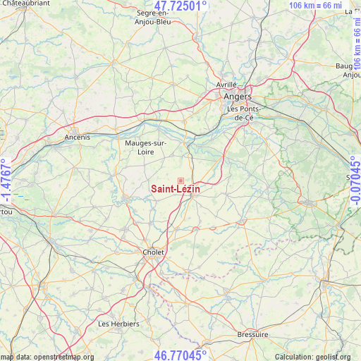
Saint-Lézin GPS coordinates[2]
47° 14' 59.568" North, 0° 46' 24.852" West
| Map corner | latitude | longitude |
|---|---|---|
| Upper-left | 47.72501°, | -1.4767° |
| Center: | 47.24988°, | -0.77357° |
| Lower-right: | 46.77045°, | -0.07045° |
| Map W x H: | 106.1×106.1 km | = 65.9×65.9mi |
| max Lat: | 51.07786° ⇑52.3% North |
| Saint-Lézin: | 47.24988° |
| min Lat: | ⇓47.7% South 41.3874° |
| min Long | Saint-Lézin | max Long |
| -5.08615° | -0.77357° | 9.52242° |
| W 13.8%⇐ | ⇒86.2% E |
Elevation
Elevation of Saint-Lézin is 96 m = 315 ft, and this is 97.7 m = 321 ft below average elevation for this country.
| Max E: |
2333 m = 7654 ft | 62.4% |
| Avg. | 193.7 m = 635 ft | |
| Saint-Lézin | 96 m = 315 ft | |
Min E: |
-1 m = -3 ft | 37.6% |
See also: France elevation on elevation.city.
Geographical zone
Saint-Lézin is located in North temperate zone (between Tropic of Cancer and the Arctic Circle). Distance of this North polar circle is 2147.5 km =1334.4 mi to North.| Distance of | km | miles | from Saint-Lézin |
|---|---|---|---|
| North Pole | 4753.4 | 2953.6 | to North |
| Arctic Circle | 2147.5 | 1334.4 | to North |
| Tropic Cancer | 2647.8 | 1645.3 | to South |
| Equator | 5253.7 | 3264.5 | to South |


Nearby cities:
15 places around Saint-Lézin: (largest is in red/bold)
• Bourgneuf-en-Mauges
8.4 km =5.2 mi,  326°
326°
• Chalonnes-sur-Loire
11.3 km =7 mi,  3°
3°
• Chanzeaux
9.9 km =6.2 mi,  81°
81°
• Chaudefonds-sur-Layon
9.8 km =6.1 mi,  31°
31°
• Chemillé-Melay
5.4 km =3.4 mi,  136°
136°
• Jallais
9.2 km =5.7 mi,  230°
230°
• La Chapelle-Rousselin
4.4 km =2.7 mi,  201°
201°
• La Jumellière
4.7 km =2.9 mi,  45°
45°
• Le Pin-en-Mauges
9.5 km =5.9 mi,  272°
272°
• Melay
9.5 km =5.9 mi, 141°
• Neuvy-en-Mauges
4.3 km =2.7 mi,  296°
296°
• Saint-Aubin-de-Luigné
11.8 km =7.3 mi,  43°
43°
• Saint-Laurent-de-la-Plaine
7.8 km =4.8 mi,  343°
343°
• Saint-Quentin-en-Mauges
11.4 km =7.1 mi,  293°
293°
• Sainte-Christine
7 km =4.3 mi,  305°
305°
Sources, notices
• [Note1] Compared only with cities in France existing in our database
• [Src1] Map data: © OpenStreetMap contributors (CC-BY-SA)
• [Src2] Other city data from geonames.org with taken over terms of usage.
• [Src3] Geographical zone / Annual Mean Temperature by Robert A. Rohde @ Wikipedia
