Chemillé-Melay geodata
Chemillé-Melay (Pays de la Loire) is a populated place; located in France in Europe/Paris (GMT+2) time zone. With population of 6,683 people, there are 1481 cities with bigger population in this country. Compared to other cities in France, 52.8% of cities are located further ↑North; 85.8% of cities are located further →East and 66.6% of cities have higher elevation than Chemillé-Melay. Note1
Administrative division(s):
- Level 1: Pays de la Loire
- Level 2: Département de Maine-et-Loire
- Level 3: Arrondissement de Cholet
- Level 4: Chemillé-en-Anjou


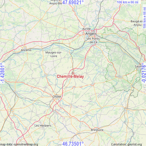
Chemillé-Melay GPS coordinates[2]
47° 12' 53.136" North, 0° 43' 29.568" West
| Map corner | latitude | longitude |
|---|---|---|
| Upper-left | 47.69021°, | -1.42801° |
| Center: | 47.21476°, | -0.72488° |
| Lower-right: | 46.73501°, | -0.02176° |
| Map W x H: | 106.2×106.2 km | = 66×66mi |
| max Lat: | 51.07786° ⇑52.8% North |
| Chemillé-Melay: | 47.21476° |
| min Lat: | ⇓47.2% South 41.3874° |
| min Long | Chemillé-Melay | max Long |
| -5.08615° | -0.72488° | 9.52242° |
| W 14.2%⇐ | ⇒85.8% E |
Elevation
Elevation of Chemillé-Melay is 86 m = 282 ft, and this is 107.7 m = 353 ft below average elevation for this country.
| Max E: |
2333 m = 7654 ft | 66.6% |
| Avg. | 193.7 m = 635 ft | |
| Chemillé-Melay | 86 m = 282 ft | |
Min E: |
-1 m = -3 ft | 33.4% |
See also: France elevation on elevation.city.
Geographical zone
Chemillé-Melay is located in North temperate zone (between Tropic of Cancer and the Arctic Circle). Distance of this North polar circle is 2151.4 km =1336.8 mi to North.| Distance of | km | miles | from Chemillé-Melay |
|---|---|---|---|
| North Pole | 4757.3 | 2956 | to North |
| Arctic Circle | 2151.4 | 1336.8 | to North |
| Tropic Cancer | 2643.9 | 1642.8 | to South |
| Equator | 5249.8 | 3262.1 | to South |


Nearby cities:
15 places around Chemillé-Melay: (largest is in red/bold)
• Chanzeaux
8.2 km =5.1 mi,  48°
48°
• Chaudefonds-sur-Layon
12.4 km =7.7 mi,  6°
6°
• Coron
11.4 km =7.1 mi,  148°
148°
• Jallais
10.9 km =6.8 mi,  259°
259°
• La Chapelle-Rousselin
5.3 km =3.3 mi,  268°
268°
• La Jumellière
7.2 km =4.5 mi,  357°
357°
• La Salle-de-Vihiers
9.4 km =5.8 mi,  134°
134°
• La Tourlandry
8.2 km =5.1 mi,  164°
164°
• Melay
4.2 km =2.6 mi, 146°
• Neuvy-en-Mauges
9.6 km =6 mi,  307°
307°
• Saint-Lambert-du-Lattay
12 km =7.5 mi,  35°
35°
• Saint-Lézin
5.4 km =3.4 mi,  316°
316°
• Sainte-Christine
12.3 km =7.6 mi, 310°
• Trémentines
11.1 km =6.9 mi,  204°
204°
• Vezins
10.6 km =6.6 mi,  173°
173°
Sources, notices
• [Note1] Compared only with cities in France existing in our database
• [Src1] Map data: © OpenStreetMap contributors (CC-BY-SA)
• [Src2] Other city data from geonames.org with taken over terms of usage.
• [Src3] Geographical zone / Annual Mean Temperature by Robert A. Rohde @ Wikipedia
