Le Pin-en-Mauges geodata
Le Pin-en-Mauges (Pays de la Loire) is a populated place; located in France in Europe/Paris (GMT+2) time zone. With population of 1,237 people, there are 7344 cities with bigger population in this country. Compared to other cities in France, 52.3% of cities are located further ↑North; 87.3% of cities are located further →East and 56.5% of cities have higher elevation than Le Pin-en-Mauges. Note1
Administrative division(s):
- Level 1: Pays de la Loire
- Level 2: Département de Maine-et-Loire
- Level 3: Arrondissement de Cholet
- Level 4: Beaupréau-en-Mauges


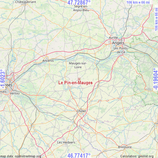
Le Pin-en-Mauges GPS coordinates[2]
47° 15' 12.852" North, 0° 53' 57.012" West
| Map corner | latitude | longitude |
|---|---|---|
| Upper-left | 47.72867°, | -1.6023° |
| Center: | 47.25357°, | -0.89917° |
| Lower-right: | 46.77417°, | -0.19604° |
| Map W x H: | 106.1×106.1 km | = 65.9×65.9mi |
| max Lat: | 51.07786° ⇑52.3% North |
| Le Pin-en-Mauges: | 47.25357° |
| min Lat: | ⇓47.7% South 41.3874° |
| min Long | Le Pin-en-Mauge | max Long |
| -5.08615° | -0.89917° | 9.52242° |
| W 12.7%⇐ | ⇒87.3% E |
Elevation
Elevation of Le Pin-en-Mauges is 112 m = 367 ft, and this is 81.7 m = 268 ft below average elevation for this country.
| Max E: |
2333 m = 7654 ft | 56.5% |
| Avg. | 193.7 m = 635 ft | |
| Le Pin-en-Mauges | 112 m = 367 ft | |
Min E: |
-1 m = -3 ft | 43.5% |
See also: France elevation on elevation.city.
Geographical zone
Le Pin-en-Mauges is located in North temperate zone (between Tropic of Cancer and the Arctic Circle). Distance of this North polar circle is 2147.1 km =1334.1 mi to North.| Distance of | km | miles | from Le Pin-en-Mauges |
|---|---|---|---|
| North Pole | 4753 | 2953.4 | to North |
| Arctic Circle | 2147.1 | 1334.1 | to North |
| Tropic Cancer | 2648.2 | 1645.5 | to South |
| Equator | 5254.1 | 3264.7 | to South |


Nearby cities:
15 places around Le Pin-en-Mauges: (largest is in red/bold)
• Andrezé
10 km =6.2 mi,  203°
203°
• Beaupréau
8.6 km =5.3 mi,  230°
230°
• Botz-en-Mauges
9.7 km =6 mi,  307°
307°
• Bourgneuf-en-Mauges
8.1 km =5 mi,  36°
36°
• Chaudron-en-Mauges
7.6 km =4.7 mi,  300°
300°
• Jallais
6.7 km =4.2 mi,  159°
159°
• La Chapelle-Rousselin
9.1 km =5.7 mi,  119°
119°
• La Jubaudière
9.1 km =5.7 mi,  176°
176°
• La Salle-et-Chapelle-Aubry
5.7 km =3.5 mi,  266°
266°
• Neuvy-en-Mauges
5.8 km =3.6 mi,  74°
74°
• Saint-Laurent-de-la-Plaine
10.1 km =6.3 mi,  45°
45°
• Saint-Lézin
9.5 km =5.9 mi,  92°
92°
• Saint-Pierre-Montlimart
9.8 km =6.1 mi,  280°
280°
• Saint-Quentin-en-Mauges
4.3 km =2.7 mi,  347°
347°
• Sainte-Christine
5.3 km =3.3 mi, 46°
Sources, notices
• [Note1] Compared only with cities in France existing in our database
• [Src1] Map data: © OpenStreetMap contributors (CC-BY-SA)
• [Src2] Other city data from geonames.org with taken over terms of usage.
• [Src3] Geographical zone / Annual Mean Temperature by Robert A. Rohde @ Wikipedia
