La Chapelle-en-Serval geodata
La Chapelle-en-Serval (Hauts-de-France) is a populated place; located in France in Europe/Paris (GMT+2) time zone. With population of 2,592 people, there are 3765 cities with bigger population in this country. Compared to other cities in France, 82.9% of cities are located further ↓South; 51.1% of cities are located further ←West and 74.6% of cities have higher elevation than La Chapelle-en-Serval. Note1
Administrative division(s):
- Level 1: Hauts-de-France
- Level 2: Département de l'Oise
- Level 3: Arrondissement de Senlis
- Level 4: La Chapelle-en-Serval
Current local time in La Chapelle-en-Serval:
05:58 AM, WednesdayDifference from your time zone: hours


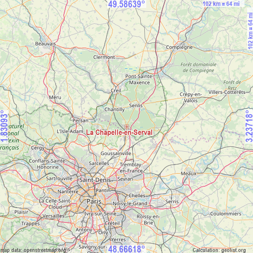
La Chapelle-en-Serval GPS coordinates[2]
49° 7' 42.312" North, 2° 32' 2.58" East
| Map corner | latitude | longitude |
|---|---|---|
| Upper-left | 49.58639°, | 1.83093° |
| Center: | 49.12842°, | 2.53405° |
| Lower-right: | 48.66618°, | 3.23718° |
| Map W x H: | 102.3×102.3 km | = 63.6×63.6mi |
| max Lat: | 51.07786° ⇑17.1% North |
| La Chapelle-en-Serval: | 49.12842° |
| min Lat: | ⇓82.9% South 41.3874° |
| min Long | La Chapelle-en- | max Long |
| -5.08615° | 2.53405° | 9.52242° |
| W 51.1%⇐ | ⇒48.9% E |
Elevation
Elevation of La Chapelle-en-Serval is 68 m = 223 ft, and this is 125.7 m = 412 ft below average elevation for this country.
| Max E: |
2333 m = 7654 ft | 74.6% |
| Avg. | 193.7 m = 635 ft | |
| La Chapelle-en-Serval | 68 m = 223 ft | |
Min E: |
-1 m = -3 ft | 25.4% |
See also: France elevation on elevation.city.
Geographical zone
La Chapelle-en-Serval is located in North temperate zone (between Tropic of Cancer and the Arctic Circle). Distance of this North polar circle is 1938.6 km =1204.6 mi to North.| Distance of | km | miles | from La Chapelle-en-Serval |
|---|---|---|---|
| North Pole | 4544.5 | 2823.8 | to North |
| Arctic Circle | 1938.6 | 1204.6 | to North |
| Tropic Cancer | 2856.6 | 1775 | to South |
| Equator | 5462.6 | 3394.3 | to South |


Nearby cities:
15 places around La Chapelle-en-Serval: (largest is in red/bold)
• Avilly-Saint-Léonard
7.4 km =4.6 mi,  4°
4°
• Bellefontaine
6 km =3.7 mi,  235°
235°
• Chaumontel
7.4 km =4.6 mi,  266°
266°
• Coye-la-Forêt
4.9 km =3 mi,  288°
288°
• Fosses
3.8 km =2.4 mi,  207°
207°
• Lamorlaye
7.4 km =4.6 mi,  300°
300°
• Marly-la-Ville
5.6 km =3.5 mi,  203°
203°
• Orry-la-Ville
1.7 km =1.1 mi, 288°
• Plailly
4.7 km =2.9 mi,  127°
127°
• Pontarmé
3 km =1.9 mi,  23°
23°
• Saint-Witz
5 km =3.1 mi,  146°
146°
• Survilliers
3.6 km =2.2 mi,  167°
167°
• Thiers-sur-Thève
3.8 km =2.4 mi,  44°
44°
• Villeron
7.9 km =4.9 mi,  175°
175°
• Vémars
7 km =4.3 mi,  160°
160°
Sources, notices
• [Note1] Compared only with cities in France existing in our database
• [Src1] Map data: © OpenStreetMap contributors (CC-BY-SA)
• [Src2] Other city data from geonames.org with taken over terms of usage.
• [Src3] Geographical zone / Annual Mean Temperature by Robert A. Rohde @ Wikipedia
