Lamorlaye geodata
Lamorlaye (Hauts-de-France) is a populated place; located in France in Europe/Paris (GMT+2) time zone. With population of 8,540 people, there are 1130 cities with bigger population in this country. Compared to other cities in France, 83.5% of cities are located further ↓South; 50.2% of cities are located further →East and 77.8% of cities have higher elevation than Lamorlaye. Note1
Administrative division(s):
- Level 1: Hauts-de-France
- Level 2: Département de l'Oise
- Level 3: Arrondissement de Senlis
- Level 4: Lamorlaye


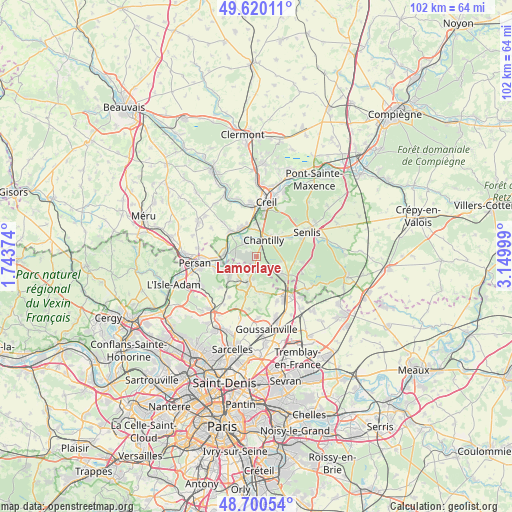
Lamorlaye GPS coordinates[2]
49° 9' 44.856" North, 2° 26' 48.732" East
| Map corner | latitude | longitude |
|---|---|---|
| Upper-left | 49.62011°, | 1.74374° |
| Center: | 49.16246°, | 2.44687° |
| Lower-right: | 48.70054°, | 3.14999° |
| Map W x H: | 102.2×102.2 km | = 63.5×63.5mi |
| max Lat: | 51.07786° ⇑16.5% North |
| Lamorlaye: | 49.16246° |
| min Lat: | ⇓83.5% South 41.3874° |
| min Long | Lamorlaye | max Long |
| -5.08615° | 2.44687° | 9.52242° |
| W 49.8%⇐ | ⇒50.2% E |
Elevation
Elevation of Lamorlaye is 60 m = 197 ft, and this is 133.7 m = 439 ft below average elevation for this country.
| Max E: |
2333 m = 7654 ft | 77.8% |
| Avg. | 193.7 m = 635 ft | |
| Lamorlaye | 60 m = 197 ft | |
Min E: |
-1 m = -3 ft | 22.2% |
See also: France elevation on elevation.city.
Geographical zone
Lamorlaye is located in North temperate zone (between Tropic of Cancer and the Arctic Circle). Distance of this North polar circle is 1934.8 km =1202.2 mi to North.| Distance of | km | miles | from Lamorlaye |
|---|---|---|---|
| North Pole | 4540.7 | 2821.5 | to North |
| Arctic Circle | 1934.8 | 1202.2 | to North |
| Tropic Cancer | 2860.4 | 1777.4 | to South |
| Equator | 5466.4 | 3396.7 | to South |


Nearby cities:
15 places around Lamorlaye: (largest is in red/bold)
• Asnières-sur-Oise
7.4 km =4.6 mi,  244°
244°
• Bellefontaine
7.3 km =4.5 mi,  168°
168°
• Boran-sur-Oise
6.5 km =4 mi,  274°
274°
• Chantilly
4 km =2.5 mi,  26°
26°
• Chaumontel
4.3 km =2.7 mi,  194°
194°
• Coye-la-Forêt
2.8 km =1.7 mi,  142°
142°
• Gouvieux
3.6 km =2.2 mi,  319°
319°
• La Chapelle-en-Serval
7.4 km =4.6 mi,  120°
120°
• Luzarches
5.8 km =3.6 mi,  198°
198°
• Orry-la-Ville
5.7 km =3.5 mi, 124°
• Saint-Maximin
6.6 km =4.1 mi,  4°
4°
• Seugy
5.9 km =3.7 mi,  220°
220°
• Viarmes
6.6 km =4.1 mi, 237°
• Villers-sous-Saint-Leu
6.7 km =4.2 mi,  325°
325°
• Vineuil-Saint-Firmin
5.5 km =3.4 mi,  40°
40°
Sources, notices
• [Note1] Compared only with cities in France existing in our database
• [Src1] Map data: © OpenStreetMap contributors (CC-BY-SA)
• [Src2] Other city data from geonames.org with taken over terms of usage.
• [Src3] Geographical zone / Annual Mean Temperature by Robert A. Rohde @ Wikipedia
