La Celle-Saint-Avant geodata
La Celle-Saint-Avant (Centre) is a populated place; located in France in Europe/Paris (GMT+2) time zone. With population of 1,126 people, there are 7971 cities with bigger population in this country. Compared to other cities in France, 55.1% of cities are located further ↑North; 72.3% of cities are located further →East and 78.2% of cities have higher elevation than La Celle-Saint-Avant. Note1
Administrative division(s):
- Level 1: Centre
- Level 2: Département d'Indre-et-Loire
- Level 3: Arrondissement de Loches
- Level 4: La Celle-Saint-Avant


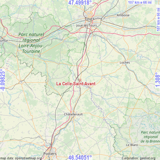
La Celle-Saint-Avant GPS coordinates[2]
47° 1' 19.2" North, 0° 36' 17.568" East
| Map corner | latitude | longitude |
|---|---|---|
| Upper-left | 47.49918°, | -0.09825° |
| Center: | 47.022°, | 0.60488° |
| Lower-right: | 46.54051°, | 1.308° |
| Map W x H: | 106.6×106.6 km | = 66.2×66.2mi |
| max Lat: | 51.07786° ⇑55.1% North |
| La Celle-Saint-Avant: | 47.022° |
| min Lat: | ⇓44.9% South 41.3874° |
| min Long | La Celle-Saint- | max Long |
| -5.08615° | 0.60488° | 9.52242° |
| W 27.7%⇐ | ⇒72.3% E |
Elevation
Elevation of La Celle-Saint-Avant is 59 m = 194 ft, and this is 134.7 m = 442 ft below average elevation for this country.
| Max E: |
2333 m = 7654 ft | 78.2% |
| Avg. | 193.7 m = 635 ft | |
| La Celle-Saint-Avant | 59 m = 194 ft | |
Min E: |
-1 m = -3 ft | 21.8% |
See also: France elevation on elevation.city.
Geographical zone
La Celle-Saint-Avant is located in North temperate zone (between Tropic of Cancer and the Arctic Circle). Distance of this North polar circle is 2172.8 km =1350.1 mi to North.| Distance of | km | miles | from La Celle-Saint-Avant |
|---|---|---|---|
| North Pole | 4778.7 | 2969.3 | to North |
| Arctic Circle | 2172.8 | 1350.1 | to North |
| Tropic Cancer | 2622.4 | 1629.5 | to South |
| Equator | 5228.4 | 3248.8 | to South |


Nearby cities:
15 places around La Celle-Saint-Avant: (largest is in red/bold)
• Cussay
13.9 km =8.6 mi,  88°
88°
• Dangé-Saint-Romain
9.9 km =6.2 mi,  182°
182°
• Descartes
9.5 km =5.9 mi,  130°
130°
• Draché
4 km =2.5 mi,  23°
23°
• Les Ormes
5.5 km =3.4 mi, 179°
• Maillé
3.9 km =2.4 mi,  334°
334°
• Marcilly-sur-Vienne
5.5 km =3.4 mi,  295°
295°
• Marigny-Marmande
9.8 km =6.1 mi,  242°
242°
• Nouâtre
5.3 km =3.3 mi,  306°
306°
• Noyant-de-Touraine
10.4 km =6.5 mi,  340°
340°
• Parçay-sur-Vienne
13.5 km =8.4 mi, 313°
• Port-de-Piles
2.2 km =1.4 mi,  189°
189°
• Pouzay
8.7 km =5.4 mi,  320°
320°
• Sainte-Maure-de-Touraine
10 km =6.2 mi,  7°
7°
• Vaux-sur-Vienne
12.5 km =7.8 mi, 193°
Sources, notices
• [Note1] Compared only with cities in France existing in our database
• [Src1] Map data: © OpenStreetMap contributors (CC-BY-SA)
• [Src2] Other city data from geonames.org with taken over terms of usage.
• [Src3] Geographical zone / Annual Mean Temperature by Robert A. Rohde @ Wikipedia
