Lacanche geodata
Lacanche (Bourgogne-Franche-Comté) is a populated place; located in France in Europe/Paris (GMT+2) time zone. With population of 650 people, there are 12520 cities with bigger population in this country. Compared to other cities in France, 54.5% of cities are located further ↑North; 72.5% of cities are located further ←West and 88.5% of cities have lower elevation than Lacanche. Note1
Administrative division(s):
- Level 1: Bourgogne-Franche-Comté
- Level 2: Département de la Côte-d'Or
- Level 3: Arrondissement de Beaune
- Level 4: Lacanche


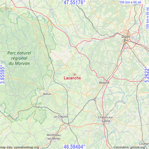
Lacanche GPS coordinates[2]
47° 4' 30.18" North, 4° 33' 32.688" East
| Map corner | latitude | longitude |
|---|---|---|
| Upper-left | 47.55176°, | 3.85595° |
| Center: | 47.07505°, | 4.55908° |
| Lower-right: | 46.59404°, | 5.2622° |
| Map W x H: | 106.5×106.5 km | = 66.2×66.2mi |
| max Lat: | 51.07786° ⇑54.5% North |
| Lacanche: | 47.07505° |
| min Lat: | ⇓45.5% South 41.3874° |
| min Long | Lacanche | max Long |
| -5.08615° | 4.55908° | 9.52242° |
| W 72.5%⇐ | ⇒27.5% E |
Elevation
Elevation of Lacanche is 397 m = 1302 ft, and this is 203.3 m = 667 ft above average elevation for this country.
| Max E: |
2333 m = 7654 ft | 11.5% |
| Lacanche | 397 m 1302 ft | |
| Avg. | 193.7 m = 635 ft | |
Min E: |
-1 m = -3 ft | 88.5% |
See also: France elevation on elevation.city.
Geographical zone
Lacanche is located in North temperate zone (between Tropic of Cancer and the Arctic Circle). Distance of this North polar circle is 2166.9 km =1346.4 mi to North.| Distance of | km | miles | from Lacanche |
|---|---|---|---|
| North Pole | 4772.8 | 2965.7 | to North |
| Arctic Circle | 2166.9 | 1346.4 | to North |
| Tropic Cancer | 2628.3 | 1633.1 | to South |
| Equator | 5234.3 | 3252.4 | to South |


Nearby cities:
15 places around Lacanche: (largest is in red/bold)
• Arnay-le-Duc
8.4 km =5.2 mi,  318°
318°
• Auxy
18.2 km =11.3 mi,  220°
220°
• Bligny-sur-Ouche
9 km =5.6 mi,  67°
67°
• Curgy
16.4 km =10.2 mi,  233°
233°
• Dracy-Saint-Loup
17.6 km =10.9 mi,  248°
248°
• Igornay
14.1 km =8.8 mi,  256°
256°
• Meursault
19.2 km =11.9 mi,  124°
124°
• Nolay
14.8 km =9.2 mi,  157°
157°
• Pommard
19.3 km =12 mi,  112°
112°
• Saint-Léger-du-Bois
10.9 km =6.8 mi, 231°
• Saint-Sernin-du-Plain
20.8 km =12.9 mi,  168°
168°
• Santenay
20.8 km =12.9 mi,  149°
149°
• Savigny-lès-Beaune
19.7 km =12.2 mi,  93°
93°
• Sully
9.9 km =6.2 mi, 220°
• Épinac
10.7 km =6.6 mi,  197°
197°
Sources, notices
• [Note1] Compared only with cities in France existing in our database
• [Src1] Map data: © OpenStreetMap contributors (CC-BY-SA)
• [Src2] Other city data from geonames.org with taken over terms of usage.
• [Src3] Geographical zone / Annual Mean Temperature by Robert A. Rohde @ Wikipedia
