Épinac geodata
Épinac (Bourgogne-Franche-Comté) is a populated place; located in France in Europe/Paris (GMT+2) time zone. With population of 2,531 people, there are 3851 cities with bigger population in this country. Compared to other cities in France, 55.5% of cities are located further ↑North; 72.2% of cities are located further ←West and 83.6% of cities have lower elevation than Épinac. Note1
Administrative division(s):
- Level 1: Bourgogne-Franche-Comté
- Level 2: Département de Saône-et-Loire
- Level 3: Autun
- Level 4: Épinac


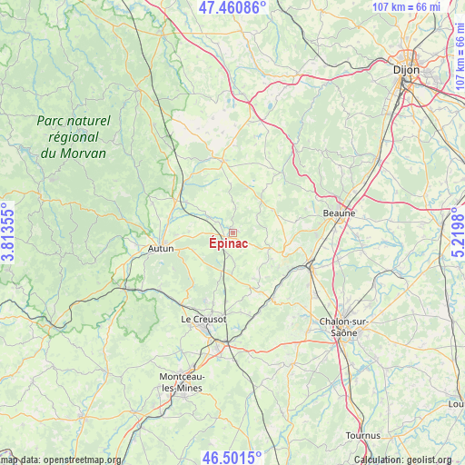
Épinac GPS coordinates[2]
46° 58' 59.988" North, 4° 31' 0.012" East
| Map corner | latitude | longitude |
|---|---|---|
| Upper-left | 47.46086°, | 3.81355° |
| Center: | 46.98333°, | 4.51667° |
| Lower-right: | 46.5015°, | 5.2198° |
| Map W x H: | 106.7×106.7 km | = 66.3×66.3mi |
| max Lat: | 51.07786° ⇑55.5% North |
| Épinac: | 46.98333° |
| min Lat: | ⇓44.5% South 41.3874° |
| min Long | Épinac | max Long |
| -5.08615° | 4.51667° | 9.52242° |
| W 72.2%⇐ | ⇒27.8% E |
Elevation
Elevation of Épinac is 330 m = 1083 ft, and this is 136.3 m = 447 ft above average elevation for this country.
| Max E: |
2333 m = 7654 ft | 16.4% |
| Épinac | 330 m 1083 ft | |
| Avg. | 193.7 m = 635 ft | |
Min E: |
-1 m = -3 ft | 83.6% |
See also: France elevation on elevation.city.
Geographical zone
Épinac is located in North temperate zone (between Tropic of Cancer and the Arctic Circle). Distance of this North polar circle is 2177.1 km =1352.8 mi to North.| Distance of | km | miles | from Épinac |
|---|---|---|---|
| North Pole | 4783 | 2972 | to North |
| Arctic Circle | 2177.1 | 1352.8 | to North |
| Tropic Cancer | 2618.1 | 1626.8 | to South |
| Equator | 5224.1 | 3246.1 | to South |


Nearby cities:
15 places around Épinac: (largest is in red/bold)
• Antully
12 km =7.5 mi,  222°
222°
• Arnay-le-Duc
16.7 km =10.4 mi,  351°
351°
• Auxy
9.3 km =5.8 mi,  246°
246°
• Couches
13.5 km =8.4 mi,  163°
163°
• Curgy
10 km =6.2 mi,  272°
272°
• Dracy-Saint-Loup
13.7 km =8.5 mi,  285°
285°
• Igornay
12.6 km =7.8 mi,  303°
303°
• Lacanche
10.7 km =6.6 mi,  17°
17°
• Nolay
9.6 km =6 mi,  111°
111°
• Saint-Forgeot
16.6 km =10.3 mi,  277°
277°
• Saint-Léger-du-Bois
6.3 km =3.9 mi, 302°
• Saint-Pierre-de-Varennes
15.8 km =9.8 mi,  184°
184°
• Saint-Sernin-du-Plain
12.7 km =7.9 mi,  143°
143°
• Santenay
15.8 km =9.8 mi,  119°
119°
• Sully
4.2 km =2.6 mi,  309°
309°
Sources, notices
• [Note1] Compared only with cities in France existing in our database
• [Src1] Map data: © OpenStreetMap contributors (CC-BY-SA)
• [Src2] Other city data from geonames.org with taken over terms of usage.
• [Src3] Geographical zone / Annual Mean Temperature by Robert A. Rohde @ Wikipedia
