Bligny-sur-Ouche geodata
Bligny-sur-Ouche (Bourgogne-Franche-Comté) is a populated place; located in France in Europe/Paris (GMT+2) time zone. With population of 820 people, there are 10392 cities with bigger population in this country. Compared to other cities in France, 54.1% of cities are located further ↑North; 73.4% of cities are located further ←West and 85.8% of cities have lower elevation than Bligny-sur-Ouche. Note1
Administrative division(s):
- Level 1: Bourgogne-Franche-Comté
- Level 2: Département de la Côte-d'Or
- Level 3: Arrondissement de Beaune
- Level 4: Bligny-sur-Ouche


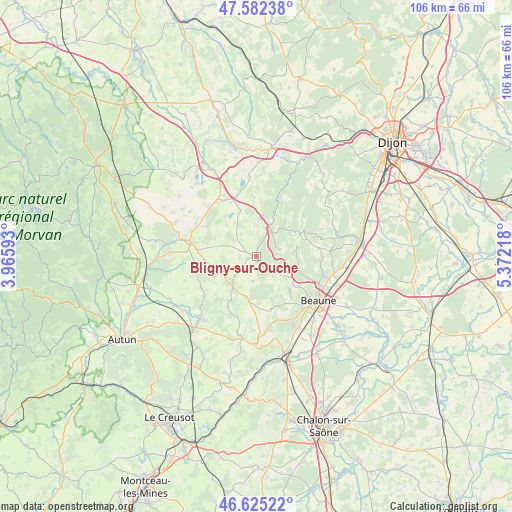
Bligny-sur-Ouche GPS coordinates[2]
47° 6' 21.42" North, 4° 40' 8.58" East
| Map corner | latitude | longitude |
|---|---|---|
| Upper-left | 47.58238°, | 3.96593° |
| Center: | 47.10595°, | 4.66905° |
| Lower-right: | 46.62522°, | 5.37218° |
| Map W x H: | 106.4×106.4 km | = 66.1×66.1mi |
| max Lat: | 51.07786° ⇑54.1% North |
| Bligny-sur-Ouche: | 47.10595° |
| min Lat: | ⇓45.9% South 41.3874° |
| min Long | Bligny-sur-Ouch | max Long |
| -5.08615° | 4.66905° | 9.52242° |
| W 73.4%⇐ | ⇒26.6% E |
Elevation
Elevation of Bligny-sur-Ouche is 359 m = 1178 ft, and this is 165.3 m = 542 ft above average elevation for this country.
| Max E: |
2333 m = 7654 ft | 14.2% |
| Bligny-sur-Ouche | 359 m 1178 ft | |
| Avg. | 193.7 m = 635 ft | |
Min E: |
-1 m = -3 ft | 85.8% |
See also: France elevation on elevation.city.
Geographical zone
Bligny-sur-Ouche is located in North temperate zone (between Tropic of Cancer and the Arctic Circle). Distance of this North polar circle is 2163.5 km =1344.3 mi to North.| Distance of | km | miles | from Bligny-sur-Ouche |
|---|---|---|---|
| North Pole | 4769.4 | 2963.6 | to North |
| Arctic Circle | 2163.5 | 1344.3 | to North |
| Tropic Cancer | 2631.8 | 1635.3 | to South |
| Equator | 5237.7 | 3254.6 | to South |


Nearby cities:
15 places around Bligny-sur-Ouche: (largest is in red/bold)
• Arnay-le-Duc
14.2 km =8.8 mi,  281°
281°
• Beaune
15.8 km =9.8 mi,  125°
125°
• Bligny-lès-Beaune
17.9 km =11.1 mi,  138°
138°
• Chorey-les-Beaune
16.2 km =10.1 mi,  112°
112°
• Corgoloin
18.6 km =11.6 mi,  97°
97°
• Lacanche
9 km =5.6 mi,  247°
247°
• Ladoix-Serrigny
16.8 km =10.4 mi, 105°
• Meursault
16.1 km =10 mi,  151°
151°
• Montagny-lès-Beaune
18.7 km =11.6 mi, 132°
• Nolay
17.3 km =10.7 mi,  188°
188°
• Pommard
14.3 km =8.9 mi, 138°
• Savigny-lès-Beaune
12.2 km =7.6 mi, 112°
• Sully
18.4 km =11.4 mi,  233°
233°
• Vignoles
18.6 km =11.6 mi,  117°
117°
• Épinac
17.9 km =11.1 mi,  220°
220°
Sources, notices
• [Note1] Compared only with cities in France existing in our database
• [Src1] Map data: © OpenStreetMap contributors (CC-BY-SA)
• [Src2] Other city data from geonames.org with taken over terms of usage.
• [Src3] Geographical zone / Annual Mean Temperature by Robert A. Rohde @ Wikipedia
