Chocques geodata
Chocques (Hauts-de-France) is a populated place; located in France in Europe/Paris (GMT+2) time zone. With population of 2,981 people, there are 3277 cities with bigger population in this country. Compared to other cities in France, 97.7% of cities are located further ↓South; 51.7% of cities are located further ←West and 92% of cities have higher elevation than Chocques. Note1
Administrative division(s):
- Level 1: Hauts-de-France
- Level 2: Pas-de-Calais
- Level 3: Arrondissement de Béthune
- Level 4: Chocques


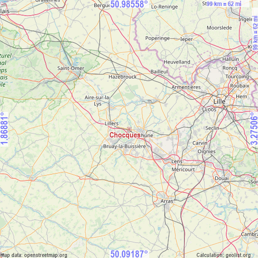
Chocques GPS coordinates[2]
50° 32' 27.024" North, 2° 34' 18.948" East
| Map corner | latitude | longitude |
|---|---|---|
| Upper-left | 50.98558°, | 1.86881° |
| Center: | 50.54084°, | 2.57193° |
| Lower-right: | 50.09187°, | 3.27506° |
| Map W x H: | 99.4×99.4 km | = 61.8×61.8mi |
| max Lat: | 51.07786° ⇑2.3% North |
| Chocques: | 50.54084° |
| min Lat: | ⇓97.7% South 41.3874° |
| min Long | Chocques | max Long |
| -5.08615° | 2.57193° | 9.52242° |
| W 51.7%⇐ | ⇒48.3% E |
Elevation
Elevation of Chocques is 25 m = 82 ft, and this is 168.7 m = 553 ft below average elevation for this country.
| Max E: |
2333 m = 7654 ft | 92% |
| Avg. | 193.7 m = 635 ft | |
| Chocques | 25 m = 82 ft | |
Min E: |
-1 m = -3 ft | 8% |
See also: France elevation on elevation.city.
Geographical zone
Chocques is located in North temperate zone (between Tropic of Cancer and the Arctic Circle). Distance of this North polar circle is 1781.6 km =1107 mi to North.| Distance of | km | miles | from Chocques |
|---|---|---|---|
| North Pole | 4387.4 | 2726.2 | to North |
| Arctic Circle | 1781.6 | 1107 | to North |
| Tropic Cancer | 3013.7 | 1872.6 | to South |
| Equator | 5619.6 | 3491.9 | to South |


Nearby cities:
15 places around Chocques: (largest is in red/bold)
• Allouagne
4.4 km =2.7 mi,  256°
256°
• Annezin
3.4 km =2.1 mi,  106°
106°
• Béthune
5 km =3.1 mi,  104°
104°
• Fouquereuil
3.2 km =2 mi,  140°
140°
• Fouquières-lès-Béthune
3.9 km =2.4 mi, 136°
• Gonnehem
2.2 km =1.4 mi,  1°
1°
• Gosnay
4 km =2.5 mi,  162°
162°
• Hesdigneul-lès-Béthune
4.5 km =2.8 mi, 164°
• Hinges
4.5 km =2.8 mi,  50°
50°
• Labeuvrière
2.5 km =1.6 mi,  195°
195°
• Lapugnoy
3.8 km =2.4 mi,  224°
224°
• Lozinghem
5.7 km =3.5 mi,  240°
240°
• Mont-Bernanchon
4.8 km =3 mi,  9°
9°
• Vaudricourt
5.8 km =3.6 mi, 139°
• Vendin-lès-Béthune
2 km =1.2 mi,  92°
92°
Sources, notices
• [Note1] Compared only with cities in France existing in our database
• [Src1] Map data: © OpenStreetMap contributors (CC-BY-SA)
• [Src2] Other city data from geonames.org with taken over terms of usage.
• [Src3] Geographical zone / Annual Mean Temperature by Robert A. Rohde @ Wikipedia
