Bessens geodata
Bessens (Occitanie) is a populated place; located in France in Europe/Paris (GMT+2) time zone. With population of 708 people, there are 11684 cities with bigger population in this country. Compared to other cities in France, 88.3% of cities are located further ↑North; 66.1% of cities are located further →East and 59.1% of cities have higher elevation than Bessens. Note1
Administrative division(s):
- Level 1: Occitanie
- Level 2: Département du Tarn-et-Garonne
- Level 3: Arrondissement de Montauban
- Level 4: Bessens


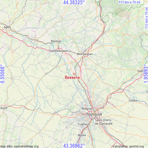
Bessens GPS coordinates[2]
43° 52' 42.924" North, 1° 15' 13.716" East
| Map corner | latitude | longitude |
|---|---|---|
| Upper-left | 44.38325°, | 0.55068° |
| Center: | 43.87859°, | 1.25381° |
| Lower-right: | 43.36962°, | 1.95693° |
| Map W x H: | 112.7×112.7 km | = 70×70mi |
| max Lat: | 51.07786° ⇑88.3% North |
| Bessens: | 43.87859° |
| min Lat: | ⇓11.7% South 41.3874° |
| min Long | Bessens | max Long |
| -5.08615° | 1.25381° | 9.52242° |
| W 33.9%⇐ | ⇒66.1% E |
Elevation
Elevation of Bessens is 105 m = 344 ft, and this is 88.7 m = 291 ft below average elevation for this country.
| Max E: |
2333 m = 7654 ft | 59.1% |
| Avg. | 193.7 m = 635 ft | |
| Bessens | 105 m = 344 ft | |
Min E: |
-1 m = -3 ft | 40.9% |
See also: France elevation on elevation.city.
Geographical zone
Bessens is located in North temperate zone (between Tropic of Cancer and the Arctic Circle). Distance of this Northern Tropic circle is 2272.9 km =1412.3 mi to South.| Distance of | km | miles | from Bessens |
|---|---|---|---|
| North Pole | 5128.2 | 3186.5 | to North |
| Arctic Circle | 2522.3 | 1567.3 | to North |
| Tropic Cancer | 2272.9 | 1412.3 | to South |
| Equator | 4878.8 | 3031.5 | to South |


Nearby cities:
15 places around Bessens: (largest is in red/bold)
• Aucamville
9.1 km =5.7 mi,  200°
200°
• Bourret
9.9 km =6.2 mi,  316°
316°
• Campsas
6.2 km =3.9 mi,  71°
71°
• Canals
4.3 km =2.7 mi,  134°
134°
• Dieupentale
2.2 km =1.4 mi,  144°
144°
• Finhan
4.7 km =2.9 mi,  325°
325°
• Grisolles
6.5 km =4 mi,  147°
147°
• Labastide-Saint-Pierre
10 km =6.2 mi,  64°
64°
• Mas-Grenier
4.8 km =3 mi,  287°
287°
• Montbartier
4.2 km =2.6 mi,  23°
23°
• Montech
9 km =5.6 mi,  348°
348°
• Pompignan
8.2 km =5.1 mi, 145°
• Saint-Sardos
9.9 km =6.2 mi,  283°
283°
• Savenès
6.8 km =4.2 mi,  220°
220°
• Verdun-sur-Garonne
3.1 km =1.9 mi,  210°
210°
Sources, notices
• [Note1] Compared only with cities in France existing in our database
• [Src1] Map data: © OpenStreetMap contributors (CC-BY-SA)
• [Src2] Other city data from geonames.org with taken over terms of usage.
• [Src3] Geographical zone / Annual Mean Temperature by Robert A. Rohde @ Wikipedia
