Lacourt-Saint-Pierre geodata
Lacourt-Saint-Pierre (Occitanie) is a populated place; located in France in Europe/Paris (GMT+2) time zone. With population of 945 people, there are 9241 cities with bigger population in this country. Compared to other cities in France, 87.2% of cities are located further ↑North; 66% of cities are located further →East and 57.9% of cities have higher elevation than Lacourt-Saint-Pierre. Note1
Administrative division(s):
- Level 1: Occitanie
- Level 2: Département du Tarn-et-Garonne
- Level 3: Arrondissement de Montauban
- Level 4: Lacourt-Saint-Pierre
Current local time in Lacourt-Saint-Pierre:
05:51 AM, WednesdayDifference from your time zone: hours


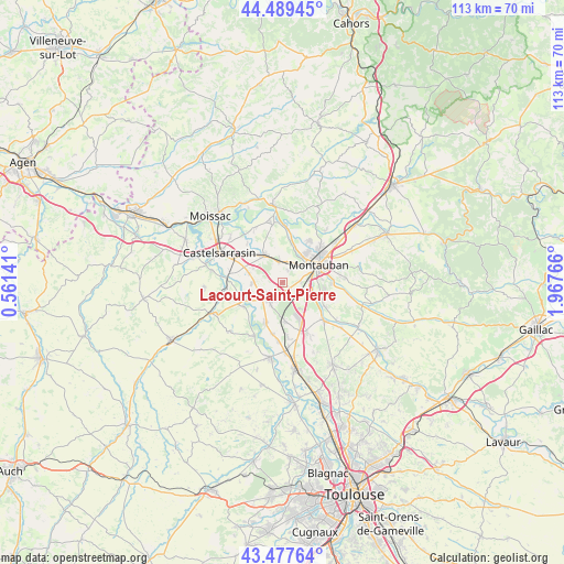
Lacourt-Saint-Pierre GPS coordinates[2]
43° 59' 8.52" North, 1° 15' 52.308" East
| Map corner | latitude | longitude |
|---|---|---|
| Upper-left | 44.48945°, | 0.56141° |
| Center: | 43.9857°, | 1.26453° |
| Lower-right: | 43.47764°, | 1.96766° |
| Map W x H: | 112.5×112.5 km | = 69.9×69.9mi |
| max Lat: | 51.07786° ⇑87.2% North |
| Lacourt-Saint-Pierre: | 43.9857° |
| min Lat: | ⇓12.8% South 41.3874° |
| min Long | Lacourt-Saint-P | max Long |
| -5.08615° | 1.26453° | 9.52242° |
| W 34%⇐ | ⇒66% E |
Elevation
Elevation of Lacourt-Saint-Pierre is 108 m = 354 ft, and this is 85.7 m = 281 ft below average elevation for this country.
| Max E: |
2333 m = 7654 ft | 57.9% |
| Avg. | 193.7 m = 635 ft | |
| Lacourt-Saint-Pierre | 108 m = 354 ft | |
Min E: |
-1 m = -3 ft | 42.1% |
See also: France elevation on elevation.city.
Geographical zone
Lacourt-Saint-Pierre is located in North temperate zone (between Tropic of Cancer and the Arctic Circle). Distance of this Northern Tropic circle is 2284.8 km =1419.7 mi to South.| Distance of | km | miles | from Lacourt-Saint-Pierre |
|---|---|---|---|
| North Pole | 5116.3 | 3179.1 | to North |
| Arctic Circle | 2510.4 | 1559.9 | to North |
| Tropic Cancer | 2284.8 | 1419.7 | to South |
| Equator | 4890.8 | 3039 | to South |


Nearby cities:
15 places around Lacourt-Saint-Pierre: (largest is in red/bold)
• Albefeuille-Lagarde
6.9 km =4.3 mi,  358°
358°
• Bourret
9.1 km =5.7 mi,  238°
238°
• Bressols
6.2 km =3.9 mi,  108°
108°
• Campsas
11.2 km =7 mi,  153°
153°
• Corbarieu
9.5 km =5.9 mi,  118°
118°
• Escatalens
6.1 km =3.8 mi,  268°
268°
• Finhan
8.8 km =5.5 mi,  203°
203°
• Labastide-Saint-Pierre
11.1 km =6.9 mi,  132°
132°
• Meauzac
11.6 km =7.2 mi,  350°
350°
• Montauban
8.8 km =5.5 mi,  65°
65°
• Montbartier
8.1 km =5 mi,  174°
174°
• Montbeton
4.5 km =2.8 mi,  39°
39°
• Montech
4 km =2.5 mi,  220°
220°
• Saint-Porquier
7.1 km =4.4 mi,  286°
286°
• Villemade
10.1 km =6.3 mi,  11°
11°
Sources, notices
• [Note1] Compared only with cities in France existing in our database
• [Src1] Map data: © OpenStreetMap contributors (CC-BY-SA)
• [Src2] Other city data from geonames.org with taken over terms of usage.
• [Src3] Geographical zone / Annual Mean Temperature by Robert A. Rohde @ Wikipedia
