Labastide-Rouairoux geodata
Labastide-Rouairoux (Occitanie) is a populated place; located in France in Europe/Paris (GMT+2) time zone. With population of 1,831 people, there are 5180 cities with bigger population in this country. Compared to other cities in France, 93.4% of cities are located further ↑North; 52.6% of cities are located further ←West and 88.3% of cities have lower elevation than Labastide-Rouairoux. Note1
Administrative division(s):
- Level 1: Occitanie
- Level 2: Tarn
- Level 3: Arrondissement de Castres
- Level 4: Labastide-Rouairoux


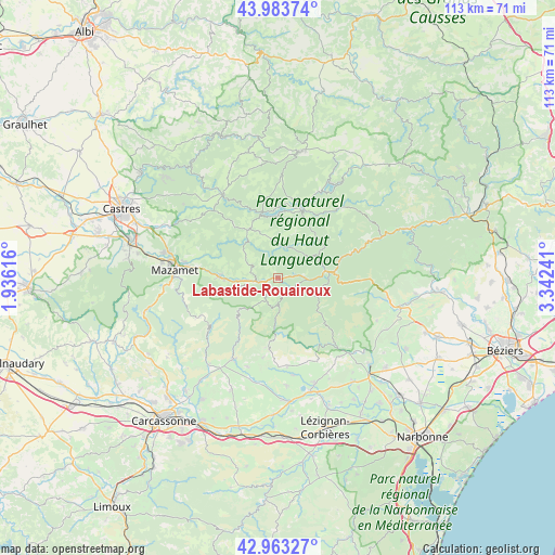
Labastide-Rouairoux GPS coordinates[2]
43° 28' 32.376" North, 2° 38' 21.444" East
| Map corner | latitude | longitude |
|---|---|---|
| Upper-left | 43.98374°, | 1.93616° |
| Center: | 43.47566°, | 2.63929° |
| Lower-right: | 42.96327°, | 3.34241° |
| Map W x H: | 113.5×113.5 km | = 70.5×70.5mi |
| max Lat: | 51.07786° ⇑93.4% North |
| Labastide-Rouairoux: | 43.47566° |
| min Lat: | ⇓6.6% South 41.3874° |
| min Long | Labastide-Rouai | max Long |
| -5.08615° | 2.63929° | 9.52242° |
| W 52.6%⇐ | ⇒47.4% E |
Elevation
Elevation of Labastide-Rouairoux is 393 m = 1289 ft, and this is 199.3 m = 654 ft above average elevation for this country.
| Max E: |
2333 m = 7654 ft | 11.7% |
| Labastide-Rouairoux | 393 m 1289 ft | |
| Avg. | 193.7 m = 635 ft | |
Min E: |
-1 m = -3 ft | 88.3% |
See also: France elevation on elevation.city.
Geographical zone
Labastide-Rouairoux is located in North temperate zone (between Tropic of Cancer and the Arctic Circle). Distance of this Northern Tropic circle is 2228.1 km =1384.5 mi to South.| Distance of | km | miles | from Labastide-Rouairoux |
|---|---|---|---|
| North Pole | 5173 | 3214.4 | to North |
| Arctic Circle | 2567.1 | 1595.1 | to North |
| Tropic Cancer | 2228.1 | 1384.5 | to South |
| Equator | 4834 | 3003.7 | to South |


Nearby cities:
15 places around Labastide-Rouairoux: (largest is in red/bold)
• Albine
8.2 km =5.1 mi,  256°
256°
• Anglès
11.6 km =7.2 mi,  327°
327°
• Bout-du-Pont-de-Larn
18.1 km =11.2 mi,  277°
277°
• Caunes-Minervois
19.1 km =11.9 mi,  208°
208°
• Courniou
5.8 km =3.6 mi,  91°
91°
• La Livinière
17.7 km =11 mi,  180°
180°
• La Salvetat-sur-Agout
15.2 km =9.4 mi,  24°
24°
• Le Bez
19.6 km =12.2 mi,  317°
317°
• Pont-de-Larn
18.9 km =11.7 mi, 279°
• Pépieux
20.1 km =12.5 mi,  170°
170°
• Riols
12.8 km =8 mi,  75°
75°
• Saint-Amans-Soult
12 km =7.5 mi,  270°
270°
• Saint-Amans-Valtoret
12 km =7.5 mi, 272°
• Saint-Pons-de-Thomières
10.3 km =6.4 mi, 85°
• Siran
18.1 km =11.2 mi, 174°
Sources, notices
• [Note1] Compared only with cities in France existing in our database
• [Src1] Map data: © OpenStreetMap contributors (CC-BY-SA)
• [Src2] Other city data from geonames.org with taken over terms of usage.
• [Src3] Geographical zone / Annual Mean Temperature by Robert A. Rohde @ Wikipedia
