Albine geodata
Albine (Occitanie) is a populated place; located in France in Europe/Paris (GMT+2) time zone. With population of 541 people, there are 14367 cities with bigger population in this country. Compared to other cities in France, 93.6% of cities are located further ↑North; 51.2% of cities are located further ←West and 84.4% of cities have lower elevation than Albine. Note1
Administrative division(s):
- Level 1: Occitanie
- Level 2: Tarn
- Level 3: Arrondissement de Castres
- Level 4: Albine


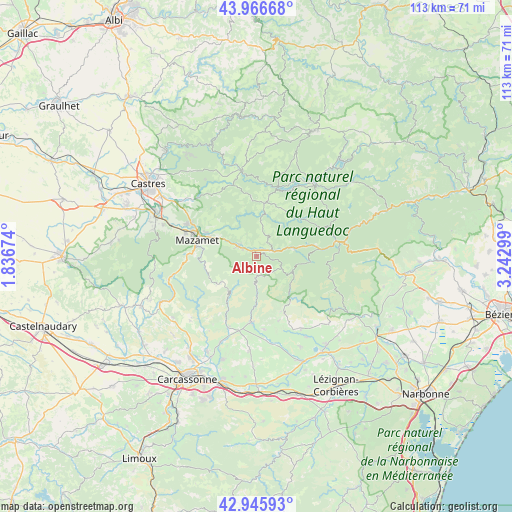
Albine GPS coordinates[2]
43° 27' 30.456" North, 2° 32' 23.496" East
| Map corner | latitude | longitude |
|---|---|---|
| Upper-left | 43.96668°, | 1.83674° |
| Center: | 43.45846°, | 2.53986° |
| Lower-right: | 42.94593°, | 3.24299° |
| Map W x H: | 113.5×113.5 km | = 70.5×70.5mi |
| max Lat: | 51.07786° ⇑93.6% North |
| Albine: | 43.45846° |
| min Lat: | ⇓6.4% South 41.3874° |
| min Long | Albine | max Long |
| -5.08615° | 2.53986° | 9.52242° |
| W 51.2%⇐ | ⇒48.8% E |
Elevation
Elevation of Albine is 340 m = 1115 ft, and this is 146.3 m = 480 ft above average elevation for this country.
| Max E: |
2333 m = 7654 ft | 15.6% |
| Albine | 340 m 1115 ft | |
| Avg. | 193.7 m = 635 ft | |
Min E: |
-1 m = -3 ft | 84.4% |
See also: France elevation on elevation.city.
Geographical zone
Albine is located in North temperate zone (between Tropic of Cancer and the Arctic Circle). Distance of this Northern Tropic circle is 2226.2 km =1383.3 mi to South.| Distance of | km | miles | from Albine |
|---|---|---|---|
| North Pole | 5174.9 | 3215.5 | to North |
| Arctic Circle | 2569 | 1596.3 | to North |
| Tropic Cancer | 2226.2 | 1383.3 | to South |
| Equator | 4832.1 | 3002.5 | to South |


Nearby cities:
15 places around Albine: (largest is in red/bold)
• Aiguefonde
18.4 km =11.4 mi,  282°
282°
• Anglès
11.8 km =7.3 mi,  8°
8°
• Aussillon
14.7 km =9.1 mi,  289°
289°
• Bout-du-Pont-de-Larn
10.9 km =6.8 mi, 293°
• Caunes-Minervois
14.8 km =9.2 mi,  184°
184°
• Courniou
13.9 km =8.6 mi,  82°
82°
• La Livinière
17.6 km =10.9 mi,  153°
153°
• Labastide-Rouairoux
8.2 km =5.1 mi, 76°
• Le Bez
17.2 km =10.7 mi,  342°
342°
• Mazamet
13.9 km =8.6 mi, 284°
• Payrin-Augmontel
17.8 km =11.1 mi,  302°
302°
• Pont-de-Larn
11.8 km =7.3 mi, 295°
• Saint-Amans-Soult
4.5 km =2.8 mi, 297°
• Saint-Amans-Valtoret
4.7 km =2.9 mi, 302°
• Villeneuve-Minervois
17.1 km =10.6 mi,  201°
201°
Sources, notices
• [Note1] Compared only with cities in France existing in our database
• [Src1] Map data: © OpenStreetMap contributors (CC-BY-SA)
• [Src2] Other city data from geonames.org with taken over terms of usage.
• [Src3] Geographical zone / Annual Mean Temperature by Robert A. Rohde @ Wikipedia
