Anglès geodata
Anglès (Occitanie) is a populated place; located in France in Europe/Paris (GMT+2) time zone. With population of 592 people, there are 13451 cities with bigger population in this country. Compared to other cities in France, 92.3% of cities are located further ↑North; 51.5% of cities are located further ←West and 97.4% of cities have lower elevation than Anglès. Note1
Administrative division(s):
- Level 1: Occitanie
- Level 2: Tarn
- Level 3: Arrondissement de Castres
- Level 4: Anglès


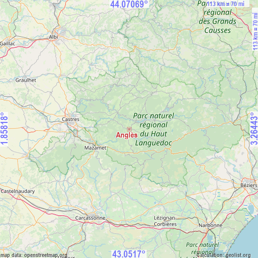
Anglès GPS coordinates[2]
43° 33' 48.06" North, 2° 33' 40.716" East
| Map corner | latitude | longitude |
|---|---|---|
| Upper-left | 44.07069°, | 1.85818° |
| Center: | 43.56335°, | 2.56131° |
| Lower-right: | 43.0517°, | 3.26443° |
| Map W x H: | 113.3×113.3 km | = 70.4×70.4mi |
| max Lat: | 51.07786° ⇑92.3% North |
| Anglès: | 43.56335° |
| min Lat: | ⇓7.7% South 41.3874° |
| min Long | Anglès | max Long |
| -5.08615° | 2.56131° | 9.52242° |
| W 51.5%⇐ | ⇒48.5% E |
Elevation
Elevation of Anglès is 759 m = 2490 ft, and this is 565.3 m = 1855 ft above average elevation for this country.
| Max E: |
2333 m = 7654 ft | 2.6% |
| Anglès | 759 m 2490 ft | |
| Avg. | 193.7 m = 635 ft | |
Min E: |
-1 m = -3 ft | 97.4% |
See also: France elevation on elevation.city.
Geographical zone
Anglès is located in North temperate zone (between Tropic of Cancer and the Arctic Circle). Distance of this Northern Tropic circle is 2237.9 km =1390.6 mi to South.| Distance of | km | miles | from Anglès |
|---|---|---|---|
| North Pole | 5163.3 | 3208.3 | to North |
| Arctic Circle | 2557.4 | 1589.1 | to North |
| Tropic Cancer | 2237.9 | 1390.6 | to South |
| Equator | 4843.8 | 3009.8 | to South |


Nearby cities:
15 places around Anglès: (largest is in red/bold)
• Albine
11.8 km =7.3 mi,  188°
188°
• Aussillon
17 km =10.6 mi,  246°
246°
• Bout-du-Pont-de-Larn
13.8 km =8.6 mi,  237°
237°
• Brassac
9 km =5.6 mi,  325°
325°
• Castelnau-de-Brassac
10.1 km =6.3 mi,  338°
338°
• Courniou
15.6 km =9.7 mi,  129°
129°
• La Salvetat-sur-Agout
13.2 km =8.2 mi,  71°
71°
• Labastide-Rouairoux
11.6 km =7.2 mi,  147°
147°
• Le Bez
8.3 km =5.2 mi,  304°
304°
• Noailhac
16.7 km =10.4 mi,  273°
273°
• Payrin-Augmontel
16.8 km =10.4 mi,  262°
262°
• Pont-de-Larn
14 km =8.7 mi, 241°
• Saint-Amans-Soult
11.2 km =7 mi,  210°
210°
• Saint-Amans-Valtoret
10.8 km =6.7 mi, 211°
• Saint-Salvy-de-la-Balme
14.1 km =8.8 mi,  292°
292°
Sources, notices
• [Note1] Compared only with cities in France existing in our database
• [Src1] Map data: © OpenStreetMap contributors (CC-BY-SA)
• [Src2] Other city data from geonames.org with taken over terms of usage.
• [Src3] Geographical zone / Annual Mean Temperature by Robert A. Rohde @ Wikipedia
