Saint-Amans-Soult geodata
Saint-Amans-Soult (Occitanie) is a populated place; located in France in Europe/Paris (GMT+2) time zone. With population of 1,839 people, there are 5152 cities with bigger population in this country. Compared to other cities in France, 93.3% of cities are located further ↑North; 50.4% of cities are located further ←West and 79.8% of cities have lower elevation than Saint-Amans-Soult. Note1
Administrative division(s):
- Level 1: Occitanie
- Level 2: Tarn
- Level 3: Arrondissement de Castres
- Level 4: Saint-Amans-Soult


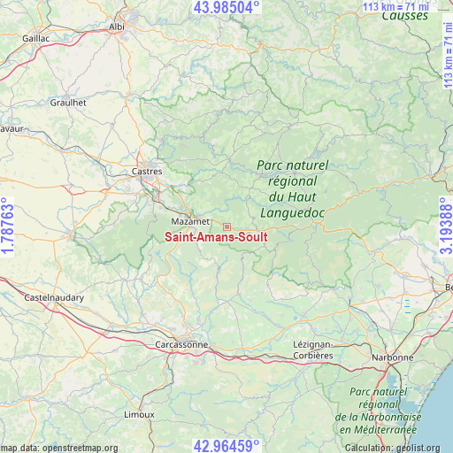
Saint-Amans-Soult GPS coordinates[2]
43° 28' 37.092" North, 2° 29' 26.736" East
| Map corner | latitude | longitude |
|---|---|---|
| Upper-left | 43.98504°, | 1.78763° |
| Center: | 43.47697°, | 2.49076° |
| Lower-right: | 42.96459°, | 3.19388° |
| Map W x H: | 113.5×113.5 km | = 70.5×70.5mi |
| max Lat: | 51.07786° ⇑93.3% North |
| Saint-Amans-Soult: | 43.47697° |
| min Lat: | ⇓6.7% South 41.3874° |
| min Long | Saint-Amans-Sou | max Long |
| -5.08615° | 2.49076° | 9.52242° |
| W 50.4%⇐ | ⇒49.6% E |
Elevation
Elevation of Saint-Amans-Soult is 288 m = 945 ft, and this is 94.3 m = 309 ft above average elevation for this country.
| Max E: |
2333 m = 7654 ft | 20.2% |
| Saint-Amans-Soult | 288 m 945 ft | |
| Avg. | 193.7 m = 635 ft | |
Min E: |
-1 m = -3 ft | 79.8% |
See also: France elevation on elevation.city.
Geographical zone
Saint-Amans-Soult is located in North temperate zone (between Tropic of Cancer and the Arctic Circle). Distance of this Northern Tropic circle is 2228.3 km =1384.6 mi to South.| Distance of | km | miles | from Saint-Amans-Soult |
|---|---|---|---|
| North Pole | 5172.9 | 3214.3 | to North |
| Arctic Circle | 2567 | 1595.1 | to North |
| Tropic Cancer | 2228.3 | 1384.6 | to South |
| Equator | 4834.2 | 3003.8 | to South |


Nearby cities:
15 places around Saint-Amans-Soult: (largest is in red/bold)
• Aiguefonde
14.2 km =8.8 mi,  277°
277°
• Albine
4.5 km =2.8 mi,  117°
117°
• Anglès
11.2 km =7 mi,  30°
30°
• Aussillon
10.3 km =6.4 mi,  286°
286°
• Bout-du-Pont-de-Larn
6.4 km =4 mi, 290°
• Brassac
17 km =10.6 mi,  1°
1°
• Caunes-Minervois
17.1 km =10.6 mi,  170°
170°
• Labastide-Rouairoux
12 km =7.5 mi,  90°
90°
• Le Bez
14.4 km =8.9 mi,  355°
355°
• Mazamet
9.6 km =6 mi, 278°
• Noailhac
15.4 km =9.6 mi,  314°
314°
• Payrin-Augmontel
13.3 km =8.3 mi,  304°
304°
• Pont-de-Larn
7.3 km =4.5 mi, 294°
• Saint-Amans-Valtoret
0.4 km =0.2 mi, 2°
• Saint-Salvy-de-la-Balme
16.7 km =10.4 mi,  333°
333°
Sources, notices
• [Note1] Compared only with cities in France existing in our database
• [Src1] Map data: © OpenStreetMap contributors (CC-BY-SA)
• [Src2] Other city data from geonames.org with taken over terms of usage.
• [Src3] Geographical zone / Annual Mean Temperature by Robert A. Rohde @ Wikipedia
