Jans geodata
Jans (Pays de la Loire) is a populated place; located in France in Europe/Paris (GMT+2) time zone. With population of 1,081 people, there are 8251 cities with bigger population in this country. Compared to other cities in France, 53% of cities are located further ↓South; 93% of cities are located further →East and 92.7% of cities have higher elevation than Jans. Note1
Administrative division(s):
- Level 1: Pays de la Loire
- Level 2: Loire-Atlantique
- Level 3: Arrondissement of Châteaubriant-Ancenis
- Level 4: Jans


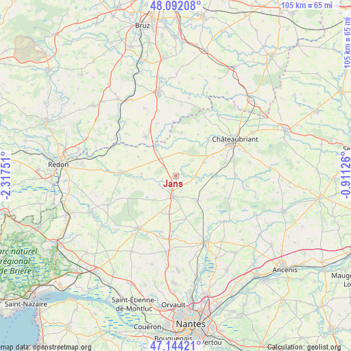
Jans GPS coordinates[2]
47° 37' 13.044" North, 1° 36' 51.768" West
| Map corner | latitude | longitude |
|---|---|---|
| Upper-left | 48.09208°, | -2.31751° |
| Center: | 47.62029°, | -1.61438° |
| Lower-right: | 47.14421°, | -0.91126° |
| Map W x H: | 105.4×105.4 km | = 65.5×65.5mi |
| max Lat: | 51.07786° ⇑47% North |
| Jans: | 47.62029° |
| min Lat: | ⇓53% South 41.3874° |
| min Long | Jans | max Long |
| -5.08615° | -1.61438° | 9.52242° |
| W 7%⇐ | ⇒93% E |
Elevation
Elevation of Jans is 23 m = 75 ft, and this is 170.7 m = 560 ft below average elevation for this country.
| Max E: |
2333 m = 7654 ft | 92.7% |
| Avg. | 193.7 m = 635 ft | |
| Jans | 23 m = 75 ft | |
Min E: |
-1 m = -3 ft | 7.3% |
See also: France elevation on elevation.city.
Geographical zone
Jans is located in North temperate zone (between Tropic of Cancer and the Arctic Circle). Distance of this North polar circle is 2106.3 km =1308.8 mi to North.| Distance of | km | miles | from Jans |
|---|---|---|---|
| North Pole | 4712.2 | 2928 | to North |
| Arctic Circle | 2106.3 | 1308.8 | to North |
| Tropic Cancer | 2689 | 1670.9 | to South |
| Equator | 5294.9 | 3290.1 | to South |


Nearby cities:
15 places around Jans: (largest is in red/bold)
• Abbaretz
9.7 km =6 mi,  140°
140°
• Conquereuil
10.3 km =6.4 mi,  273°
273°
• Derval
6.7 km =4.2 mi,  321°
321°
• Issé
12.2 km =7.6 mi,  87°
87°
• La Grigonnais
11.1 km =6.9 mi,  201°
201°
• Lusanger
7.1 km =4.4 mi,  15°
15°
• Marsac-sur-Don
5.6 km =3.5 mi,  241°
241°
• Nozay
6.2 km =3.9 mi,  188°
188°
• Pierric
11.7 km =7.3 mi,  309°
309°
• Puceul
10.9 km =6.8 mi,  180°
180°
• Saffré
13.5 km =8.4 mi,  168°
168°
• Saint-Vincent-des-Landes
9.8 km =6.1 mi,  65°
65°
• Sion-les-Mines
12.8 km =8 mi,  7°
7°
• Treffieux
5.8 km =3.6 mi, 90°
• Vay
9.8 km =6.1 mi,  221°
221°
Sources, notices
• [Note1] Compared only with cities in France existing in our database
• [Src1] Map data: © OpenStreetMap contributors (CC-BY-SA)
• [Src2] Other city data from geonames.org with taken over terms of usage.
• [Src3] Geographical zone / Annual Mean Temperature by Robert A. Rohde @ Wikipedia
