Hordain geodata
Hordain (Hauts-de-France) is a populated place; located in France in Europe/Paris (GMT+2) time zone. With population of 1,214 people, there are 7460 cities with bigger population in this country. Compared to other cities in France, 95.2% of cities are located further ↓South; 62.2% of cities are located further ←West and 86.2% of cities have higher elevation than Hordain. Note1
Administrative division(s):
- Level 1: Hauts-de-France
- Level 2: Nord
- Level 3: Arrondissement de Valenciennes
- Level 4: Hordain


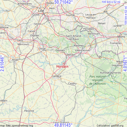
Hordain GPS coordinates[2]
50° 15' 47.016" North, 3° 18' 48.888" East
| Map corner | latitude | longitude |
|---|---|---|
| Upper-left | 50.71042°, | 2.61046° |
| Center: | 50.26306°, | 3.31358° |
| Lower-right: | 49.81145°, | 4.01671° |
| Map W x H: | 100×100 km | = 62.1×62.1mi |
| max Lat: | 51.07786° ⇑4.8% North |
| Hordain: | 50.26306° |
| min Lat: | ⇓95.2% South 41.3874° |
| min Long | Hordain | max Long |
| -5.08615° | 3.31358° | 9.52242° |
| W 62.2%⇐ | ⇒37.8% E |
Elevation
Elevation of Hordain is 39 m = 128 ft, and this is 154.7 m = 508 ft below average elevation for this country.
| Max E: |
2333 m = 7654 ft | 86.2% |
| Avg. | 193.7 m = 635 ft | |
| Hordain | 39 m = 128 ft | |
Min E: |
-1 m = -3 ft | 13.8% |
See also: France elevation on elevation.city.
Geographical zone
Hordain is located in North temperate zone (between Tropic of Cancer and the Arctic Circle). Distance of this North polar circle is 1812.4 km =1126.2 mi to North.| Distance of | km | miles | from Hordain |
|---|---|---|---|
| North Pole | 4418.3 | 2745.4 | to North |
| Arctic Circle | 1812.4 | 1126.2 | to North |
| Tropic Cancer | 2982.8 | 1853.4 | to South |
| Equator | 5588.7 | 3472.7 | to South |


Nearby cities:
15 places around Hordain: (largest is in red/bold)
• Avesnes-le-Sec
4.7 km =2.9 mi,  106°
106°
• Bouchain
2.5 km =1.6 mi,  2°
2°
• Hem-Lenglet
6.1 km =3.8 mi,  264°
264°
• Iwuy
3.4 km =2.1 mi,  171°
171°
• Lieu-Saint-Amand
2.6 km =1.6 mi,  64°
64°
• Lourches
6.3 km =3.9 mi,  26°
26°
• Marcq-en-Ostrevent
5.9 km =3.7 mi,  295°
295°
• Marquette-en-Ostrevant
4 km =2.5 mi, 304°
• Mastaing
4.8 km =3 mi,  352°
352°
• Naves
6.7 km =4.2 mi,  178°
178°
• Neuville-sur-Escaut
4.9 km =3 mi, 32°
• Noyelles-sur-Selle
5.8 km =3.6 mi, 64°
• Paillencourt
3.3 km =2.1 mi,  237°
237°
• Rœulx
4.3 km =2.7 mi,  18°
18°
• Wasnes-au-Bac
3.9 km =2.4 mi,  283°
283°
Sources, notices
• [Note1] Compared only with cities in France existing in our database
• [Src1] Map data: © OpenStreetMap contributors (CC-BY-SA)
• [Src2] Other city data from geonames.org with taken over terms of usage.
• [Src3] Geographical zone / Annual Mean Temperature by Robert A. Rohde @ Wikipedia
