Avesnes-le-Sec geodata
Avesnes-le-Sec (Hauts-de-France) is a populated place; located in France in Europe/Paris (GMT+2) time zone. With population of 1,309 people, there are 6984 cities with bigger population in this country. Compared to other cities in France, 95.1% of cities are located further ↓South; 62.9% of cities are located further ←West and 75.8% of cities have higher elevation than Avesnes-le-Sec. Note1
Administrative division(s):
- Level 1: Hauts-de-France
- Level 2: Nord
- Level 3: Arrondissement de Valenciennes
- Level 4: Avesnes-le-Sec


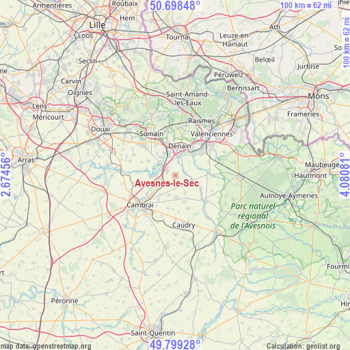
Avesnes-le-Sec GPS coordinates[2]
50° 15' 3.6" North, 3° 22' 39.648" East
| Map corner | latitude | longitude |
|---|---|---|
| Upper-left | 50.69848°, | 2.67456° |
| Center: | 50.251°, | 3.37768° |
| Lower-right: | 49.79928°, | 4.08081° |
| Map W x H: | 100×100 km | = 62.1×62.1mi |
| max Lat: | 51.07786° ⇑4.9% North |
| Avesnes-le-Sec: | 50.251° |
| min Lat: | ⇓95.1% South 41.3874° |
| min Long | Avesnes-le-Sec | max Long |
| -5.08615° | 3.37768° | 9.52242° |
| W 62.9%⇐ | ⇒37.1% E |
Elevation
Elevation of Avesnes-le-Sec is 65 m = 213 ft, and this is 128.7 m = 422 ft below average elevation for this country.
| Max E: |
2333 m = 7654 ft | 75.8% |
| Avg. | 193.7 m = 635 ft | |
| Avesnes-le-Sec | 65 m = 213 ft | |
Min E: |
-1 m = -3 ft | 24.2% |
See also: France elevation on elevation.city.
Geographical zone
Avesnes-le-Sec is located in North temperate zone (between Tropic of Cancer and the Arctic Circle). Distance of this North polar circle is 1813.8 km =1127 mi to North.| Distance of | km | miles | from Avesnes-le-Sec |
|---|---|---|---|
| North Pole | 4419.7 | 2746.3 | to North |
| Arctic Circle | 1813.8 | 1127 | to North |
| Tropic Cancer | 2981.5 | 1852.6 | to South |
| Equator | 5587.4 | 3471.8 | to South |


Nearby cities:
15 places around Avesnes-le-Sec: (largest is in red/bold)
• Avesnes-les-Aubert
5.7 km =3.5 mi,  175°
175°
• Bouchain
5.9 km =3.7 mi,  310°
310°
• Douchy-les-Mines
5.6 km =3.5 mi,  10°
10°
• Haspres
2.9 km =1.8 mi,  73°
73°
• Hordain
4.7 km =2.9 mi,  286°
286°
• Iwuy
4.5 km =2.8 mi,  243°
243°
• Lieu-Saint-Amand
3.3 km =2.1 mi,  317°
317°
• Neuville-sur-Escaut
5.8 km =3.6 mi,  340°
340°
• Noyelles-sur-Selle
3.9 km =2.4 mi, 9°
• Rieux-en-Cambrésis
5.9 km =3.7 mi,  197°
197°
• Rœulx
6.3 km =3.9 mi,  329°
329°
• Saint-Aubert
5.5 km =3.4 mi,  149°
149°
• Saint-Vaast-en-Cambrésis
6.3 km =3.9 mi, 153°
• Saulzoir
4.9 km =3 mi,  103°
103°
• Villers-en-Cauchies
3.4 km =2.1 mi, 146°
Sources, notices
• [Note1] Compared only with cities in France existing in our database
• [Src1] Map data: © OpenStreetMap contributors (CC-BY-SA)
• [Src2] Other city data from geonames.org with taken over terms of usage.
• [Src3] Geographical zone / Annual Mean Temperature by Robert A. Rohde @ Wikipedia
