Montgaillard geodata
Montgaillard (Nouvelle-Aquitaine) is a populated place; located in France in Europe/Paris (GMT+2) time zone. With population of 559 people, there are 14019 cities with bigger population in this country. Compared to other cities in France, 89.8% of cities are located further ↑North; 83.2% of cities are located further →East and 55.2% of cities have higher elevation than Montgaillard. Note1
Administrative division(s):
- Level 1: Nouvelle-Aquitaine
- Level 2: Landes
- Level 3: Arrondissement de Mont-de-Marsan
- Level 4: Montgaillard


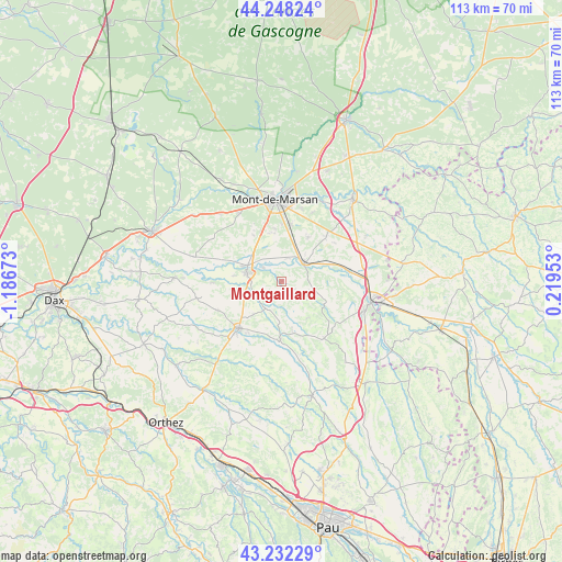
Montgaillard GPS coordinates[2]
43° 44' 32.712" North, 0° 29' 0.96" West
| Map corner | latitude | longitude |
|---|---|---|
| Upper-left | 44.24824°, | -1.18673° |
| Center: | 43.74242°, | -0.4836° |
| Lower-right: | 43.23229°, | 0.21953° |
| Map W x H: | 113×113 km | = 70.2×70.2mi |
| max Lat: | 51.07786° ⇑89.8% North |
| Montgaillard: | 43.74242° |
| min Lat: | ⇓10.2% South 41.3874° |
| min Long | Montgaillard | max Long |
| -5.08615° | -0.4836° | 9.52242° |
| W 16.8%⇐ | ⇒83.2% E |
Elevation
Elevation of Montgaillard is 116 m = 381 ft, and this is 77.7 m = 255 ft below average elevation for this country.
| Max E: |
2333 m = 7654 ft | 55.2% |
| Avg. | 193.7 m = 635 ft | |
| Montgaillard | 116 m = 381 ft | |
Min E: |
-1 m = -3 ft | 44.8% |
See also: France elevation on elevation.city.
Geographical zone
Montgaillard is located in North temperate zone (between Tropic of Cancer and the Arctic Circle). Distance of this Northern Tropic circle is 2257.8 km =1402.9 mi to South.| Distance of | km | miles | from Montgaillard |
|---|---|---|---|
| North Pole | 5143.4 | 3196 | to North |
| Arctic Circle | 2537.5 | 1576.7 | to North |
| Tropic Cancer | 2257.8 | 1402.9 | to South |
| Equator | 4863.7 | 3022.2 | to South |


Nearby cities:
15 places around Montgaillard: (largest is in red/bold)
• Aurice
12.6 km =7.8 mi,  309°
309°
• Bascons
10.4 km =6.5 mi,  30°
30°
• Benquet
9.8 km =6.1 mi,  351°
351°
• Bretagne-de-Marsan
11.8 km =7.3 mi,  7°
7°
• Eugénie-les-Bains
9.9 km =6.2 mi,  121°
121°
• Grenade-sur-l’Adour
5.8 km =3.6 mi,  48°
48°
• Haut-Mauco
11 km =6.8 mi,  328°
328°
• Horsarrieu
11.3 km =7 mi,  234°
234°
• Larrivière-Saint-Savin
6 km =3.7 mi,  63°
63°
• Montsoué
2.2 km =1.4 mi,  241°
241°
• Renung
10.3 km =6.4 mi,  87°
87°
• Saint-Maurice-sur-Adour
4.9 km =3 mi,  15°
15°
• Saint-Sever
7.4 km =4.6 mi,  282°
282°
• Sainte-Colombe
8.9 km =5.5 mi,  221°
221°
• Samadet
11.7 km =7.3 mi,  181°
181°
Sources, notices
• [Note1] Compared only with cities in France existing in our database
• [Src1] Map data: © OpenStreetMap contributors (CC-BY-SA)
• [Src2] Other city data from geonames.org with taken over terms of usage.
• [Src3] Geographical zone / Annual Mean Temperature by Robert A. Rohde @ Wikipedia
