Noyelles-lès-Vermelles geodata
Noyelles-lès-Vermelles (Hauts-de-France) is a populated place; located in France in Europe/Paris (GMT+2) time zone. With population of 1,968 people, there are 4860 cities with bigger population in this country. Compared to other cities in France, 97.2% of cities are located further ↓South; 53.9% of cities are located further ←West and 89.5% of cities have higher elevation than Noyelles-lès-Vermelles. Note1
Administrative division(s):
- Level 1: Hauts-de-France
- Level 2: Pas-de-Calais
- Level 3: Arrondissement de Béthune
- Level 4: Noyelles-lès-Vermelles
Current local time in Noyelles-lès-Vermelles:
06:01 AM, WednesdayDifference from your time zone: hours


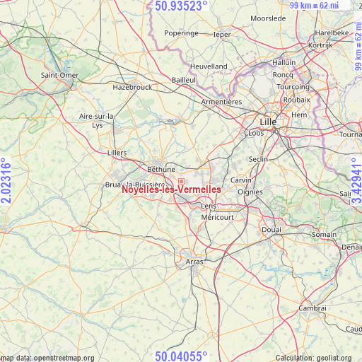
Noyelles-lès-Vermelles GPS coordinates[2]
50° 29' 24.036" North, 2° 43' 34.608" East
| Map corner | latitude | longitude |
|---|---|---|
| Upper-left | 50.93523°, | 2.02316° |
| Center: | 50.49001°, | 2.72628° |
| Lower-right: | 50.04055°, | 3.42941° |
| Map W x H: | 99.5×99.5 km | = 61.8×61.8mi |
| max Lat: | 51.07786° ⇑2.8% North |
| Noyelles-lès-Vermelles: | 50.49001° |
| min Lat: | ⇓97.2% South 41.3874° |
| min Long | Noyelles-lès-V | max Long |
| -5.08615° | 2.72628° | 9.52242° |
| W 53.9%⇐ | ⇒46.1% E |
Elevation
Elevation of Noyelles-lès-Vermelles is 31 m = 102 ft, and this is 162.7 m = 534 ft below average elevation for this country.
| Max E: |
2333 m = 7654 ft | 89.5% |
| Avg. | 193.7 m = 635 ft | |
| Noyelles-lès-Vermelles | 31 m = 102 ft | |
Min E: |
-1 m = -3 ft | 10.5% |
See also: France elevation on elevation.city.
Geographical zone
Noyelles-lès-Vermelles is located in North temperate zone (between Tropic of Cancer and the Arctic Circle). Distance of this North polar circle is 1787.2 km =1110.5 mi to North.| Distance of | km | miles | from Noyelles-lès-Vermelles |
|---|---|---|---|
| North Pole | 4393.1 | 2729.7 | to North |
| Arctic Circle | 1787.2 | 1110.5 | to North |
| Tropic Cancer | 3008 | 1869.1 | to South |
| Equator | 5614 | 3488.4 | to South |


Nearby cities:
15 places around Noyelles-lès-Vermelles: (largest is in red/bold)
• Annequin
1.7 km =1.1 mi,  345°
345°
• Auchy-les-Mines
4.8 km =3 mi,  56°
56°
• Beuvry
4.1 km =2.5 mi,  315°
315°
• Bully-les-Mines
5.1 km =3.2 mi,  179°
179°
• Cambrin
2.4 km =1.5 mi,  25°
25°
• Cuinchy
3.4 km =2.1 mi, 27°
• Festubert
5.9 km =3.7 mi,  6°
6°
• Grenay
4.8 km =3 mi,  158°
158°
• Haisnes
5.2 km =3.2 mi,  67°
67°
• Labourse
3.3 km =2.1 mi,  287°
287°
• Loos-en-Gohelle
5.9 km =3.7 mi,  127°
127°
• Mazingarbe
2.2 km =1.4 mi,  200°
200°
• Nœux-les-Mines
4.3 km =2.7 mi,  260°
260°
• Sailly-Labourse
2.4 km =1.5 mi,  301°
301°
• Vermelles
1.5 km =0.9 mi,  92°
92°
Sources, notices
• [Note1] Compared only with cities in France existing in our database
• [Src1] Map data: © OpenStreetMap contributors (CC-BY-SA)
• [Src2] Other city data from geonames.org with taken over terms of usage.
• [Src3] Geographical zone / Annual Mean Temperature by Robert A. Rohde @ Wikipedia
