Loos-en-Gohelle geodata
Loos-en-Gohelle (Hauts-de-France) is a populated place; located in France in Europe/Paris (GMT+2) time zone. With population of 7,150 people, there are 1359 cities with bigger population in this country. Compared to other cities in France, 96.9% of cities are located further ↓South; 54.8% of cities are located further ←West and 84.5% of cities have higher elevation than Loos-en-Gohelle. Note1
Administrative division(s):
- Level 1: Hauts-de-France
- Level 2: Pas-de-Calais
- Level 3: Arrondissement de Lens
- Level 4: Loos-en-Gohelle


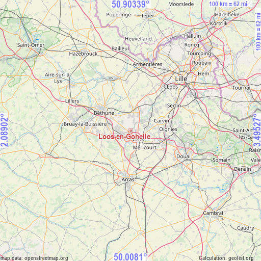
Loos-en-Gohelle GPS coordinates[2]
50° 27' 28.296" North, 2° 47' 31.74" East
| Map corner | latitude | longitude |
|---|---|---|
| Upper-left | 50.90339°, | 2.08902° |
| Center: | 50.45786°, | 2.79215° |
| Lower-right: | 50.0081°, | 3.49527° |
| Map W x H: | 99.5×99.5 km | = 61.8×61.8mi |
| max Lat: | 51.07786° ⇑3.1% North |
| Loos-en-Gohelle: | 50.45786° |
| min Lat: | ⇓96.9% South 41.3874° |
| min Long | Loos-en-Gohelle | max Long |
| -5.08615° | 2.79215° | 9.52242° |
| W 54.8%⇐ | ⇒45.2% E |
Elevation
Elevation of Loos-en-Gohelle is 43 m = 141 ft, and this is 150.7 m = 494 ft below average elevation for this country.
| Max E: |
2333 m = 7654 ft | 84.5% |
| Avg. | 193.7 m = 635 ft | |
| Loos-en-Gohelle | 43 m = 141 ft | |
Min E: |
-1 m = -3 ft | 15.5% |
See also: France elevation on elevation.city.
Geographical zone
Loos-en-Gohelle is located in North temperate zone (between Tropic of Cancer and the Arctic Circle). Distance of this North polar circle is 1790.8 km =1112.8 mi to North.| Distance of | km | miles | from Loos-en-Gohelle |
|---|---|---|---|
| North Pole | 4396.7 | 2732 | to North |
| Arctic Circle | 1790.8 | 1112.8 | to North |
| Tropic Cancer | 3004.5 | 1866.9 | to South |
| Equator | 5610.4 | 3486.1 | to South |


Nearby cities:
15 places around Loos-en-Gohelle: (largest is in red/bold)
• Angres
6.2 km =3.9 mi,  201°
201°
• Avion
5.9 km =3.7 mi,  152°
152°
• Bully-les-Mines
4.9 km =3 mi,  251°
251°
• Grenay
3 km =1.9 mi, 252°
• Haisnes
5.6 km =3.5 mi,  1°
1°
• Hulluch
3.8 km =2.4 mi,  22°
22°
• Lens
3.7 km =2.3 mi,  137°
137°
• Liévin
4.3 km =2.7 mi,  190°
190°
• Loison-sous-Lens
4.9 km =3 mi,  117°
117°
• Mazingarbe
5.6 km =3.5 mi,  285°
285°
• Noyelles-lès-Vermelles
5.9 km =3.7 mi,  307°
307°
• Vendin-le-Vieil
5.6 km =3.5 mi,  71°
71°
• Vermelles
4.7 km =2.9 mi,  317°
317°
• Wingles
6 km =3.7 mi,  48°
48°
• Éleu-dit-Leauwette
4.3 km =2.7 mi,  161°
161°
Sources, notices
• [Note1] Compared only with cities in France existing in our database
• [Src1] Map data: © OpenStreetMap contributors (CC-BY-SA)
• [Src2] Other city data from geonames.org with taken over terms of usage.
• [Src3] Geographical zone / Annual Mean Temperature by Robert A. Rohde @ Wikipedia
