Granges geodata
Granges (Auvergne-Rhône-Alpes) is a populated place; located in France in Europe/Paris (GMT+2) time zone. With population of 535 people, there are 14511 cities with bigger population in this country. Compared to other cities in France, 63% of cities are located further ↑North; 82.9% of cities are located further ←West and 85.1% of cities have lower elevation than Granges. Note1
Administrative division(s):
- Level 1: Auvergne-Rhône-Alpes
- Level 2: Département de l'Ain
- Level 3: Arrondissement de Nantua
- Level 4: Matafelon-Granges


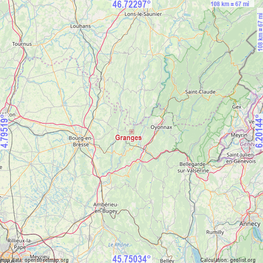
Granges GPS coordinates[2]
46° 14' 19.716" North, 5° 29' 53.916" East
| Map corner | latitude | longitude |
|---|---|---|
| Upper-left | 46.72297°, | 4.79519° |
| Center: | 46.23881°, | 5.49831° |
| Lower-right: | 45.75034°, | 6.20144° |
| Map W x H: | 108.1×108.1 km | = 67.2×67.2mi |
| max Lat: | 51.07786° ⇑63% North |
| Granges: | 46.23881° |
| min Lat: | ⇓37% South 41.3874° |
| min Long | Granges | max Long |
| -5.08615° | 5.49831° | 9.52242° |
| W 82.9%⇐ | ⇒17.1% E |
Elevation
Elevation of Granges is 348 m = 1142 ft, and this is 154.3 m = 506 ft above average elevation for this country.
| Max E: |
2333 m = 7654 ft | 14.9% |
| Granges | 348 m 1142 ft | |
| Avg. | 193.7 m = 635 ft | |
Min E: |
-1 m = -3 ft | 85.1% |
See also: France elevation on elevation.city.
Geographical zone
Granges is located in North temperate zone (between Tropic of Cancer and the Arctic Circle). Distance of this North polar circle is 2259.9 km =1404.2 mi to North.| Distance of | km | miles | from Granges |
|---|---|---|---|
| North Pole | 4865.8 | 3023.5 | to North |
| Arctic Circle | 2259.9 | 1404.2 | to North |
| Tropic Cancer | 2535.4 | 1575.4 | to South |
| Equator | 5141.3 | 3194.7 | to South |


Nearby cities:
15 places around Granges: (largest is in red/bold)
• Aromas
6.2 km =3.9 mi,  347°
347°
• Bellignat
10 km =6.2 mi,  87°
87°
• Brion
8.4 km =5.2 mi,  150°
150°
• Béard-Géovreissiat
6.8 km =4.2 mi,  144°
144°
• Chavannes-sur-Suran
6.1 km =3.8 mi,  296°
296°
• Corveissiat
1.4 km =0.9 mi, 297°
• Groissiat
8.6 km =5.3 mi,  102°
102°
• Géovreisset
9.4 km =5.8 mi,  77°
77°
• Izernore
5 km =3.1 mi,  124°
124°
• Martignat
9.2 km =5.7 mi,  110°
110°
• Montréal-la-Cluse
9 km =5.6 mi,  133°
133°
• Port
9.9 km =6.2 mi, 147°
• Simandre-sur-Suran
6.3 km =3.9 mi,  258°
258°
• Thoirette
4.2 km =2.6 mi,  34°
34°
• Treffort-Cuisiat
10.6 km =6.6 mi,  287°
287°
Sources, notices
• [Note1] Compared only with cities in France existing in our database
• [Src1] Map data: © OpenStreetMap contributors (CC-BY-SA)
• [Src2] Other city data from geonames.org with taken over terms of usage.
• [Src3] Geographical zone / Annual Mean Temperature by Robert A. Rohde @ Wikipedia
