Bourbon-Lancy geodata
Bourbon-Lancy (Bourgogne-Franche-Comté) is a populated place; located in France in Europe/Paris (GMT+2) time zone. With population of 5,484 people, there are 1802 cities with bigger population in this country. Compared to other cities in France, 59% of cities are located further ↑North; 66.2% of cities are located further ←West and 75.6% of cities have lower elevation than Bourbon-Lancy. Note1
Administrative division(s):
- Level 1: Bourgogne-Franche-Comté
- Level 2: Département de Saône-et-Loire
- Level 3: Arrondissement de Charolles
- Level 4: Bourbon-Lancy


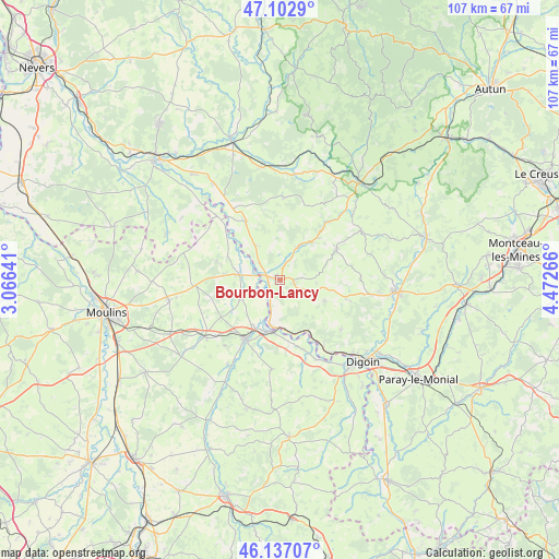
Bourbon-Lancy GPS coordinates[2]
46° 37' 19.704" North, 3° 46' 10.308" East
| Map corner | latitude | longitude |
|---|---|---|
| Upper-left | 47.1029°, | 3.06641° |
| Center: | 46.62214°, | 3.76953° |
| Lower-right: | 46.13707°, | 4.47266° |
| Map W x H: | 107.4×107.4 km | = 66.7×66.7mi |
| max Lat: | 51.07786° ⇑59% North |
| Bourbon-Lancy: | 46.62214° |
| min Lat: | ⇓41% South 41.3874° |
| min Long | Bourbon-Lancy | max Long |
| -5.08615° | 3.76953° | 9.52242° |
| W 66.2%⇐ | ⇒33.8% E |
Elevation
Elevation of Bourbon-Lancy is 254 m = 833 ft, and this is 60.3 m = 198 ft above average elevation for this country.
| Max E: |
2333 m = 7654 ft | 24.4% |
| Bourbon-Lancy | 254 m 833 ft | |
| Avg. | 193.7 m = 635 ft | |
Min E: |
-1 m = -3 ft | 75.6% |
See also: France elevation on elevation.city.
Geographical zone
Bourbon-Lancy is located in North temperate zone (between Tropic of Cancer and the Arctic Circle). Distance of this North polar circle is 2217.3 km =1377.8 mi to North.| Distance of | km | miles | from Bourbon-Lancy |
|---|---|---|---|
| North Pole | 4823.2 | 2997 | to North |
| Arctic Circle | 2217.3 | 1377.8 | to North |
| Tropic Cancer | 2578 | 1601.9 | to South |
| Equator | 5183.9 | 3221.1 | to South |


Nearby cities:
15 places around Bourbon-Lancy: (largest is in red/bold)
• Beaulon
7.7 km =4.8 mi,  252°
252°
• Chalmoux
6.5 km =4 mi,  113°
113°
• Chevagnes
16.7 km =10.4 mi,  265°
265°
• Cronat
12.8 km =8 mi,  330°
330°
• Diou
9.9 km =6.2 mi,  191°
191°
• Dompierre-sur-Besbre
13 km =8.1 mi,  211°
211°
• Garnat-sur-Engièvre
8.2 km =5.1 mi,  278°
278°
• Gilly-sur-Loire
9.4 km =5.8 mi,  175°
175°
• Grury
12.3 km =7.6 mi,  60°
60°
• Issy-l’Évêque
18.2 km =11.3 mi, 58°
• Neuvy-Grandchamp
13.2 km =8.2 mi, 106°
• Pierrefitte-sur-Loire
13.3 km =8.3 mi,  164°
164°
• Saint-Agnan
15.5 km =9.6 mi,  151°
151°
• Saligny-sur-Roudon
17.2 km =10.7 mi, 184°
• Thiel-sur-Acolin
18.1 km =11.2 mi,  232°
232°
Sources, notices
• [Note1] Compared only with cities in France existing in our database
• [Src1] Map data: © OpenStreetMap contributors (CC-BY-SA)
• [Src2] Other city data from geonames.org with taken over terms of usage.
• [Src3] Geographical zone / Annual Mean Temperature by Robert A. Rohde @ Wikipedia
