Dompierre-sur-Besbre geodata
Dompierre-sur-Besbre (Auvergne-Rhône-Alpes) is a populated place; located in France in Europe/Paris (GMT+2) time zone. With population of 3,576 people, there are 2726 cities with bigger population in this country. Compared to other cities in France, 60% of cities are located further ↑North; 65.6% of cities are located further ←West and 70.1% of cities have lower elevation than Dompierre-sur-Besbre. Note1
Administrative division(s):
- Level 1: Auvergne-Rhône-Alpes
- Level 2: Département de l'Allier
- Level 3: Arrondissement de Moulins
- Level 4: Dompierre-sur-Besbre
Current local time in Dompierre-sur-Besbre:
01:14 AM, WednesdayDifference from your time zone: hours


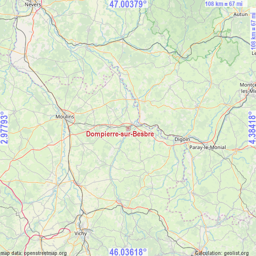
Dompierre-sur-Besbre GPS coordinates[2]
46° 31' 19.704" North, 3° 40' 51.816" East
| Map corner | latitude | longitude |
|---|---|---|
| Upper-left | 47.00379°, | 2.97793° |
| Center: | 46.52214°, | 3.68106° |
| Lower-right: | 46.03618°, | 4.38418° |
| Map W x H: | 107.6×107.6 km | = 66.9×66.9mi |
| max Lat: | 51.07786° ⇑60% North |
| Dompierre-sur-Besbre: | 46.52214° |
| min Lat: | ⇓40% South 41.3874° |
| min Long | Dompierre-sur-B | max Long |
| -5.08615° | 3.68106° | 9.52242° |
| W 65.6%⇐ | ⇒34.4% E |
Elevation
Elevation of Dompierre-sur-Besbre is 220 m = 722 ft, and this is 26.3 m = 86 ft above average elevation for this country.
| Max E: |
2333 m = 7654 ft | 29.9% |
| Dompierre-sur-Besbre | 220 m 722 ft | |
| Avg. | 193.7 m = 635 ft | |
Min E: |
-1 m = -3 ft | 70.1% |
See also: France elevation on elevation.city.
Geographical zone
Dompierre-sur-Besbre is located in North temperate zone (between Tropic of Cancer and the Arctic Circle). Distance of this North polar circle is 2228.4 km =1384.7 mi to North.| Distance of | km | miles | from Dompierre-sur-Besbre |
|---|---|---|---|
| North Pole | 4834.3 | 3003.9 | to North |
| Arctic Circle | 2228.4 | 1384.7 | to North |
| Tropic Cancer | 2566.9 | 1595 | to South |
| Equator | 5172.8 | 3214.2 | to South |


Nearby cities:
15 places around Dompierre-sur-Besbre: (largest is in red/bold)
• Beaulon
8.9 km =5.5 mi,  356°
356°
• Bourbon-Lancy
13 km =8.1 mi,  31°
31°
• Chalmoux
15.4 km =9.6 mi,  56°
56°
• Chevagnes
14 km =8.7 mi,  314°
314°
• Diou
5 km =3.1 mi,  74°
74°
• Garnat-sur-Engièvre
12.5 km =7.8 mi,  353°
353°
• Gilly-sur-Loire
7.8 km =4.8 mi,  76°
76°
• Lusigny
16.2 km =10.1 mi,  296°
296°
• Montbeugny
14.7 km =9.1 mi,  272°
272°
• Pierrefitte-sur-Loire
10.5 km =6.5 mi,  99°
99°
• Saint-Agnan
14.4 km =8.9 mi, 99°
• Saint-Léon
13.3 km =8.3 mi,  178°
178°
• Saligny-sur-Roudon
8 km =5 mi,  138°
138°
• Thiel-sur-Acolin
7.6 km =4.7 mi, 271°
• Vaumas
9.3 km =5.8 mi,  204°
204°
Sources, notices
• [Note1] Compared only with cities in France existing in our database
• [Src1] Map data: © OpenStreetMap contributors (CC-BY-SA)
• [Src2] Other city data from geonames.org with taken over terms of usage.
• [Src3] Geographical zone / Annual Mean Temperature by Robert A. Rohde @ Wikipedia
