Retzwiller geodata
Retzwiller (Grand Est) is a populated place; located in France in Europe/Paris (GMT+2) time zone. With population of 615 people, there are 13071 cities with bigger population in this country. Compared to other cities in France, 53.2% of cities are located further ↓South; 95.2% of cities are located further ←West and 81.9% of cities have lower elevation than Retzwiller. Note1
Administrative division(s):
- Level 1: Grand Est
- Level 2: Haut-Rhin
- Level 3: Altkirch
- Level 4: Retzwiller


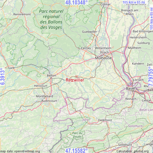
Retzwiller GPS coordinates[2]
47° 37' 54.48" North, 7° 5' 39.912" East
| Map corner | latitude | longitude |
|---|---|---|
| Upper-left | 48.10348°, | 6.3913° |
| Center: | 47.6318°, | 7.09442° |
| Lower-right: | 47.15582°, | 7.79755° |
| Map W x H: | 105.4×105.4 km | = 65.5×65.5mi |
| max Lat: | 51.07786° ⇑46.8% North |
| Retzwiller: | 47.6318° |
| min Lat: | ⇓53.2% South 41.3874° |
| min Long | Retzwiller | max Long |
| -5.08615° | 7.09442° | 9.52242° |
| W 95.2%⇐ | ⇒4.8% E |
Elevation
Elevation of Retzwiller is 310 m = 1017 ft, and this is 116.3 m = 382 ft above average elevation for this country.
| Max E: |
2333 m = 7654 ft | 18.1% |
| Retzwiller | 310 m 1017 ft | |
| Avg. | 193.7 m = 635 ft | |
Min E: |
-1 m = -3 ft | 81.9% |
See also: France elevation on elevation.city.
Geographical zone
Retzwiller is located in North temperate zone (between Tropic of Cancer and the Arctic Circle). Distance of this North polar circle is 2105 km =1308 mi to North.| Distance of | km | miles | from Retzwiller |
|---|---|---|---|
| North Pole | 4710.9 | 2927.2 | to North |
| Arctic Circle | 2105 | 1308 | to North |
| Tropic Cancer | 2690.2 | 1671.6 | to South |
| Equator | 5296.2 | 3290.9 | to South |


Nearby cities:
15 places around Retzwiller: (largest is in red/bold)
• Aspach
10.5 km =6.5 mi,  83°
83°
• Ballersdorf
5.1 km =3.2 mi,  100°
100°
• Balschwiller
7.1 km =4.4 mi,  52°
52°
• Bernwiller
9.7 km =6 mi, 47°
• Carspach
8.8 km =5.5 mi, 101°
• Dannemarie
1.9 km =1.2 mi, 95°
• Fontaine
7.8 km =4.8 mi,  294°
294°
• Foussemagne
6.7 km =4.2 mi,  273°
273°
• Friesen
8.6 km =5.3 mi,  150°
150°
• Hagenbach
5.1 km =3.2 mi,  67°
67°
• Hirtzbach
10.3 km =6.4 mi,  111°
111°
• Manspach
1.7 km =1.1 mi, 152°
• Montreux-Château
7.5 km =4.7 mi,  251°
251°
• Montreux-Vieux
5.6 km =3.5 mi, 254°
• Soppe-le-Bas
9.6 km =6 mi,  357°
357°
Sources, notices
• [Note1] Compared only with cities in France existing in our database
• [Src1] Map data: © OpenStreetMap contributors (CC-BY-SA)
• [Src2] Other city data from geonames.org with taken over terms of usage.
• [Src3] Geographical zone / Annual Mean Temperature by Robert A. Rohde @ Wikipedia
