Fresnoy-Folny geodata
Fresnoy-Folny (Normandy) is a populated place; located in France in Europe/Paris (GMT+2) time zone. With population of 659 people, there are 12396 cities with bigger population in this country. Compared to other cities in France, 92.9% of cities are located further ↓South; 64% of cities are located further →East and 64.4% of cities have lower elevation than Fresnoy-Folny. Note1
Administrative division(s):
- Level 1: Normandy
- Level 2: Seine-Maritime
- Level 3: Arrondissement de Dieppe
- Level 4: Fresnoy-Folny


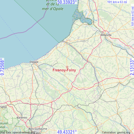
Fresnoy-Folny GPS coordinates[2]
49° 53' 18.06" North, 1° 25' 41.52" East
| Map corner | latitude | longitude |
|---|---|---|
| Upper-left | 50.33923°, | 0.72508° |
| Center: | 49.88835°, | 1.4282° |
| Lower-right: | 49.43321°, | 2.13133° |
| Map W x H: | 100.7×100.7 km | = 62.6×62.6mi |
| max Lat: | 51.07786° ⇑7.1% North |
| Fresnoy-Folny: | 49.88835° |
| min Lat: | ⇓92.9% South 41.3874° |
| min Long | Fresnoy-Folny | max Long |
| -5.08615° | 1.4282° | 9.52242° |
| W 36%⇐ | ⇒64% E |
Elevation
Elevation of Fresnoy-Folny is 191 m = 627 ft, and this is 2.7 m = 9 ft below average elevation for this country.
| Max E: |
2333 m = 7654 ft | 35.6% |
| Avg. | 193.7 m = 635 ft | |
| Fresnoy-Folny | 191 m = 627 ft | |
Min E: |
-1 m = -3 ft | 64.4% |
See also: France elevation on elevation.city.
Geographical zone
Fresnoy-Folny is located in North temperate zone (between Tropic of Cancer and the Arctic Circle). Distance of this North polar circle is 1854.1 km =1152.1 mi to North.| Distance of | km | miles | from Fresnoy-Folny |
|---|---|---|---|
| North Pole | 4460 | 2771.3 | to North |
| Arctic Circle | 1854.1 | 1152.1 | to North |
| Tropic Cancer | 2941.1 | 1827.5 | to South |
| Equator | 5547.1 | 3446.8 | to South |


Nearby cities:
15 places around Fresnoy-Folny: (largest is in red/bold)
• Bailly-en-Rivière
7.1 km =4.4 mi,  291°
291°
• Blangy-sur-Bresle
14.9 km =9.3 mi,  70°
70°
• Envermeu
11.7 km =7.3 mi,  273°
273°
• Foucarmont
11.1 km =6.9 mi,  114°
114°
• Gamaches
14.2 km =8.8 mi,  40°
40°
• Incheville
14.6 km =9.1 mi,  18°
18°
• Londinières
6.5 km =4 mi,  196°
196°
• Longroy
13.7 km =8.5 mi, 35°
• Mesnières-en-Bray
14.5 km =9 mi,  193°
193°
• Monchaux-Soreng
13.7 km =8.5 mi,  60°
60°
• Monchy-sur-Eu
12 km =7.5 mi,  8°
8°
• Rieux
12.2 km =7.6 mi, 64°
• Saint-Nicolas-d’Aliermont
14.6 km =9.1 mi, 265°
• Saint-Pierre-en-Val
14.9 km =9.3 mi, 5°
• Saint-Vaast-d’Équiqueville
14.1 km =8.8 mi,  235°
235°
Sources, notices
• [Note1] Compared only with cities in France existing in our database
• [Src1] Map data: © OpenStreetMap contributors (CC-BY-SA)
• [Src2] Other city data from geonames.org with taken over terms of usage.
• [Src3] Geographical zone / Annual Mean Temperature by Robert A. Rohde @ Wikipedia
