Féricy geodata
Féricy (Île-de-France) is a populated place; located in France in Europe/Paris (GMT+2) time zone. With population of 554 people, there are 14131 cities with bigger population in this country. Compared to other cities in France, 67.5% of cities are located further ↓South; 54.9% of cities are located further ←West and 63.2% of cities have higher elevation than Féricy. Note1
Administrative division(s):
- Level 1: Île-de-France
- Level 2: Seine-et-Marne
- Level 3: Arrondissement de Melun
- Level 4: Féricy


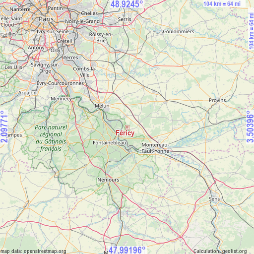
Féricy GPS coordinates[2]
48° 27' 37.332" North, 2° 48' 2.988" East
| Map corner | latitude | longitude |
|---|---|---|
| Upper-left | 48.9245°, | 2.09771° |
| Center: | 48.46037°, | 2.80083° |
| Lower-right: | 47.99196°, | 3.50396° |
| Map W x H: | 103.7×103.7 km | = 64.4×64.4mi |
| max Lat: | 51.07786° ⇑32.5% North |
| Féricy: | 48.46037° |
| min Lat: | ⇓67.5% South 41.3874° |
| min Long | Féricy | max Long |
| -5.08615° | 2.80083° | 9.52242° |
| W 54.9%⇐ | ⇒45.1% E |
Elevation
Elevation of Féricy is 94 m = 308 ft, and this is 99.7 m = 327 ft below average elevation for this country.
| Max E: |
2333 m = 7654 ft | 63.2% |
| Avg. | 193.7 m = 635 ft | |
| Féricy | 94 m = 308 ft | |
Min E: |
-1 m = -3 ft | 36.8% |
See also: France elevation on elevation.city.
Geographical zone
Féricy is located in North temperate zone (between Tropic of Cancer and the Arctic Circle). Distance of this North polar circle is 2012.9 km =1250.8 mi to North.| Distance of | km | miles | from Féricy |
|---|---|---|---|
| North Pole | 4618.8 | 2870 | to North |
| Arctic Circle | 2012.9 | 1250.8 | to North |
| Tropic Cancer | 2782.4 | 1728.9 | to South |
| Equator | 5388.3 | 3348.1 | to South |


Nearby cities:
15 places around Féricy: (largest is in red/bold)
• Bois-le-Roi
7.2 km =4.5 mi,  281°
281°
• Champagne-sur-Seine
6.9 km =4.3 mi,  181°
181°
• Chartrettes
8 km =5 mi,  292°
292°
• Fontaine-le-Port
3.8 km =2.4 mi,  317°
317°
• Héricy
3 km =1.9 mi,  243°
243°
• Le Châtelet-en-Brie
5.2 km =3.2 mi,  352°
352°
• Les Écrennes
6.5 km =4 mi,  40°
40°
• Machault
2.3 km =1.4 mi,  103°
103°
• Pamfou
5.1 km =3.2 mi,  89°
89°
• Samois-sur-Seine
3.8 km =2.4 mi,  256°
256°
• Samoreau
4.8 km =3 mi,  223°
223°
• Sivry-Courtry
8.3 km =5.2 mi,  335°
335°
• Thomery
6 km =3.7 mi,  188°
188°
• Valence-en-Brie
6.9 km =4.3 mi,  106°
106°
• Vulaines-sur-Seine
4.1 km =2.5 mi, 220°
Sources, notices
• [Note1] Compared only with cities in France existing in our database
• [Src1] Map data: © OpenStreetMap contributors (CC-BY-SA)
• [Src2] Other city data from geonames.org with taken over terms of usage.
• [Src3] Geographical zone / Annual Mean Temperature by Robert A. Rohde @ Wikipedia
