Héricy geodata
Héricy (Île-de-France) is a populated place; located in France in Europe/Paris (GMT+2) time zone. With population of 2,842 people, there are 3431 cities with bigger population in this country. Compared to other cities in France, 67.2% of cities are located further ↓South; 54.4% of cities are located further ←West and 81.5% of cities have higher elevation than Héricy. Note1
Administrative division(s):
- Level 1: Île-de-France
- Level 2: Seine-et-Marne
- Level 3: Arrondissement de Fontainebleau
- Level 4: Héricy


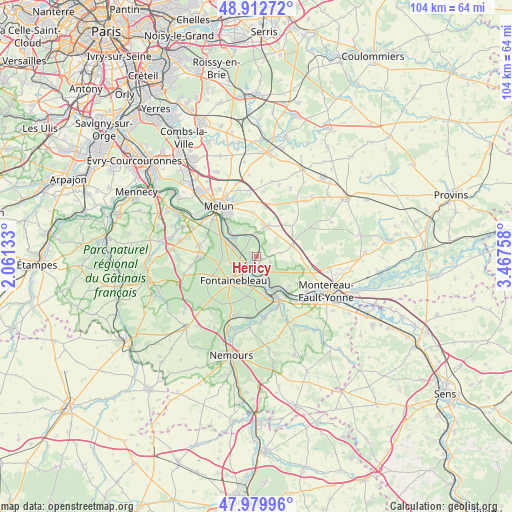
Héricy GPS coordinates[2]
48° 26' 54.528" North, 2° 45' 52.02" East
| Map corner | latitude | longitude |
|---|---|---|
| Upper-left | 48.91272°, | 2.06133° |
| Center: | 48.44848°, | 2.76445° |
| Lower-right: | 47.97996°, | 3.46758° |
| Map W x H: | 103.7×103.7 km | = 64.4×64.4mi |
| max Lat: | 51.07786° ⇑32.8% North |
| Héricy: | 48.44848° |
| min Lat: | ⇓67.2% South 41.3874° |
| min Long | Héricy | max Long |
| -5.08615° | 2.76445° | 9.52242° |
| W 54.4%⇐ | ⇒45.6% E |
Elevation
Elevation of Héricy is 51 m = 167 ft, and this is 142.7 m = 468 ft below average elevation for this country.
| Max E: |
2333 m = 7654 ft | 81.5% |
| Avg. | 193.7 m = 635 ft | |
| Héricy | 51 m = 167 ft | |
Min E: |
-1 m = -3 ft | 18.5% |
See also: France elevation on elevation.city.
Geographical zone
Héricy is located in North temperate zone (between Tropic of Cancer and the Arctic Circle). Distance of this North polar circle is 2014.2 km =1251.6 mi to North.| Distance of | km | miles | from Héricy |
|---|---|---|---|
| North Pole | 4620.1 | 2870.8 | to North |
| Arctic Circle | 2014.2 | 1251.6 | to North |
| Tropic Cancer | 2781 | 1728 | to South |
| Equator | 5387 | 3347.3 | to South |


Nearby cities:
15 places around Héricy: (largest is in red/bold)
• Avon
6.1 km =3.8 mi,  212°
212°
• Bois-le-Roi
5.2 km =3.2 mi,  302°
302°
• Champagne-sur-Seine
6.1 km =3.8 mi,  156°
156°
• Chartrettes
6.4 km =4 mi,  313°
313°
• Fontaine-le-Port
4.1 km =2.5 mi,  0°
0°
• Fontainebleau
6.4 km =4 mi,  226°
226°
• Féricy
3 km =1.9 mi,  63°
63°
• Le Châtelet-en-Brie
6.8 km =4.2 mi,  17°
17°
• Machault
5 km =3.1 mi,  80°
80°
• Pamfou
7.9 km =4.9 mi, 79°
• Saint-Mammès
8.1 km =5 mi,  151°
151°
• Samois-sur-Seine
1.1 km =0.7 mi,  293°
293°
• Samoreau
2.2 km =1.4 mi,  196°
196°
• Thomery
4.9 km =3 mi, 158°
• Vulaines-sur-Seine
1.8 km =1.1 mi,  179°
179°
Sources, notices
• [Note1] Compared only with cities in France existing in our database
• [Src1] Map data: © OpenStreetMap contributors (CC-BY-SA)
• [Src2] Other city data from geonames.org with taken over terms of usage.
• [Src3] Geographical zone / Annual Mean Temperature by Robert A. Rohde @ Wikipedia
