Pamfou geodata
Pamfou (Île-de-France) is a populated place; located in France in Europe/Paris (GMT+2) time zone. With population of 914 people, there are 9537 cities with bigger population in this country. Compared to other cities in France, 67.5% of cities are located further ↓South; 56% of cities are located further ←West and 53.1% of cities have higher elevation than Pamfou. Note1
Administrative division(s):
- Level 1: Île-de-France
- Level 2: Seine-et-Marne
- Level 3: Arrondissement de Melun
- Level 4: Pamfou


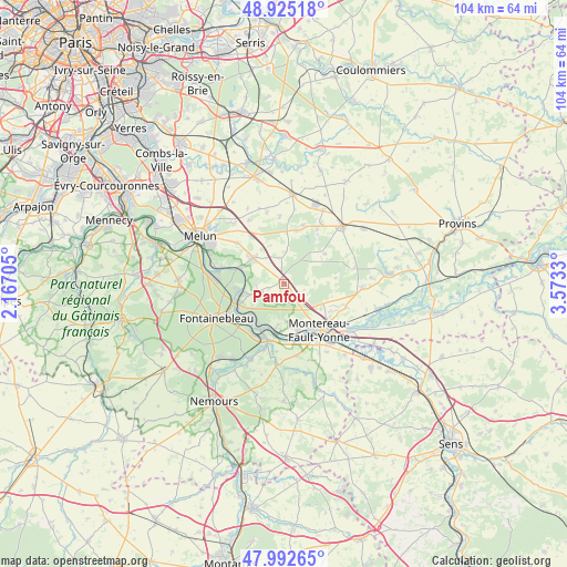
Pamfou GPS coordinates[2]
48° 27' 39.816" North, 2° 52' 12.612" East
| Map corner | latitude | longitude |
|---|---|---|
| Upper-left | 48.92518°, | 2.16705° |
| Center: | 48.46106°, | 2.87017° |
| Lower-right: | 47.99265°, | 3.5733° |
| Map W x H: | 103.7×103.7 km | = 64.4×64.4mi |
| max Lat: | 51.07786° ⇑32.5% North |
| Pamfou: | 48.46106° |
| min Lat: | ⇓67.5% South 41.3874° |
| min Long | Pamfou | max Long |
| -5.08615° | 2.87017° | 9.52242° |
| W 56%⇐ | ⇒44% E |
Elevation
Elevation of Pamfou is 122 m = 400 ft, and this is 71.7 m = 235 ft below average elevation for this country.
| Max E: |
2333 m = 7654 ft | 53.1% |
| Avg. | 193.7 m = 635 ft | |
| Pamfou | 122 m = 400 ft | |
Min E: |
-1 m = -3 ft | 46.9% |
See also: France elevation on elevation.city.
Geographical zone
Pamfou is located in North temperate zone (between Tropic of Cancer and the Arctic Circle). Distance of this North polar circle is 2012.8 km =1250.7 mi to North.| Distance of | km | miles | from Pamfou |
|---|---|---|---|
| North Pole | 4618.7 | 2869.9 | to North |
| Arctic Circle | 2012.8 | 1250.7 | to North |
| Tropic Cancer | 2782.4 | 1728.9 | to South |
| Equator | 5388.4 | 3348.2 | to South |


Nearby cities:
15 places around Pamfou: (largest is in red/bold)
• Champagne-sur-Seine
8.8 km =5.5 mi,  217°
217°
• Fontaine-le-Port
8.2 km =5.1 mi,  289°
289°
• Féricy
5.1 km =3.2 mi,  269°
269°
• Héricy
7.9 km =4.9 mi,  259°
259°
• La Grande-Paroisse
8.6 km =5.3 mi,  164°
164°
• Le Châtelet-en-Brie
7.7 km =4.8 mi,  311°
311°
• Les Écrennes
4.9 km =3 mi,  349°
349°
• Machault
2.9 km =1.8 mi, 257°
• Samois-sur-Seine
8.9 km =5.5 mi, 263°
• Samoreau
9.1 km =5.7 mi,  247°
247°
• Thomery
8.5 km =5.3 mi,  225°
225°
• Valence-en-Brie
2.5 km =1.6 mi,  143°
143°
• Vernou-la-Celle-sur-Seine
8.3 km =5.2 mi,  191°
191°
• Vulaines-sur-Seine
8.4 km =5.2 mi, 247°
• Échouboulains
5.6 km =3.5 mi,  86°
86°
Sources, notices
• [Note1] Compared only with cities in France existing in our database
• [Src1] Map data: © OpenStreetMap contributors (CC-BY-SA)
• [Src2] Other city data from geonames.org with taken over terms of usage.
• [Src3] Geographical zone / Annual Mean Temperature by Robert A. Rohde @ Wikipedia
