Eymet geodata
Eymet (Nouvelle-Aquitaine) is a populated place; located in France in Europe/Paris (GMT+2) time zone. With population of 2,718 people, there are 3600 cities with bigger population in this country. Compared to other cities in France, 82.3% of cities are located further ↑North; 74.4% of cities are located further →East and 80.6% of cities have higher elevation than Eymet. Note1
Administrative division(s):
- Level 1: Nouvelle-Aquitaine
- Level 2: Dordogne
- Level 3: Arrondissement de Bergerac
- Level 4: Eymet


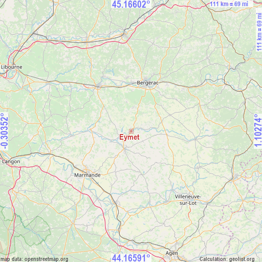
Eymet GPS coordinates[2]
44° 40' 5.232" North, 0° 23' 58.596" East
| Map corner | latitude | longitude |
|---|---|---|
| Upper-left | 45.16602°, | -0.30352° |
| Center: | 44.66812°, | 0.39961° |
| Lower-right: | 44.16591°, | 1.10274° |
| Map W x H: | 111.2×111.2 km | = 69.1×69.1mi |
| max Lat: | 51.07786° ⇑82.3% North |
| Eymet: | 44.66812° |
| min Lat: | ⇓17.7% South 41.3874° |
| min Long | Eymet | max Long |
| -5.08615° | 0.39961° | 9.52242° |
| W 25.6%⇐ | ⇒74.4% E |
Elevation
Elevation of Eymet is 53 m = 174 ft, and this is 140.7 m = 462 ft below average elevation for this country.
| Max E: |
2333 m = 7654 ft | 80.6% |
| Avg. | 193.7 m = 635 ft | |
| Eymet | 53 m = 174 ft | |
Min E: |
-1 m = -3 ft | 19.4% |
See also: France elevation on elevation.city.
Geographical zone
Eymet is located in North temperate zone (between Tropic of Cancer and the Arctic Circle). Distance of this Northern Tropic circle is 2360.7 km =1466.9 mi to South.| Distance of | km | miles | from Eymet |
|---|---|---|---|
| North Pole | 5040.4 | 3132 | to North |
| Arctic Circle | 2434.5 | 1512.7 | to North |
| Tropic Cancer | 2360.7 | 1466.9 | to South |
| Equator | 4966.6 | 3086.1 | to South |


Nearby cities:
15 places around Eymet: (largest is in red/bold)
• Bouniagues
14.2 km =8.8 mi,  44°
44°
• Castillonnès
15.3 km =9.5 mi,  96°
96°
• Fongrave
15 km =9.3 mi,  179°
179°
• Lauzun
6.5 km =4 mi,  131°
131°
• Lavergne
8.5 km =5.3 mi, 180°
• Lévignac-de-Guyenne
16.4 km =10.2 mi,  254°
254°
• Miramont-de-Guyenne
8 km =5 mi,  201°
201°
• Monbahus
17.1 km =10.6 mi,  141°
141°
• Monbazillac
15.8 km =9.8 mi,  27°
27°
• Pomport
12.4 km =7.7 mi,  6°
6°
• Roumagne
7.4 km =4.6 mi,  220°
220°
• Saint-Laurent-des-Vignes
17 km =10.6 mi, 14°
• Saint-Pardoux-Isaac
6.6 km =4.1 mi, 198°
• Seyches
14.9 km =9.3 mi,  209°
209°
• Sigoulès
10.2 km =6.3 mi, 5°
Sources, notices
• [Note1] Compared only with cities in France existing in our database
• [Src1] Map data: © OpenStreetMap contributors (CC-BY-SA)
• [Src2] Other city data from geonames.org with taken over terms of usage.
• [Src3] Geographical zone / Annual Mean Temperature by Robert A. Rohde @ Wikipedia
