Entraigues-sur-la-Sorgue geodata
Entraigues-sur-la-Sorgue (Provence-Alpes-Côte d'Azur) is a populated place; located in France in Europe/Paris (GMT+2) time zone. With population of 7,206 people, there are 1353 cities with bigger population in this country. Compared to other cities in France, 87.1% of cities are located further ↑North; 76.8% of cities are located further ←West and 91.2% of cities have higher elevation than Entraigues-sur-la-Sorgue. Note1
Administrative division(s):
- Level 1: Provence-Alpes-Côte d'Azur
- Level 2: Département du Vaucluse
- Level 3: Arrondissement d’Avignon
- Level 4: Entraigues-sur-la-Sorgue
Current local time in Entraigues-sur-la-Sorgue:
05:52 AM, WednesdayDifference from your time zone: hours


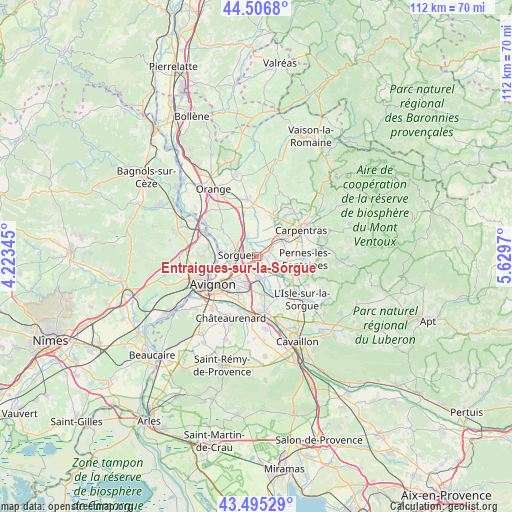
Entraigues-sur-la-Sorgue GPS coordinates[2]
44° 0' 11.52" North, 4° 55' 35.652" East
| Map corner | latitude | longitude |
|---|---|---|
| Upper-left | 44.5068°, | 4.22345° |
| Center: | 44.0032°, | 4.92657° |
| Lower-right: | 43.49529°, | 5.6297° |
| Map W x H: | 112.5×112.5 km | = 69.9×69.9mi |
| max Lat: | 51.07786° ⇑87.1% North |
| Entraigues-sur-la-Sorgue: | 44.0032° |
| min Lat: | ⇓12.9% South 41.3874° |
| min Long | Entraigues-sur- | max Long |
| -5.08615° | 4.92657° | 9.52242° |
| W 76.8%⇐ | ⇒23.2% E |
Elevation
Elevation of Entraigues-sur-la-Sorgue is 27 m = 89 ft, and this is 166.7 m = 547 ft below average elevation for this country.
| Max E: |
2333 m = 7654 ft | 91.2% |
| Avg. | 193.7 m = 635 ft | |
| Entraigues-sur-la-Sorgue | 27 m = 89 ft | |
Min E: |
-1 m = -3 ft | 8.8% |
See also: France elevation on elevation.city.
Geographical zone
Entraigues-sur-la-Sorgue is located in North temperate zone (between Tropic of Cancer and the Arctic Circle). Distance of this Northern Tropic circle is 2286.8 km =1421 mi to South.| Distance of | km | miles | from Entraigues-sur-la-Sorgue |
|---|---|---|---|
| North Pole | 5114.4 | 3177.9 | to North |
| Arctic Circle | 2508.5 | 1558.7 | to North |
| Tropic Cancer | 2286.8 | 1421 | to South |
| Equator | 4892.7 | 3040.2 | to South |


Nearby cities:
15 places around Entraigues-sur-la-Sorgue: (largest is in red/bold)
• Althen-des-Paluds
2.6 km =1.6 mi,  87°
87°
• Bédarrides
4.7 km =2.9 mi,  331°
331°
• Châteauneuf-de-Gadagne
8.6 km =5.3 mi,  170°
170°
• Châteauneuf-du-Pape
9.6 km =6 mi,  308°
308°
• Jonquerettes
6.3 km =3.9 mi,  175°
175°
• Le Pontet
7.1 km =4.4 mi,  228°
228°
• Le Thor
9.9 km =6.2 mi,  146°
146°
• Monteux
6.7 km =4.2 mi,  56°
56°
• Montfavet
8.9 km =5.5 mi,  208°
208°
• Morières-lès-Avignon
7.3 km =4.5 mi,  196°
196°
• Saint-Saturnin-lès-Avignon
5.4 km =3.4 mi, 180°
• Sarrians
9.6 km =6 mi,  21°
21°
• Sorgues
4.3 km =2.7 mi,  280°
280°
• Vedène
3.4 km =2.1 mi, 211°
• Velleron
9.7 km =6 mi,  121°
121°
In other languages:
- In France: Entraigues-sur-la-Sorgue, Entraigues-sur-Sorgue
- In Russian: Антрег-сюр-ла-Сорг
- In Chinese: 拉索尔居河畔昂特赖居厄
Sources, notices
• [Note1] Compared only with cities in France existing in our database
• [Src1] Map data: © OpenStreetMap contributors (CC-BY-SA)
• [Src2] Other city data from geonames.org with taken over terms of usage.
• [Src3] Geographical zone / Annual Mean Temperature by Robert A. Rohde @ Wikipedia
