Denney geodata
Denney (Bourgogne-Franche-Comté) is a populated place; located in France in Europe/Paris (GMT+2) time zone. With population of 659 people, there are 12396 cities with bigger population in this country. Compared to other cities in France, 53.6% of cities are located further ↓South; 94.4% of cities are located further ←West and 85.3% of cities have lower elevation than Denney. Note1
Administrative division(s):
- Level 1: Bourgogne-Franche-Comté
- Level 2: Territoire de Belfort
- Level 3: Arrondissement de Belfort
- Level 4: Denney


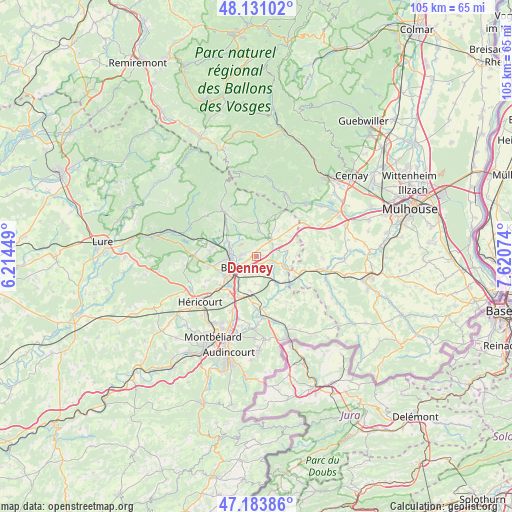
Denney GPS coordinates[2]
47° 39' 34.524" North, 6° 55' 3.396" East
| Map corner | latitude | longitude |
|---|---|---|
| Upper-left | 48.13102°, | 6.21449° |
| Center: | 47.65959°, | 6.91761° |
| Lower-right: | 47.18386°, | 7.62074° |
| Map W x H: | 105.3×105.3 km | = 65.4×65.4mi |
| max Lat: | 51.07786° ⇑46.4% North |
| Denney: | 47.65959° |
| min Lat: | ⇓53.6% South 41.3874° |
| min Long | Denney | max Long |
| -5.08615° | 6.91761° | 9.52242° |
| W 94.4%⇐ | ⇒5.6% E |
Elevation
Elevation of Denney is 350 m = 1148 ft, and this is 156.3 m = 513 ft above average elevation for this country.
| Max E: |
2333 m = 7654 ft | 14.7% |
| Denney | 350 m 1148 ft | |
| Avg. | 193.7 m = 635 ft | |
Min E: |
-1 m = -3 ft | 85.3% |
See also: France elevation on elevation.city.
Geographical zone
Denney is located in North temperate zone (between Tropic of Cancer and the Arctic Circle). Distance of this North polar circle is 2101.9 km =1306.1 mi to North.| Distance of | km | miles | from Denney |
|---|---|---|---|
| North Pole | 4707.8 | 2925.3 | to North |
| Arctic Circle | 2101.9 | 1306.1 | to North |
| Tropic Cancer | 2693.3 | 1673.5 | to South |
| Equator | 5299.2 | 3292.8 | to South |


Nearby cities:
15 places around Denney: (largest is in red/bold)
• Anjoutey
4.7 km =2.9 mi,  13°
13°
• Belfort
5.2 km =3.2 mi,  247°
247°
• Bessoncourt
1.9 km =1.2 mi,  145°
145°
• Chèvremont
3.4 km =2.1 mi,  176°
176°
• Cravanche
6.5 km =4 mi,  263°
263°
• Danjoutin
6.2 km =3.9 mi,  222°
222°
• Fontaine
6.2 km =3.9 mi,  88°
88°
• Offemont
3 km =1.9 mi,  276°
276°
• Pérouse
3.2 km =2 mi, 217°
• Roppe
1.1 km =0.7 mi, 5°
• Saint-Germain-le-Châtelet
5.2 km =3.2 mi,  35°
35°
• Sermamagny
7 km =4.3 mi,  300°
300°
• Valdoie
5.8 km =3.6 mi, 282°
• Vézelois
5.7 km =3.5 mi, 181°
• Éloie
4.7 km =2.9 mi,  315°
315°
Sources, notices
• [Note1] Compared only with cities in France existing in our database
• [Src1] Map data: © OpenStreetMap contributors (CC-BY-SA)
• [Src2] Other city data from geonames.org with taken over terms of usage.
• [Src3] Geographical zone / Annual Mean Temperature by Robert A. Rohde @ Wikipedia
