Éloie geodata
Éloie (Bourgogne-Franche-Comté) is a populated place; located in France in Europe/Paris (GMT+2) time zone. With population of 941 people, there are 9290 cities with bigger population in this country. Compared to other cities in France, 54.1% of cities are located further ↓South; 94.1% of cities are located further ←West and 88.6% of cities have lower elevation than Éloie. Note1
Administrative division(s):
- Level 1: Bourgogne-Franche-Comté
- Level 2: Territoire de Belfort
- Level 3: Arrondissement de Belfort
- Level 4: Éloie


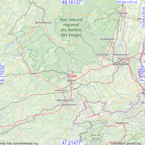
Éloie GPS coordinates[2]
47° 41' 24.792" North, 6° 52' 24.42" East
| Map corner | latitude | longitude |
|---|---|---|
| Upper-left | 48.16137°, | 6.17032° |
| Center: | 47.69022°, | 6.87345° |
| Lower-right: | 47.21477°, | 7.57657° |
| Map W x H: | 105.3×105.3 km | = 65.4×65.4mi |
| max Lat: | 51.07786° ⇑45.9% North |
| Éloie: | 47.69022° |
| min Lat: | ⇓54.1% South 41.3874° |
| min Long | Éloie | max Long |
| -5.08615° | 6.87345° | 9.52242° |
| W 94.1%⇐ | ⇒5.9% E |
Elevation
Elevation of Éloie is 400 m = 1312 ft, and this is 206.3 m = 677 ft above average elevation for this country.
| Max E: |
2333 m = 7654 ft | 11.4% |
| Éloie | 400 m 1312 ft | |
| Avg. | 193.7 m = 635 ft | |
Min E: |
-1 m = -3 ft | 88.6% |
See also: France elevation on elevation.city.
Geographical zone
Éloie is located in North temperate zone (between Tropic of Cancer and the Arctic Circle). Distance of this North polar circle is 2098.5 km =1303.9 mi to North.| Distance of | km | miles | from Éloie |
|---|---|---|---|
| North Pole | 4704.4 | 2923.2 | to North |
| Arctic Circle | 2098.5 | 1303.9 | to North |
| Tropic Cancer | 2696.7 | 1675.7 | to South |
| Equator | 5302.7 | 3294.9 | to South |


Nearby cities:
15 places around Éloie: (largest is in red/bold)
• Anjoutey
4.6 km =2.9 mi,  75°
75°
• Belfort
5.5 km =3.4 mi,  195°
195°
• Chaux
4 km =2.5 mi,  314°
314°
• Cravanche
5.1 km =3.2 mi,  217°
217°
• Denney
4.7 km =2.9 mi,  135°
135°
• Grosmagny
3.8 km =2.4 mi,  13°
13°
• Lachapelle-sous-Chaux
4.3 km =2.7 mi,  292°
292°
• Offemont
3.1 km =1.9 mi,  174°
174°
• Pérouse
6.1 km =3.8 mi, 166°
• Roppe
4.1 km =2.5 mi,  123°
123°
• Rougegoutte
5.1 km =3.2 mi,  340°
340°
• Saint-Germain-le-Châtelet
6.4 km =4 mi, 82°
• Salbert
5.1 km =3.2 mi,  243°
243°
• Sermamagny
2.7 km =1.7 mi,  271°
271°
• Valdoie
3.2 km =2 mi,  226°
226°
Sources, notices
• [Note1] Compared only with cities in France existing in our database
• [Src1] Map data: © OpenStreetMap contributors (CC-BY-SA)
• [Src2] Other city data from geonames.org with taken over terms of usage.
• [Src3] Geographical zone / Annual Mean Temperature by Robert A. Rohde @ Wikipedia
