Chèvremont geodata
Chèvremont (Bourgogne-Franche-Comté) is a populated place; located in France in Europe/Paris (GMT+2) time zone. With population of 1,281 people, there are 7125 cities with bigger population in this country. Compared to other cities in France, 53.1% of cities are located further ↓South; 94.4% of cities are located further ←West and 85.1% of cities have lower elevation than Chèvremont. Note1
Administrative division(s):
- Level 1: Bourgogne-Franche-Comté
- Level 2: Territoire de Belfort
- Level 3: Arrondissement de Belfort
- Level 4: Chèvremont


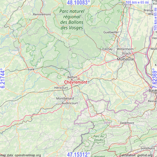
Chèvremont GPS coordinates[2]
47° 37' 44.832" North, 6° 55' 14.016" East
| Map corner | latitude | longitude |
|---|---|---|
| Upper-left | 48.10083°, | 6.21744° |
| Center: | 47.62912°, | 6.92056° |
| Lower-right: | 47.15312°, | 7.62369° |
| Map W x H: | 105.4×105.4 km | = 65.5×65.5mi |
| max Lat: | 51.07786° ⇑46.9% North |
| Chèvremont: | 47.62912° |
| min Lat: | ⇓53.1% South 41.3874° |
| min Long | Chèvremont | max Long |
| -5.08615° | 6.92056° | 9.52242° |
| W 94.4%⇐ | ⇒5.6% E |
Elevation
Elevation of Chèvremont is 348 m = 1142 ft, and this is 154.3 m = 506 ft above average elevation for this country.
| Max E: |
2333 m = 7654 ft | 14.9% |
| Chèvremont | 348 m 1142 ft | |
| Avg. | 193.7 m = 635 ft | |
Min E: |
-1 m = -3 ft | 85.1% |
See also: France elevation on elevation.city.
Geographical zone
Chèvremont is located in North temperate zone (between Tropic of Cancer and the Arctic Circle). Distance of this North polar circle is 2105.3 km =1308.2 mi to North.| Distance of | km | miles | from Chèvremont |
|---|---|---|---|
| North Pole | 4711.2 | 2927.4 | to North |
| Arctic Circle | 2105.3 | 1308.2 | to North |
| Tropic Cancer | 2689.9 | 1671.4 | to South |
| Equator | 5295.9 | 3290.7 | to South |


Nearby cities:
15 places around Chèvremont: (largest is in red/bold)
• Andelnans
5 km =3.1 mi,  234°
234°
• Bavilliers
6.4 km =4 mi,  263°
263°
• Belfort
5.2 km =3.2 mi,  286°
286°
• Bessoncourt
2 km =1.2 mi,  25°
25°
• Danjoutin
4.5 km =2.8 mi,  254°
254°
• Denney
3.4 km =2.1 mi,  356°
356°
• Fontaine
6.9 km =4.3 mi,  59°
59°
• Foussemagne
6.4 km =4 mi,  83°
83°
• Meroux
4.1 km =2.5 mi,  203°
203°
• Montreux-Château
6.3 km =3.9 mi,  109°
109°
• Offemont
4.9 km =3 mi,  319°
319°
• Pérouse
2.3 km =1.4 mi, 291°
• Roppe
4.5 km =2.8 mi, 358°
• Sevenans
6.2 km =3.9 mi,  220°
220°
• Vézelois
2.4 km =1.5 mi,  189°
189°
Sources, notices
• [Note1] Compared only with cities in France existing in our database
• [Src1] Map data: © OpenStreetMap contributors (CC-BY-SA)
• [Src2] Other city data from geonames.org with taken over terms of usage.
• [Src3] Geographical zone / Annual Mean Temperature by Robert A. Rohde @ Wikipedia
