Cornebarrieu geodata
Cornebarrieu (Occitanie) is a populated place; located in France in Europe/Paris (GMT+2) time zone. With population of 5,256 people, there are 1872 cities with bigger population in this country. Compared to other cities in France, 91.2% of cities are located further ↑North; 65.3% of cities are located further →East and 55% of cities have lower elevation than Cornebarrieu. Note1
Administrative division(s):
- Level 1: Occitanie
- Level 2: Haute-Garonne
- Level 3: Arrondissement de Toulouse
- Level 4: Cornebarrieu


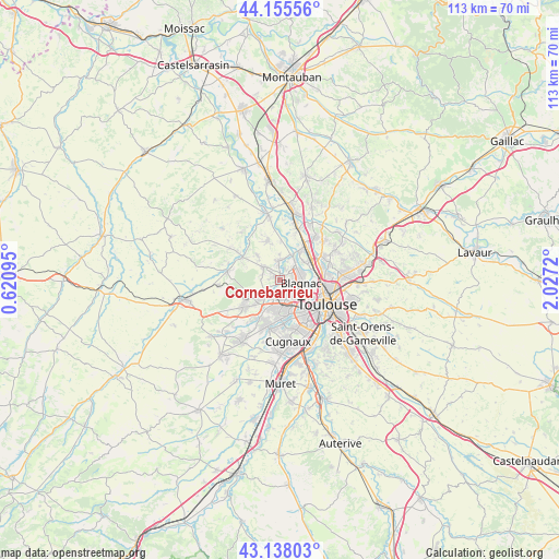
Cornebarrieu GPS coordinates[2]
43° 38' 56.22" North, 1° 19' 26.652" East
| Map corner | latitude | longitude |
|---|---|---|
| Upper-left | 44.15556°, | 0.62095° |
| Center: | 43.64895°, | 1.32407° |
| Lower-right: | 43.13803°, | 2.0272° |
| Map W x H: | 113.1×113.1 km | = 70.3×70.3mi |
| max Lat: | 51.07786° ⇑91.2% North |
| Cornebarrieu: | 43.64895° |
| min Lat: | ⇓8.8% South 41.3874° |
| min Long | Cornebarrieu | max Long |
| -5.08615° | 1.32407° | 9.52242° |
| W 34.7%⇐ | ⇒65.3% E |
Elevation
Elevation of Cornebarrieu is 150 m = 492 ft, and this is 43.7 m = 143 ft below average elevation for this country.
| Max E: |
2333 m = 7654 ft | 45% |
| Avg. | 193.7 m = 635 ft | |
| Cornebarrieu | 150 m = 492 ft | |
Min E: |
-1 m = -3 ft | 55% |
See also: France elevation on elevation.city.
Geographical zone
Cornebarrieu is located in North temperate zone (between Tropic of Cancer and the Arctic Circle). Distance of this Northern Tropic circle is 2247.4 km =1396.5 mi to South.| Distance of | km | miles | from Cornebarrieu |
|---|---|---|---|
| North Pole | 5153.8 | 3202.4 | to North |
| Arctic Circle | 2547.9 | 1583.2 | to North |
| Tropic Cancer | 2247.4 | 1396.5 | to South |
| Equator | 4853.3 | 3015.7 | to South |


Nearby cities:
15 places around Cornebarrieu: (largest is in red/bold)
• Aussonne
3.7 km =2.3 mi,  353°
353°
• Beauzelle
4.6 km =2.9 mi,  63°
63°
• Blagnac
5.9 km =3.7 mi,  107°
107°
• Brax
7.6 km =4.7 mi,  243°
243°
• Colomiers
4.4 km =2.7 mi,  168°
168°
• Daux
6.8 km =4.2 mi,  319°
319°
• Fenouillet
6.5 km =4 mi, 57°
• Gagnac-sur-Garonne
7 km =4.3 mi,  36°
36°
• Lespinasse
8.5 km =5.3 mi,  34°
34°
• Merville
8.6 km =5.3 mi, 345°
• Mondonville
4.1 km =2.5 mi,  311°
311°
• Pibrac
4.4 km =2.7 mi,  224°
224°
• Saint-Alban
8.5 km =5.3 mi,  54°
54°
• Seilh
5.7 km =3.5 mi, 26°
• Tournefeuille
6.7 km =4.2 mi,  183°
183°
Sources, notices
• [Note1] Compared only with cities in France existing in our database
• [Src1] Map data: © OpenStreetMap contributors (CC-BY-SA)
• [Src2] Other city data from geonames.org with taken over terms of usage.
• [Src3] Geographical zone / Annual Mean Temperature by Robert A. Rohde @ Wikipedia
