Condé-sur-l’Escaut geodata
Condé-sur-l’Escaut (Hauts-de-France) is a populated place; located in France in Europe/Paris (GMT+2) time zone. With population of 10,215 people, there are 927 cities with bigger population in this country. Compared to other cities in France, 96.9% of cities are located further ↓South; 65% of cities are located further ←West and 91.6% of cities have higher elevation than Condé-sur-l’Escaut. Note1
Administrative division(s):
- Level 1: Hauts-de-France
- Level 2: Nord
- Level 3: Arrondissement de Valenciennes
- Level 4: Condé-sur-l'Escaut


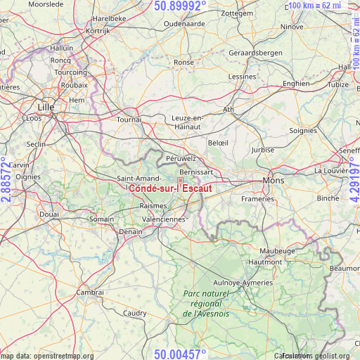
Condé-sur-l’Escaut GPS coordinates[2]
50° 27' 15.696" North, 3° 35' 19.824" East
| Map corner | latitude | longitude |
|---|---|---|
| Upper-left | 50.89992°, | 2.88572° |
| Center: | 50.45436°, | 3.58884° |
| Lower-right: | 50.00457°, | 4.29197° |
| Map W x H: | 99.6×99.6 km | = 61.9×61.9mi |
| max Lat: | 51.07786° ⇑3.1% North |
| Condé-sur-l’Escaut: | 50.45436° |
| min Lat: | ⇓96.9% South 41.3874° |
| min Long | Condé-sur-l’ | max Long |
| -5.08615° | 3.58884° | 9.52242° |
| W 65%⇐ | ⇒35% E |
Elevation
Elevation of Condé-sur-l’Escaut is 26 m = 85 ft, and this is 167.7 m = 550 ft below average elevation for this country.
| Max E: |
2333 m = 7654 ft | 91.6% |
| Avg. | 193.7 m = 635 ft | |
| Condé-sur-l’Escaut | 26 m = 85 ft | |
Min E: |
-1 m = -3 ft | 8.4% |
See also: France elevation on elevation.city.
Geographical zone
Condé-sur-l’Escaut is located in North temperate zone (between Tropic of Cancer and the Arctic Circle). Distance of this North polar circle is 1791.2 km =1113 mi to North.| Distance of | km | miles | from Condé-sur-l’Escaut |
|---|---|---|---|
| North Pole | 4397.1 | 2732.2 | to North |
| Arctic Circle | 1791.2 | 1113 | to North |
| Tropic Cancer | 3004.1 | 1866.7 | to South |
| Equator | 5610 | 3485.9 | to South |


Nearby cities:
15 places around Condé-sur-l’Escaut: (largest is in red/bold)
• Bruay-sur-l’Escaut
6.9 km =4.3 mi,  207°
207°
• Bruille-Saint-Amand
6.4 km =4 mi,  281°
281°
• Crespin
6.3 km =3.9 mi,  125°
125°
• Escautpont
4.7 km =2.9 mi, 212°
• Fresnes-sur-Escaut
2.4 km =1.5 mi,  199°
199°
• Hergnies
4.9 km =3 mi,  294°
294°
• Odomez
4.6 km =2.9 mi,  268°
268°
• Onnaing
7.7 km =4.8 mi,  174°
174°
• Quarouble
7.9 km =4.9 mi,  162°
162°
• Quiévrechain
8.9 km =5.5 mi,  141°
141°
• Saint-Saulve
9.5 km =5.9 mi,  194°
194°
• Thivencelle
3.6 km =2.2 mi,  116°
116°
• Thun-Saint-Amand
10 km =6.2 mi, 281°
• Vicq
5.3 km =3.3 mi, 168°
• Vieux-Condé
1.6 km =1 mi, 290°
Sources, notices
• [Note1] Compared only with cities in France existing in our database
• [Src1] Map data: © OpenStreetMap contributors (CC-BY-SA)
• [Src2] Other city data from geonames.org with taken over terms of usage.
• [Src3] Geographical zone / Annual Mean Temperature by Robert A. Rohde @ Wikipedia
