Glénic geodata
Glénic (Nouvelle-Aquitaine) is a populated place; located in France in Europe/Paris (GMT+2) time zone. With population of 605 people, there are 13241 cities with bigger population in this country. Compared to other cities in France, 63.2% of cities are located further ↑North; 58% of cities are located further →East and 84.7% of cities have lower elevation than Glénic. Note1
Administrative division(s):
- Level 1: Nouvelle-Aquitaine
- Level 2: Creuse
- Level 3: Arrondissement de Guéret
- Level 4: Glénic


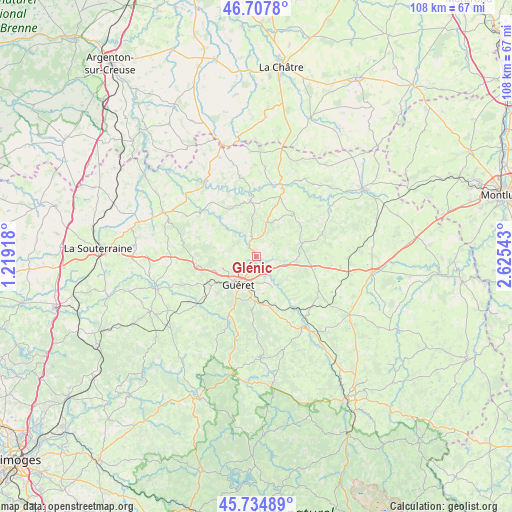
Glénic GPS coordinates[2]
46° 13' 24.6" North, 1° 55' 20.28" East
| Map corner | latitude | longitude |
|---|---|---|
| Upper-left | 46.7078°, | 1.21918° |
| Center: | 46.2235°, | 1.9223° |
| Lower-right: | 45.73489°, | 2.62543° |
| Map W x H: | 108.2×108.2 km | = 67.2×67.2mi |
| max Lat: | 51.07786° ⇑63.2% North |
| Glénic: | 46.2235° |
| min Lat: | ⇓36.8% South 41.3874° |
| min Long | Glénic | max Long |
| -5.08615° | 1.9223° | 9.52242° |
| W 42%⇐ | ⇒58% E |
Elevation
Elevation of Glénic is 342 m = 1122 ft, and this is 148.3 m = 487 ft above average elevation for this country.
| Max E: |
2333 m = 7654 ft | 15.3% |
| Glénic | 342 m 1122 ft | |
| Avg. | 193.7 m = 635 ft | |
Min E: |
-1 m = -3 ft | 84.7% |
See also: France elevation on elevation.city.
Geographical zone
Glénic is located in North temperate zone (between Tropic of Cancer and the Arctic Circle). Distance of this North polar circle is 2261.6 km =1405.3 mi to North.| Distance of | km | miles | from Glénic |
|---|---|---|---|
| North Pole | 4867.5 | 3024.5 | to North |
| Arctic Circle | 2261.6 | 1405.3 | to North |
| Tropic Cancer | 2533.7 | 1574.4 | to South |
| Equator | 5139.6 | 3193.6 | to South |


Nearby cities:
15 places around Glénic: (largest is in red/bold)
• Ajain
6 km =3.7 mi,  107°
107°
• Anzême
6.6 km =4.1 mi,  316°
316°
• Bonnat
11.7 km =7.3 mi,  353°
353°
• Bussière-Dunoise
12.9 km =8 mi,  287°
287°
• Châtelus-Malvaleix
11.9 km =7.4 mi,  40°
40°
• Guéret
6.9 km =4.3 mi,  214°
214°
• Jarnages
13.3 km =8.3 mi, 110°
• La Celle-Dunoise
15 km =9.3 mi,  309°
309°
• La Saunière
10.4 km =6.5 mi,  173°
173°
• Pionnat
9.9 km =6.2 mi,  126°
126°
• Saint-Fiel
2.4 km =1.5 mi,  244°
244°
• Saint-Laurent
7.2 km =4.5 mi,  154°
154°
• Saint-Sulpice-le-Guérétois
7.7 km =4.8 mi,  250°
250°
• Saint-Vaury
13 km =8.1 mi,  260°
260°
• Sainte-Feyre
9.4 km =5.8 mi,  183°
183°
Sources, notices
• [Note1] Compared only with cities in France existing in our database
• [Src1] Map data: © OpenStreetMap contributors (CC-BY-SA)
• [Src2] Other city data from geonames.org with taken over terms of usage.
• [Src3] Geographical zone / Annual Mean Temperature by Robert A. Rohde @ Wikipedia
