Chaumont-sur-Tharonne geodata
Chaumont-sur-Tharonne (Centre) is a populated place; located in France in Europe/Paris (GMT+2) time zone. With population of 1,108 people, there are 8076 cities with bigger population in this country. Compared to other cities in France, 52.8% of cities are located further ↓South; 58.2% of cities are located further →East and 50.3% of cities have lower elevation than Chaumont-sur-Tharonne. Note1
Administrative division(s):
- Level 1: Centre
- Level 2: Département du Loir-et-Cher
- Level 3: Arrondissement de Romorantin-Lanthenay
- Level 4: Chaumont-sur-Tharonne
Current local time in Chaumont-sur-Tharonne:
05:38 AM, SaturdayDifference from your time zone: hours


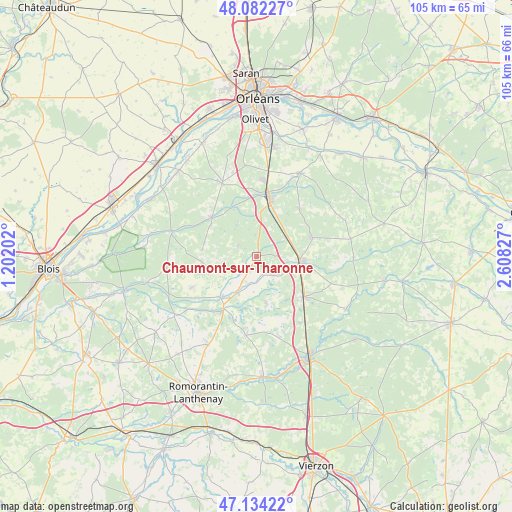
Chaumont-sur-Tharonne GPS coordinates[2]
47° 36' 37.404" North, 1° 54' 18.504" East
| Map corner | latitude | longitude |
|---|---|---|
| Upper-left | 48.08227°, | 1.20202° |
| Center: | 47.61039°, | 1.90514° |
| Lower-right: | 47.13422°, | 2.60827° |
| Map W x H: | 105.4×105.4 km | = 65.5×65.5mi |
| max Lat: | 51.07786° ⇑47.2% North |
| Chaumont-sur-Tharonne: | 47.61039° |
| min Lat: | ⇓52.8% South 41.3874° |
| min Long | Chaumont-sur-Th | max Long |
| -5.08615° | 1.90514° | 9.52242° |
| W 41.8%⇐ | ⇒58.2% E |
Elevation
Elevation of Chaumont-sur-Tharonne is 133 m = 436 ft, and this is 60.7 m = 199 ft below average elevation for this country.
| Max E: |
2333 m = 7654 ft | 49.7% |
| Avg. | 193.7 m = 635 ft | |
| Chaumont-sur-Tharonne | 133 m = 436 ft | |
Min E: |
-1 m = -3 ft | 50.3% |
See also: France elevation on elevation.city.
Geographical zone
Chaumont-sur-Tharonne is located in North temperate zone (between Tropic of Cancer and the Arctic Circle). Distance of this North polar circle is 2107.4 km =1309.5 mi to North.| Distance of | km | miles | from Chaumont-sur-Tharonne |
|---|---|---|---|
| North Pole | 4713.3 | 2928.7 | to North |
| Arctic Circle | 2107.4 | 1309.5 | to North |
| Tropic Cancer | 2687.9 | 1670.2 | to South |
| Equator | 5293.8 | 3289.4 | to South |


Nearby cities:
15 places around Chaumont-sur-Tharonne: (largest is in red/bold)
• Dhuizon
18.7 km =11.6 mi,  262°
262°
• Jouy-le-Potier
16.6 km =10.3 mi,  334°
334°
• La Ferté-Beauharnais
8.6 km =5.3 mi,  208°
208°
• La Ferté-Saint-Aubin
12.1 km =7.5 mi,  12°
12°
• La Ferté-Saint-Cyr
18.1 km =11.2 mi,  286°
286°
• Lamotte-Beuvron
9.3 km =5.8 mi,  95°
95°
• Ligny-le-Ribault
12.4 km =7.7 mi,  311°
311°
• Marcilly-en-Gault
16.2 km =10.1 mi,  188°
188°
• Montrieux-en-Sologne
14.8 km =9.2 mi,  245°
245°
• Ménestreau-en-Villette
13.3 km =8.3 mi,  41°
41°
• Neung-sur-Beuvron
11.3 km =7 mi,  221°
221°
• Nouan-le-Fuzelier
12.9 km =8 mi,  130°
130°
• Saint-Viâtre
9.8 km =6.1 mi,  167°
167°
• Vouzon
12 km =7.5 mi,  71°
71°
• Yvoy-le-Marron
4.6 km =2.9 mi,  301°
301°
Sources, notices
• [Note1] Compared only with cities in France existing in our database
• [Src1] Map data: © OpenStreetMap contributors (CC-BY-SA)
• [Src2] Other city data from geonames.org with taken over terms of usage.
• [Src3] Geographical zone / Annual Mean Temperature by Robert A. Rohde @ Wikipedia
