Montrieux-en-Sologne geodata
Montrieux-en-Sologne (Centre) is a populated place; located in France in Europe/Paris (GMT+2) time zone. With population of 542 people, there are 14349 cities with bigger population in this country. Compared to other cities in France, 52.1% of cities are located further ↓South; 60.2% of cities are located further →East and 56.2% of cities have higher elevation than Montrieux-en-Sologne. Note1
Administrative division(s):
- Level 1: Centre
- Level 2: Département du Loir-et-Cher
- Level 3: Arrondissement de Romorantin-Lanthenay
- Level 4: Montrieux-en-Sologne


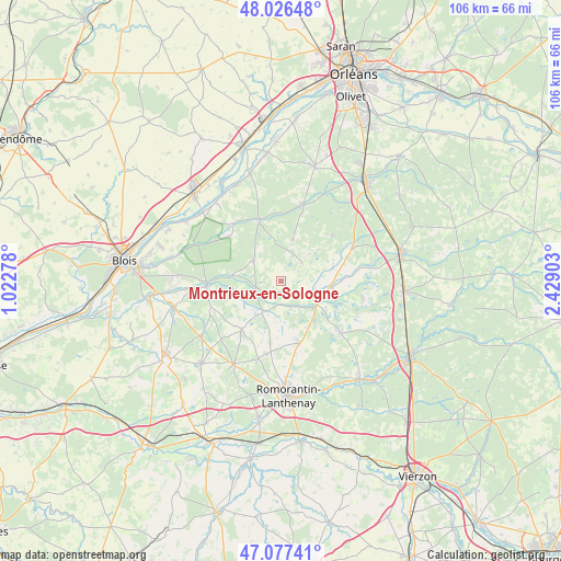
Montrieux-en-Sologne GPS coordinates[2]
47° 33' 14.724" North, 1° 43' 33.276" East
| Map corner | latitude | longitude |
|---|---|---|
| Upper-left | 48.02648°, | 1.02278° |
| Center: | 47.55409°, | 1.72591° |
| Lower-right: | 47.07741°, | 2.42903° |
| Map W x H: | 105.5×105.5 km | = 65.6×65.6mi |
| max Lat: | 51.07786° ⇑47.9% North |
| Montrieux-en-Sologne: | 47.55409° |
| min Lat: | ⇓52.1% South 41.3874° |
| min Long | Montrieux-en-So | max Long |
| -5.08615° | 1.72591° | 9.52242° |
| W 39.8%⇐ | ⇒60.2% E |
Elevation
Elevation of Montrieux-en-Sologne is 113 m = 371 ft, and this is 80.7 m = 265 ft below average elevation for this country.
| Max E: |
2333 m = 7654 ft | 56.2% |
| Avg. | 193.7 m = 635 ft | |
| Montrieux-en-Sologne | 113 m = 371 ft | |
Min E: |
-1 m = -3 ft | 43.8% |
See also: France elevation on elevation.city.
Geographical zone
Montrieux-en-Sologne is located in North temperate zone (between Tropic of Cancer and the Arctic Circle). Distance of this North polar circle is 2113.7 km =1313.4 mi to North.| Distance of | km | miles | from Montrieux-en-Sologne |
|---|---|---|---|
| North Pole | 4719.5 | 2932.6 | to North |
| Arctic Circle | 2113.7 | 1313.4 | to North |
| Tropic Cancer | 2681.6 | 1666.3 | to South |
| Equator | 5287.5 | 3285.5 | to South |


Nearby cities:
15 places around Montrieux-en-Sologne: (largest is in red/bold)
• Bracieux
13.9 km =8.6 mi,  267°
267°
• Chaumont-sur-Tharonne
14.8 km =9.2 mi,  65°
65°
• Crouy-sur-Cosson
13.8 km =8.6 mi,  321°
321°
• Dhuizon
6.3 km =3.9 mi,  305°
305°
• Fontaines-en-Sologne
14.1 km =8.8 mi,  249°
249°
• La Ferté-Beauharnais
9.4 km =5.8 mi,  98°
98°
• La Ferté-Saint-Cyr
12 km =7.5 mi,  340°
340°
• Ligny-le-Ribault
15.1 km =9.4 mi,  16°
16°
• Marcilly-en-Gault
14.8 km =9.2 mi,  131°
131°
• Millançay
12.4 km =7.7 mi,  163°
163°
• Neung-sur-Beuvron
6.3 km =3.9 mi,  109°
109°
• Saint-Viâtre
15.9 km =9.9 mi, 102°
• Tour-en-Sologne
16.6 km =10.3 mi,  264°
264°
• Vernou-en-Sologne
6.8 km =4.2 mi,  209°
209°
• Yvoy-le-Marron
12.9 km =8 mi,  47°
47°
Sources, notices
• [Note1] Compared only with cities in France existing in our database
• [Src1] Map data: © OpenStreetMap contributors (CC-BY-SA)
• [Src2] Other city data from geonames.org with taken over terms of usage.
• [Src3] Geographical zone / Annual Mean Temperature by Robert A. Rohde @ Wikipedia
