Ligny-le-Ribault geodata
Ligny-le-Ribault (Centre) is a populated place; located in France in Europe/Paris (GMT+2) time zone. With population of 1,199 people, there are 7541 cities with bigger population in this country. Compared to other cities in France, 54% of cities are located further ↓South; 59.6% of cities are located further →East and 62.8% of cities have higher elevation than Ligny-le-Ribault. Note1
Administrative division(s):
- Level 1: Centre
- Level 2: Loiret
- Level 3: Arrondissement d’Orléans
- Level 4: Ligny-le-Ribault


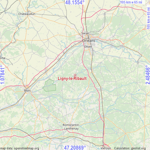
Ligny-le-Ribault GPS coordinates[2]
47° 41' 3.084" North, 1° 46' 53.508" East
| Map corner | latitude | longitude |
|---|---|---|
| Upper-left | 48.1554°, | 1.07841° |
| Center: | 47.68419°, | 1.78153° |
| Lower-right: | 47.20869°, | 2.48466° |
| Map W x H: | 105.3×105.3 km | = 65.4×65.4mi |
| max Lat: | 51.07786° ⇑46% North |
| Ligny-le-Ribault: | 47.68419° |
| min Lat: | ⇓54% South 41.3874° |
| min Long | Ligny-le-Ribaul | max Long |
| -5.08615° | 1.78153° | 9.52242° |
| W 40.4%⇐ | ⇒59.6% E |
Elevation
Elevation of Ligny-le-Ribault is 95 m = 312 ft, and this is 98.7 m = 324 ft below average elevation for this country.
| Max E: |
2333 m = 7654 ft | 62.8% |
| Avg. | 193.7 m = 635 ft | |
| Ligny-le-Ribault | 95 m = 312 ft | |
Min E: |
-1 m = -3 ft | 37.2% |
See also: France elevation on elevation.city.
Geographical zone
Ligny-le-Ribault is located in North temperate zone (between Tropic of Cancer and the Arctic Circle). Distance of this North polar circle is 2099.2 km =1304.4 mi to North.| Distance of | km | miles | from Ligny-le-Ribault |
|---|---|---|---|
| North Pole | 4705.1 | 2923.6 | to North |
| Arctic Circle | 2099.2 | 1304.4 | to North |
| Tropic Cancer | 2696.1 | 1675.3 | to South |
| Equator | 5302 | 3294.5 | to South |


Nearby cities:
15 places around Ligny-le-Ribault: (largest is in red/bold)
• Ardon
12.6 km =7.8 mi,  33°
33°
• Chaumont-sur-Tharonne
12.4 km =7.7 mi,  131°
131°
• Cléry-Saint-André
15.5 km =9.6 mi,  351°
351°
• Crouy-sur-Cosson
13.4 km =8.3 mi,  253°
253°
• Dhuizon
14.2 km =8.8 mi,  220°
220°
• Dry
13.5 km =8.4 mi,  337°
337°
• Jouy-le-Potier
7.2 km =4.5 mi,  17°
17°
• La Ferté-Saint-Aubin
12.3 km =7.6 mi,  72°
72°
• La Ferté-Saint-Cyr
8.7 km =5.4 mi, 248°
• Lailly-en-Val
11.9 km =7.4 mi,  323°
323°
• Montrieux-en-Sologne
15.1 km =9.4 mi,  196°
196°
• Mézières-lez-Cléry
14.8 km =9.2 mi,  6°
6°
• Saint-Laurent-Nouan
14.1 km =8.8 mi,  284°
284°
• Tavers
15.1 km =9.4 mi,  303°
303°
• Yvoy-le-Marron
7.9 km =4.9 mi,  137°
137°
Sources, notices
• [Note1] Compared only with cities in France existing in our database
• [Src1] Map data: © OpenStreetMap contributors (CC-BY-SA)
• [Src2] Other city data from geonames.org with taken over terms of usage.
• [Src3] Geographical zone / Annual Mean Temperature by Robert A. Rohde @ Wikipedia
