Chaudron-en-Mauges geodata
Chaudron-en-Mauges (Pays de la Loire) is a populated place; located in France in Europe/Paris (GMT+2) time zone. With population of 1,497 people, there are 6199 cities with bigger population in this country. Compared to other cities in France, 51.7% of cities are located further ↑North; 88% of cities are located further →East and 71% of cities have higher elevation than Chaudron-en-Mauges. Note1
Administrative division(s):
- Level 1: Pays de la Loire
- Level 2: Département de Maine-et-Loire
- Level 3: Arrondissement de Cholet
- Level 4: Montrevault-sur-Èvre


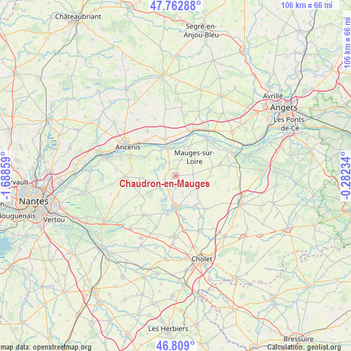
Chaudron-en-Mauges GPS coordinates[2]
47° 17' 17.124" North, 0° 59' 7.692" West
| Map corner | latitude | longitude |
|---|---|---|
| Upper-left | 47.76288°, | -1.68859° |
| Center: | 47.28809°, | -0.98547° |
| Lower-right: | 46.809°, | -0.28234° |
| Map W x H: | 106.1×106.1 km | = 65.9×65.9mi |
| max Lat: | 51.07786° ⇑51.7% North |
| Chaudron-en-Mauges: | 47.28809° |
| min Lat: | ⇓48.3% South 41.3874° |
| min Long | Chaudron-en-Mau | max Long |
| -5.08615° | -0.98547° | 9.52242° |
| W 12%⇐ | ⇒88% E |
Elevation
Elevation of Chaudron-en-Mauges is 76 m = 249 ft, and this is 117.7 m = 386 ft below average elevation for this country.
| Max E: |
2333 m = 7654 ft | 71% |
| Avg. | 193.7 m = 635 ft | |
| Chaudron-en-Mauges | 76 m = 249 ft | |
Min E: |
-1 m = -3 ft | 29% |
See also: France elevation on elevation.city.
Geographical zone
Chaudron-en-Mauges is located in North temperate zone (between Tropic of Cancer and the Arctic Circle). Distance of this North polar circle is 2143.2 km =1331.7 mi to North.| Distance of | km | miles | from Chaudron-en-Mauges |
|---|---|---|---|
| North Pole | 4749.1 | 2951 | to North |
| Arctic Circle | 2143.2 | 1331.7 | to North |
| Tropic Cancer | 2652 | 1647.9 | to South |
| Equator | 5257.9 | 3267.1 | to South |


Nearby cities:
15 places around Chaudron-en-Mauges: (largest is in red/bold)
• Beaupréau
9.3 km =5.8 mi,  180°
180°
• Botz-en-Mauges
2.4 km =1.5 mi,  330°
330°
• La Chapelle-Saint-Florent
7.4 km =4.6 mi,  313°
313°
• La Salle-et-Chapelle-Aubry
4.3 km =2.7 mi,  169°
169°
• Le Fief-Sauvin
8.6 km =5.3 mi,  209°
209°
• Le Fuilet
9.6 km =6 mi,  266°
266°
• Le Marillais
10.3 km =6.4 mi,  318°
318°
• Le Mesnil-en-Vallée
9.4 km =5.8 mi,  23°
23°
• Le Pin-en-Mauges
7.6 km =4.7 mi,  120°
120°
• Montrevault
5.6 km =3.5 mi,  235°
235°
• Saint-Florent-le-Vieil
8.4 km =5.2 mi,  344°
344°
• Saint-Laurent-du-Mottay
7.5 km =4.7 mi, 21°
• Saint-Pierre-Montlimart
3.8 km =2.4 mi, 237°
• Saint-Quentin-en-Mauges
5.6 km =3.5 mi,  86°
86°
• Saint-Rémy-en-Mauges
7 km =4.3 mi,  255°
255°
Sources, notices
• [Note1] Compared only with cities in France existing in our database
• [Src1] Map data: © OpenStreetMap contributors (CC-BY-SA)
• [Src2] Other city data from geonames.org with taken over terms of usage.
• [Src3] Geographical zone / Annual Mean Temperature by Robert A. Rohde @ Wikipedia
