Châteauroux geodata
Châteauroux (Centre) is a seat of a second-order administrative division; located in France in Europe/Paris (GMT+2) time zone. With population of 53,301 people, there are 108 cities with bigger population in this country. Compared to other cities in France, 57.1% of cities are located further ↑North; 60.5% of cities are located further →East and 55.3% of cities have lower elevation than Châteauroux. Note1
Administrative division(s):
- Level 1: Centre
- Level 2: Département de l'Indre
- Level 3: Arrondissement de Châteauroux
- Level 4: Châteauroux


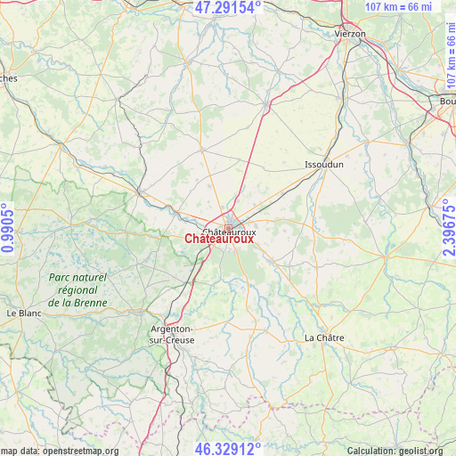
Châteauroux GPS coordinates[2]
46° 48' 44.928" North, 1° 41' 37.032" East
| Map corner | latitude | longitude |
|---|---|---|
| Upper-left | 47.29154°, | 0.9905° |
| Center: | 46.81248°, | 1.69362° |
| Lower-right: | 46.32912°, | 2.39675° |
| Map W x H: | 107×107 km | = 66.5×66.5mi |
| max Lat: | 51.07786° ⇑57.1% North |
| Châteauroux: | 46.81248° |
| min Lat: | ⇓42.9% South 41.3874° |
| min Long | Châteauroux | max Long |
| -5.08615° | 1.69362° | 9.52242° |
| W 39.5%⇐ | ⇒60.5% E |
Elevation
Elevation of Châteauroux is 151 m = 495 ft, and this is 42.7 m = 140 ft below average elevation for this country.
| Max E: |
2333 m = 7654 ft | 44.7% |
| Avg. | 193.7 m = 635 ft | |
| Châteauroux | 151 m = 495 ft | |
Min E: |
-1 m = -3 ft | 55.3% |
See also: Châteauroux elevation on elevation.city.
Geographical zone
Châteauroux is located in North temperate zone (between Tropic of Cancer and the Arctic Circle). Distance of this North polar circle is 2196.1 km =1364.6 mi to North.| Distance of | km | miles | from Châteauroux |
|---|---|---|---|
| North Pole | 4802 | 2983.8 | to North |
| Arctic Circle | 2196.1 | 1364.6 | to North |
| Tropic Cancer | 2599.1 | 1615 | to South |
| Equator | 5205.1 | 3234.3 | to South |


Nearby cities:
15 places around Châteauroux: (largest is in red/bold)
• Ardentes
13.3 km =8.3 mi,  126°
126°
• Arthon
13.2 km =8.2 mi,  178°
178°
• Coings
8.4 km =5.2 mi,  11°
11°
• Diors
10.4 km =6.5 mi,  80°
80°
• Déols
2 km =1.2 mi,  23°
23°
• Le Poinçonnet
5.7 km =3.5 mi,  161°
161°
• Luant
13.6 km =8.5 mi,  229°
229°
• Montierchaume
8.2 km =5.1 mi,  46°
46°
• Mâron
12.9 km =8 mi,  92°
92°
• Niherne
10 km =6.2 mi,  279°
279°
• Saint-Maur
4.2 km =2.6 mi,  261°
261°
• Velles
14.1 km =8.8 mi,  193°
193°
• Villedieu-sur-Indre
12.3 km =7.6 mi,  287°
287°
• Vineuil
10.7 km =6.6 mi,  335°
335°
• Étrechet
7.8 km =4.8 mi,  118°
118°
Sources, notices
• [Note1] Compared only with cities in France existing in our database
• [Src1] Map data: © OpenStreetMap contributors (CC-BY-SA)
• [Src2] Other city data from geonames.org with taken over terms of usage.
• [Src3] Geographical zone / Annual Mean Temperature by Robert A. Rohde @ Wikipedia
