Chessy-les-Prés geodata
Chessy-les-Prés (Grand Est) is a populated place; located in France in Europe/Paris (GMT+2) time zone. With population of 514 people, there are 14947 cities with bigger population in this country. Compared to other cities in France, 59.7% of cities are located further ↓South; 67.1% of cities are located further ←West and 55.6% of cities have higher elevation than Chessy-les-Prés. Note1
Administrative division(s):
- Level 1: Grand Est
- Level 2: Département de l'Aube
- Level 3: Arrondissement de Troyes
- Level 4: Chessy-les-Prés


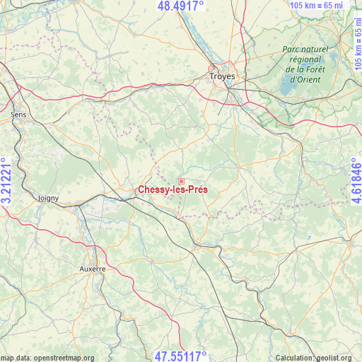
Chessy-les-Prés GPS coordinates[2]
48° 1' 24.888" North, 3° 54' 55.224" East
| Map corner | latitude | longitude |
|---|---|---|
| Upper-left | 48.4917°, | 3.21221° |
| Center: | 48.02358°, | 3.91534° |
| Lower-right: | 47.55117°, | 4.61846° |
| Map W x H: | 104.6×104.6 km | = 65×65mi |
| max Lat: | 51.07786° ⇑40.3% North |
| Chessy-les-Prés: | 48.02358° |
| min Lat: | ⇓59.7% South 41.3874° |
| min Long | Chessy-les-Pré | max Long |
| -5.08615° | 3.91534° | 9.52242° |
| W 67.1%⇐ | ⇒32.9% E |
Elevation
Elevation of Chessy-les-Prés is 115 m = 377 ft, and this is 78.7 m = 258 ft below average elevation for this country.
| Max E: |
2333 m = 7654 ft | 55.6% |
| Avg. | 193.7 m = 635 ft | |
| Chessy-les-Prés | 115 m = 377 ft | |
Min E: |
-1 m = -3 ft | 44.4% |
See also: France elevation on elevation.city.
Geographical zone
Chessy-les-Prés is located in North temperate zone (between Tropic of Cancer and the Arctic Circle). Distance of this North polar circle is 2061.5 km =1281 mi to North.| Distance of | km | miles | from Chessy-les-Prés |
|---|---|---|---|
| North Pole | 4667.3 | 2900.1 | to North |
| Arctic Circle | 2061.5 | 1281 | to North |
| Tropic Cancer | 2733.8 | 1698.7 | to South |
| Equator | 5339.7 | 3317.9 | to South |


Nearby cities:
15 places around Chessy-les-Prés: (largest is in red/bold)
• Auxon
9 km =5.6 mi,  1°
1°
• Chailley
17.2 km =10.7 mi,  292°
292°
• Champlost
18.2 km =11.3 mi,  270°
270°
• Chaource
17 km =10.6 mi,  76°
76°
• Ervy-le-Châtel
2 km =1.2 mi,  348°
348°
• Flogny-la-Chapelle
8.9 km =5.5 mi,  203°
203°
• Germigny
10.5 km =6.5 mi,  252°
252°
• Ligny-le-Châtel
18.1 km =11.2 mi,  220°
220°
• Neuvy-Sautour
9.2 km =5.7 mi,  282°
282°
• Saint-Florentin
14.4 km =8.9 mi,  259°
259°
• Saint-Mards-en-Othe
18.7 km =11.6 mi,  332°
332°
• Turny
12.6 km =7.8 mi, 275°
• Venizy
15.3 km =9.5 mi, 274°
• Vergigny
15.8 km =9.8 mi, 248°
• Épineuil
17.5 km =10.9 mi,  164°
164°
Sources, notices
• [Note1] Compared only with cities in France existing in our database
• [Src1] Map data: © OpenStreetMap contributors (CC-BY-SA)
• [Src2] Other city data from geonames.org with taken over terms of usage.
• [Src3] Geographical zone / Annual Mean Temperature by Robert A. Rohde @ Wikipedia
